File:Blank map cities shaded.PNG

Size of this preview: 800 × 375 pixels. Other resolutions: 320 × 150 pixels | 640 × 300 pixels | 1,314 × 616 pixels.
Original file (1,314 × 616 pixels, file size: 60 KB, MIME type: image/png)
Captions
Captions
Add a one-line explanation of what this file represents
Summary edit
| Description |
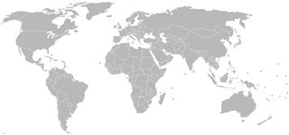
English: Blank map of the world with 2010 boundaries. All capitals and other major cities are indicated with small circles (Hue=160, Sat=0, Lum=181, red/green/blue = 192), which are a shade of grey slightly lighter than the grey used for continents (Hue=160, Sat=0, Lum=174, red/green/blue = 185). The grey circles are thus invisible for practical purposes, but by colouring circles with a more distinctive colour, editors can indicate on the map particular cities. Additional cities can be added by copying the sample grey circle located at the bottom left corner and pasting it cropped |
| Date | |
| Source | Own work |
| Author | Kransky |
Licensing edit
I, the copyright holder of this work, hereby publish it under the following license:
This file is licensed under the Creative Commons Attribution 3.0 Unported license.
- You are free:
- to share – to copy, distribute and transmit the work
- to remix – to adapt the work
- Under the following conditions:
- attribution – You must give appropriate credit, provide a link to the license, and indicate if changes were made. You may do so in any reasonable manner, but not in any way that suggests the licensor endorses you or your use.
File history
Click on a date/time to view the file as it appeared at that time.
| Date/Time | Thumbnail | Dimensions | User | Comment | |
|---|---|---|---|---|---|
| current | 20:12, 24 September 2011 | | 1,314 × 616 (60 KB) | Tiiliskivi (talk | contribs) | + South Sudan |
| 09:02, 7 March 2010 |  | 1,314 × 616 (54 KB) | Kransky (talk | contribs) | fixes to a few cities. Fixed US/Canada border | |
| 00:02, 27 February 2010 |  | 1,357 × 628 (55 KB) | Kransky (talk | contribs) | Cities enlarged to 16x16 pixel squares, using same slight shade of grey. More cities added. | |
| 09:26, 26 February 2010 |  | 1,357 × 628 (55 KB) | Kransky (talk | contribs) | {{Information |Description={{en|1=Blank map of the world with 2010 boundaries. All capitals and other major cities are indicated with small circles (Hue=160, Sat=0, Lum=181, red/green/blue = 192), which are a shade of grey slightly lighter than the grey |
You cannot overwrite this file.
File usage on Commons
There are no pages that use this file.
File usage on other wikis
The following other wikis use this file: