File:Blue Flame Pinnacles map.png
Size of this preview: 486 × 599 pixels. Other resolutions: 195 × 240 pixels | 389 × 480 pixels | 623 × 768 pixels | 831 × 1,024 pixels | 1,662 × 2,048 pixels | 3,000 × 3,697 pixels.
Original file (3,000 × 3,697 pixels, file size: 560 KB, MIME type: image/png)
Captions
Captions
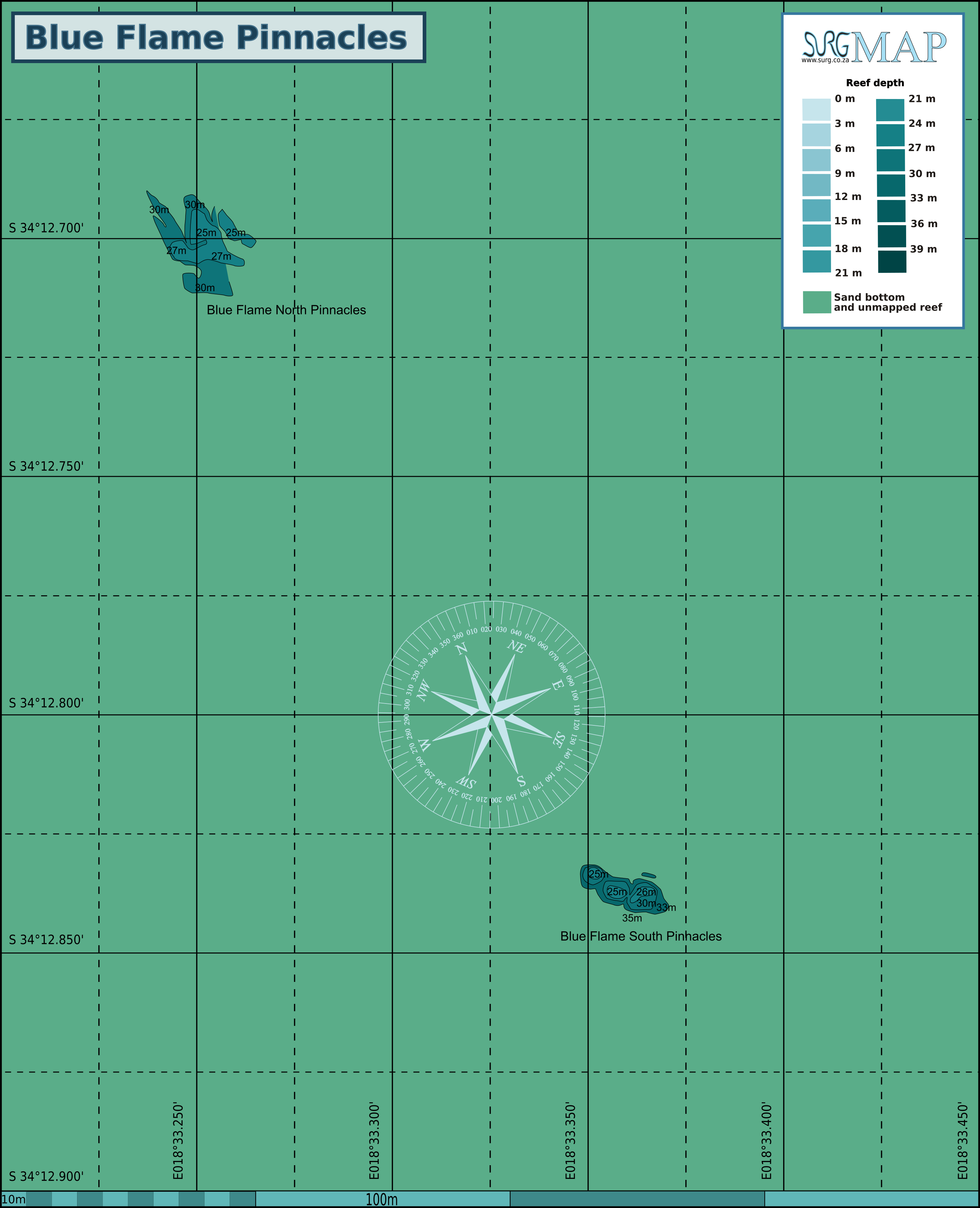
Map of the dive site at Blue Flame Pinnacle in False Bay, South Africa
Summary edit
| Description |
English: Map of the dive site at Blue Flame Pinnacle in False Bay, South Africa |
| Date | |
| Source | Own work |
| Author | Peter Southwood |
Licensing edit
I, the copyright holder of this work, hereby publish it under the following license:
This file is licensed under the Creative Commons Attribution-Share Alike 4.0 International license.
- You are free:
- to share – to copy, distribute and transmit the work
- to remix – to adapt the work
- Under the following conditions:
- attribution – You must give appropriate credit, provide a link to the license, and indicate if changes were made. You may do so in any reasonable manner, but not in any way that suggests the licensor endorses you or your use.
- share alike – If you remix, transform, or build upon the material, you must distribute your contributions under the same or compatible license as the original.
File history
Click on a date/time to view the file as it appeared at that time.
| Date/Time | Thumbnail | Dimensions | User | Comment | |
|---|---|---|---|---|---|
| current | 08:46, 2 August 2021 | | 3,000 × 3,697 (560 KB) | Pbsouthwood (talk | contribs) | Added Blue Flame North punnacles |
| 18:39, 25 May 2021 |  | 2,394 × 2,245 (431 KB) | Pbsouthwood (talk | contribs) | Uploaded own work with UploadWizard |
You cannot overwrite this file.
File usage on Commons
There are no pages that use this file.
File usage on other wikis
The following other wikis use this file:
- Usage on en.wikivoyage.org
- Usage on www.wikidata.org