File:Bodegas.jpg
Size of this preview: 800 × 600 pixels. Other resolutions: 320 × 240 pixels | 640 × 480 pixels | 1,024 × 768 pixels | 1,280 × 960 pixels.
Original file (1,280 × 960 pixels, file size: 261 KB, MIME type: image/jpeg)
Captions
Captions
Add a one-line explanation of what this file represents
| Description |
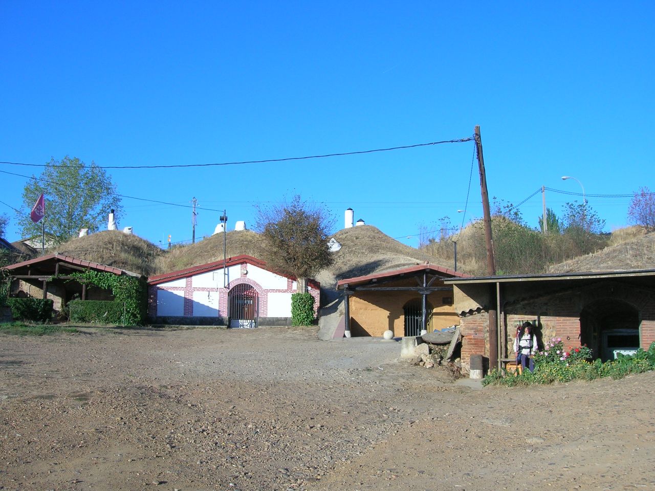
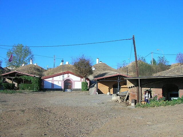
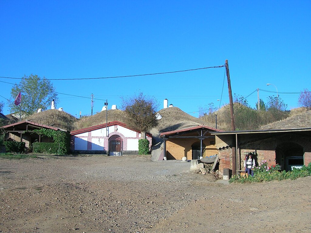
Bodegas semienterradas en Trobajo del Camino (Necesitas Google Earth) |
| Date | |
| Source | Bodegas |
| Author | José Antonio Gil Martínez from Vigo, Spain |
| Camera location | | View this and other nearby images on: OpenStreetMap |
|---|
Licensing
edit
This file is licensed under the Creative Commons Attribution 2.0 Generic license.
- You are free:
- to share – to copy, distribute and transmit the work
- to remix – to adapt the work
- Under the following conditions:
- attribution – You must give appropriate credit, provide a link to the license, and indicate if changes were made. You may do so in any reasonable manner, but not in any way that suggests the licensor endorses you or your use.
| This image, originally posted to Flickr, was reviewed on 18 August 2008 by the administrator or reviewer Brynn, who confirmed that it was available on Flickr under the stated license on that date. |
File history
Click on a date/time to view the file as it appeared at that time.
| Date/Time | Thumbnail | Dimensions | User | Comment | |
|---|---|---|---|---|---|
| current | 12:15, 18 August 2008 | | 1,280 × 960 (261 KB) | Brynn (talk | contribs) | |
| 08:47, 18 August 2008 |  | 500 × 375 (114 KB) | Vicky petereit (talk | contribs) | {{Information |Description= Bodegas semienterradas en Trobajo del Camino [http://www.roblog.com/flickrfly.kml Vuela hasta esta localización] (Necesitas [http://earth.google.com Google Earth]) |Source=[http://www.flickr.com/photos/17364971@N00/64272470/ |
You cannot overwrite this file.
File usage on Commons
The following page uses this file:
- File:Bodegas (64272470).jpg (file redirect)
.jpg&redirect=no)
File usage on other wikis
The following other wikis use this file:
- Usage on de.wikipedia.org
- Usage on eo.wikipedia.org
- Usage on es.wikipedia.org
- Usage on fr.wikipedia.org