File:Bodleian Libraries, Elaborate TO map.jpg
Original file (672 × 1,000 pixels, file size: 162 KB, MIME type: image/jpeg)
Captions
Captions
Summary edit
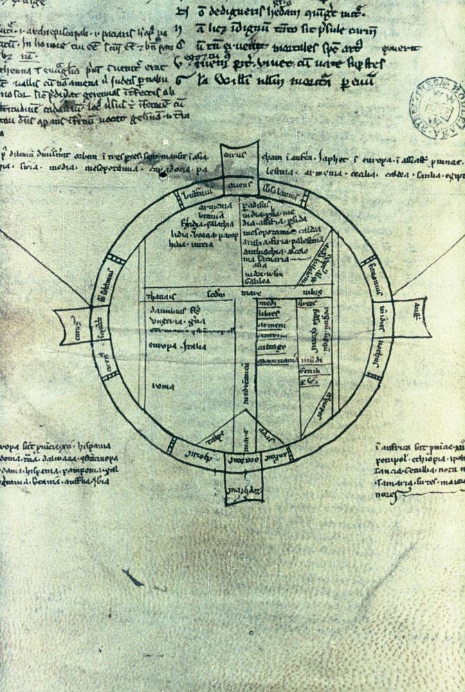
| [Elaborate T-O map] | ||||||
|---|---|---|---|---|---|---|
| Title |
[Elaborate T-O map] |
|||||
| Description |
Map with truncated Nile and Don; with some place-names (but not Jerusalem), in English manuscript of Ph. de Castellione, Alexandreis. The four tags around the circle bear the names of the winds and the cardinal points. |
|||||
| Date | between 1245 and 1300 | |||||
| Dimensions | 72 diameter mm; 35mm slide | |||||
| Accession number |
MS. Bodl. 527, fol. 189r |
|||||
| Notes | Filmstrip Roll 177A, frame 5; Source filename: mapsxx003-aer-0001-0 | |||||
| Source/Photographer |
|
|||||
| Permission (Reusing this file) |
|
|||||
File history
Click on a date/time to view the file as it appeared at that time.
| Date/Time | Thumbnail | Dimensions | User | Comment | |
|---|---|---|---|---|---|
| current | 21:01, 26 February 2016 | | 672 × 1,000 (162 KB) | SteinsplitterBot (talk | contribs) | Bot: Image rotated by 90° |
| 20:01, 26 February 2016 |  | 1,000 × 675 (164 KB) | MartinPoulter (talk | contribs) | GWToolset: Creating mediafile for MartinPoulter. Bulk upload of Maps collection from Digital Bodleian |
You cannot overwrite this file.
File usage on Commons
The following page uses this file: