File:Boerderij. Tweede Moordrechtse Tiendeweg 2 in Gouda.jpg
Size of this preview: 800 × 487 pixels. Other resolutions: 320 × 195 pixels | 640 × 390 pixels | 1,024 × 624 pixels | 1,280 × 780 pixels | 2,560 × 1,559 pixels | 4,320 × 2,631 pixels.
Original file (4,320 × 2,631 pixels, file size: 6.82 MB, MIME type: image/jpeg)
File information
Structured data
Captions
Summary edit
DescriptionBoerderij. Tweede Moordrechtse Tiendeweg 2 in Gouda.jpg |
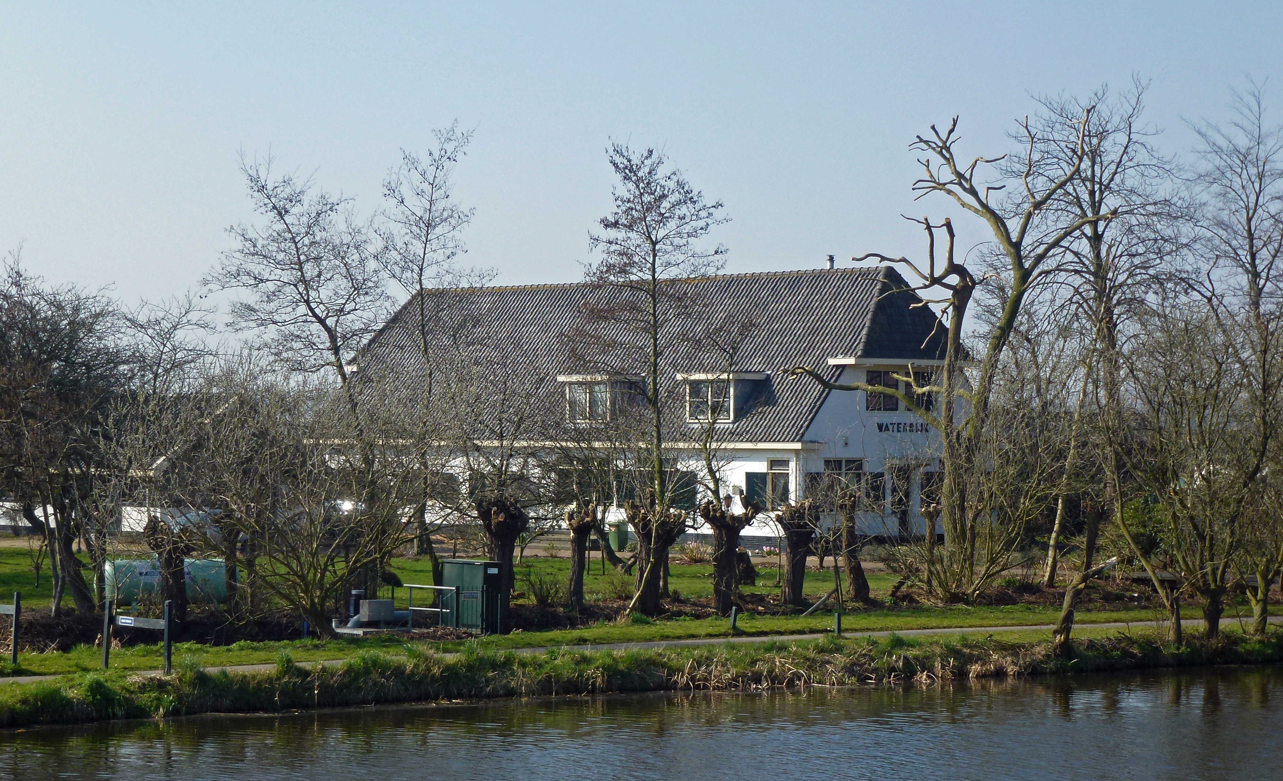
Nederlands: Boerderij "Waterrijk" uit ongeveer 1935-1940 met wolfsdak en dakpannen, nu in gebruik als woonhuis. De boerderij ligt achter de dijk van het Gouwekanaal.
|
||
Date | |||
Source | Own work | ||
Author | Agaath |
Camera location | 52° 00′ 41.38″ N, 4° 41′ 08.01″ E | View this and other nearby images on: OpenStreetMap | 52.011494; 4.685558 |
---|
Licensing edit
I, the copyright holder of this work, hereby publish it under the following license:
This file is licensed under the Creative Commons Attribution-Share Alike 3.0 Unported license.
- You are free:
- to share – to copy, distribute and transmit the work
- to remix – to adapt the work
- Under the following conditions:
- attribution – You must give appropriate credit, provide a link to the license, and indicate if changes were made. You may do so in any reasonable manner, but not in any way that suggests the licensor endorses you or your use.
- share alike – If you remix, transform, or build upon the material, you must distribute your contributions under the same or compatible license as the original.
File history
Click on a date/time to view the file as it appeared at that time.
Date/Time | Thumbnail | Dimensions | User | Comment | |
---|---|---|---|---|---|
current | 11:11, 17 March 2014 | 4,320 × 2,631 (6.82 MB) | Agaath (talk | contribs) | User created page with UploadWizard |
You cannot overwrite this file.
File usage on Commons
There are no pages that use this file.
File usage on other wikis
The following other wikis use this file:
- Usage on nl.wikipedia.org
Metadata
This file contains additional information such as Exif metadata which may have been added by the digital camera, scanner, or software program used to create or digitize it. If the file has been modified from its original state, some details such as the timestamp may not fully reflect those of the original file. The timestamp is only as accurate as the clock in the camera, and it may be completely wrong.
Camera manufacturer | Panasonic |
---|---|
Camera model | DMC-TZ20 |
Exposure time | 1/400 sec (0.0025) |
F-number | f/4.7 |
ISO speed rating | 100 |
Date and time of data generation | 13:48, 12 March 2014 |
Lens focal length | 13.6 mm |
Latitude | 52° 0′ 41.38″ N |
Longitude | 4° 41′ 8.01″ E |
Width | 4,320 px |
Height | 3,240 px |
Bits per component |
|
Pixel composition | RGB |
Orientation | Normal |
Number of components | 3 |
Horizontal resolution | 180 dpi |
Vertical resolution | 180 dpi |
Software used | Adobe Photoshop Elements 12.0 Windows |
File change date and time | 10:49, 17 March 2014 |
Y and C positioning | Co-sited |
Exposure Program | Landscape mode (for landscape photos with the background in focus) |
Exif version | 2.3 |
Date and time of digitizing | 13:48, 12 March 2014 |
Meaning of each component |
|
Image compression mode | 4 |
APEX shutter speed | 8.643856 |
APEX aperture | 4.465322 |
APEX exposure bias | 0 |
Maximum land aperture | 4.46875 APEX (f/4.71) |
Metering mode | Pattern |
Light source | Unknown |
Flash | Flash did not fire, compulsory flash suppression |
Supported Flashpix version | 1 |
Color space | sRGB |
Sensing method | One-chip color area sensor |
File source | Digital still camera |
Scene type | A directly photographed image |
Custom image processing | Normal process |
Exposure mode | Auto exposure |
White balance | Auto white balance |
Digital zoom ratio | 0 |
Focal length in 35 mm film | 81 mm |
Scene capture type | Standard |
Scene control | None |
Contrast | Normal |
Saturation | Normal |
Sharpness | Normal |
GPS time (atomic clock) | 12:47 |
Satellites used for measurement | 4 |
Receiver status | Measurement in progress |
Measurement mode | 2-dimensional measurement |
Measurement precision | Fair (1.9) |
Geodetic survey data used | WGS-84 |
GPS date | 12 March 2014 |
GPS tag version | 0.0.3.2 |
Date metadata was last modified | 11:49, 17 March 2014 |
Unique ID of original document | 8FCD28C47AF36F07A7646802E538AAAF |