File:Bonamargy Friary, Ballycastle.jpg
No higher resolution available.
Bonamargy_Friary,_Ballycastle.jpg (640 × 278 pixels, file size: 69 KB, MIME type: image/jpeg)
Captions
Captions
Add a one-line explanation of what this file represents
| Camera location | | View this and other nearby images on: OpenStreetMap |
|---|
| Object location | | View this and other nearby images on: OpenStreetMap |
|---|
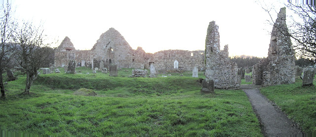
| Description | Bonamargy Friary, a friary situated in County Antrim, Northern Ireland, off the Cushendall Road on the approach to Ballycastle. | ||
| Date | |||
| Source | Geograph project | ||
| Author | Kenneth Allen | ||
| Permission (Reusing this file) |
This file is licensed under the Creative Commons Attribution-Share Alike 2.0 Generic license. Attribution: Kenneth Allen
|

_region:GB-NIR_heading:225.00&language=en)
_region:GB-NIR_heading:225.00&language=en)
File history
Click on a date/time to view the file as it appeared at that time.
| Date/Time | Thumbnail | Dimensions | User | Comment | |
|---|---|---|---|---|---|
| current | 13:56, 24 November 2006 | | 640 × 278 (69 KB) | GeeJo (talk | contribs) | {{Information| |Description = Bonamargy Friary, a friary situated in County Antrim, Northern Ireland, off the Cushendall Road on the approach to Ballycastle. |Source = [http://www.geograph.org.uk/photo/114900 Geograph project] |D |
You cannot overwrite this file.
File usage on Commons
There are no pages that use this file.
File usage on other wikis
The following other wikis use this file:
- Usage on en.wikipedia.org
- Usage on es.wikipedia.org
- Usage on fr.wikipedia.org