File:Bonnestell crater.jpg
Size of this preview: 800 × 380 pixels. Other resolutions: 320 × 152 pixels | 640 × 304 pixels | 1,024 × 486 pixels | 1,871 × 888 pixels.
Original file (1,871 × 888 pixels, file size: 309 KB, MIME type: image/jpeg)
Captions
Captions
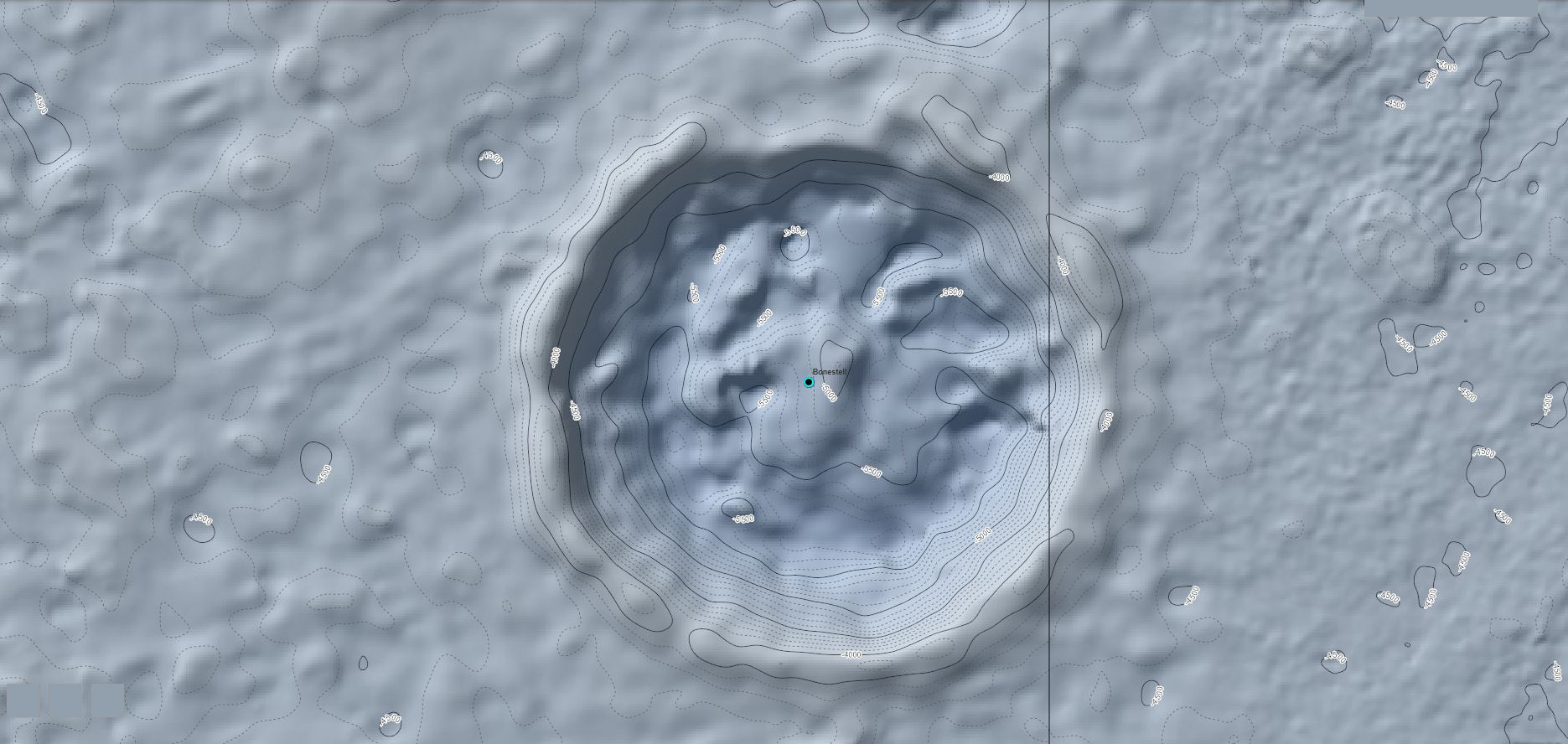
A topographic map illustrating the elevation of Bonestell Crater
Summary
edit
| Description |
English: The topography of Bonestell is very steep in the south and west walls with about a 900 meter elevation difference between the bottom and the highest point on the rim. |
| Date | |
| Source | Own work |
| Author | Mtraynier |
Licensing
edit
I, the copyright holder of this work, hereby publish it under the following license:
This file is licensed under the Creative Commons Attribution-Share Alike 4.0 International license.
- You are free:
- to share – to copy, distribute and transmit the work
- to remix – to adapt the work
- Under the following conditions:
- attribution – You must give appropriate credit, provide a link to the license, and indicate if changes were made. You may do so in any reasonable manner, but not in any way that suggests the licensor endorses you or your use.
- share alike – If you remix, transform, or build upon the material, you must distribute your contributions under the same or compatible license as the original.
File history
Click on a date/time to view the file as it appeared at that time.
| Date/Time | Thumbnail | Dimensions | User | Comment | |
|---|---|---|---|---|---|
| current | 04:13, 23 August 2021 | | 1,871 × 888 (309 KB) | Jstuby (talk | contribs) | crop |
| 22:20, 1 June 2019 |  | 1,920 × 929 (219 KB) | Mtraynier (talk | contribs) | User created page with UploadWizard |
You cannot overwrite this file.
File usage on Commons
There are no pages that use this file.
File usage on other wikis
The following other wikis use this file:
- Usage on zh.wikipedia.org