File:Bornholmerfærgen route map.svg

Size of this PNG preview of this SVG file: 800 × 586 pixels. Other resolutions: 320 × 234 pixels | 640 × 469 pixels | 1,024 × 750 pixels | 1,280 × 938 pixels | 2,560 × 1,876 pixels | 1,104 × 809 pixels.
Original file (SVG file, nominally 1,104 × 809 pixels, file size: 357 KB)
Captions
Captions
Add a one-line explanation of what this file represents
Summary edit
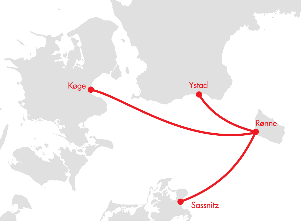
| Description | BornholmerFærgen Route Map |
| Date | (UTC) |
| Source | |
| Author |
|
| This is a retouched picture, which means that it has been digitally altered from its original version. The original can be viewed here: Denmark location map.svg:
|
Licensing edit
I, the copyright holder of this work, hereby publish it under the following licenses:
This file is licensed under the Creative Commons Attribution-Share Alike 3.0 Unported license.
- You are free:
- to share – to copy, distribute and transmit the work
- to remix – to adapt the work
- Under the following conditions:
- attribution – You must give appropriate credit, provide a link to the license, and indicate if changes were made. You may do so in any reasonable manner, but not in any way that suggests the licensor endorses you or your use.
- share alike – If you remix, transform, or build upon the material, you must distribute your contributions under the same or compatible license as the original.

|
Permission is granted to copy, distribute and/or modify this document under the terms of the GNU Free Documentation License, Version 1.2 or any later version published by the Free Software Foundation; with no Invariant Sections, no Front-Cover Texts, and no Back-Cover Texts. A copy of the license is included in the section entitled GNU Free Documentation License. |
You may select the license of your choice.
Original upload log edit
This image is a derivative work of the following images:
- File:Denmark_location_map.svg licensed with Cc-by-sa-3.0, GFDL
- 2008-08-25T18:57:20Z NordNordWest 1836x1479 (451991 Bytes) size correction
- 2008-07-02T08:53:40Z NordNordWest 612x493 (444624 Bytes) {{Information |Description= {{de|Positionskarte von [[:de:Dänemark|Dänemark]]}} Quadratische Plattkarte, N-S-Streckung 170 %. Geographische Begrenzung der Karte: * N: 57.9° N * S: 54.3° N * W: 8.8° O * O: 15.4° O {{en|L
Uploaded with derivativeFX
File history
Click on a date/time to view the file as it appeared at that time.
| Date/Time | Thumbnail | Dimensions | User | Comment | |
|---|---|---|---|---|---|
| current | 17:36, 26 September 2010 | | 1,104 × 809 (357 KB) | Joe200576 (talk | contribs) | {{Information |Description={{de|Positionskarte von Dänemark}} Quadratische Plattkarte, N-S-Streckung 170 %. Geographische Begrenzung der Karte: * N: 57.9° N * S: 54.3° N * W: 7.8° O * O: 15.4° O {{en|Location map of [[:en:Denmark|De |
You cannot overwrite this file.
File usage on Commons
There are no pages that use this file.
File usage on other wikis
The following other wikis use this file:
- Usage on da.wikipedia.org
- Usage on de.wikipedia.org
- Usage on en.wikipedia.org
- Usage on nl.wikipedia.org