File:Bosporus and Pontus MAP.png
No higher resolution available.
Bosporus_and_Pontus_MAP.png (768 × 576 pixels, file size: 88 KB, MIME type: image/png)
Captions
Captions
Add a one-line explanation of what this file represents
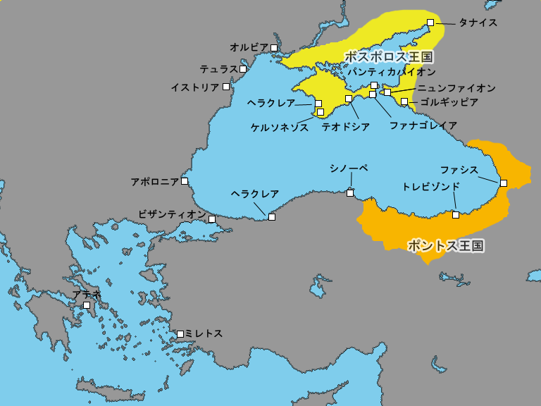
自作の歴史地図。ボスポロス王国とポントス王国の大雑把な勢力範囲及び黒海沿岸の主要なギリシア植民市の位置を表示。
| I, the copyright holder of this work, release this work into the public domain. This applies worldwide. In some countries this may not be legally possible; if so: I grant anyone the right to use this work for any purpose, without any conditions, unless such conditions are required by law. |
File history
Click on a date/time to view the file as it appeared at that time.
| Date/Time | Thumbnail | Dimensions | User | Comment | |
|---|---|---|---|---|---|
| current | 16:10, 28 March 2006 | | 768 × 576 (88 KB) | TEN (talk | contribs) | 用語統一版{{PD}} |
| 15:02, 28 March 2006 |  | 768 × 576 (88 KB) | TEN (talk | contribs) | 自作の歴史地図。ボスポロス王国とポントス王国の大雑把な勢力範囲及び黒海沿岸の主要なギリシア植民市の位置を表示。{{PD}} |
You cannot overwrite this file.
File usage on Commons
There are no pages that use this file.
File usage on other wikis
The following other wikis use this file:
- Usage on ja.wikipedia.org