File:Bouvet Island-CIA WFB Map-sl.png
No higher resolution available.
Bouvet_Island-CIA_WFB_Map-sl.png (327 × 352 pixels, file size: 5 KB, MIME type: image/png)
Captions
Captions
Add a one-line explanation of what this file represents
Summary edit
| Description |
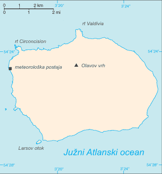
English: Map of Bouvet Island in Slovene.
Slovenščina: Zemljevid Bouvetovega otoka v slovenščini. |
| Source | sl:Image:Bouvet Island.png, Image:Bouvet Island-CIA WFB Map.png |
| Author | CIA, translated by Matijap |
| Other versions | Image:Bouvet Island-CIA WFB Map.png |
Licensing edit
This image is in the public domain because it contains materials that originally came from the United States Central Intelligence Agency's World Factbook.
|
 |
File history
Click on a date/time to view the file as it appeared at that time.
| Date/Time | Thumbnail | Dimensions | User | Comment | |
|---|---|---|---|---|---|
| current | 22:35, 21 December 2007 | | 327 × 352 (5 KB) | Dbc334 (talk | contribs) | {{Information |Description= {{en|Map of en:Bouvet Island in Slovene.}} {{en|Zemljevid Bouvetov otok v slovenščini.}} |Source=sl:Image:Bouvet Island.png, Image:Bouvet Island-CIA WFB Map.png |Date= |Author=CIA, tra |
You cannot overwrite this file.
File usage on Commons
The following page uses this file: