File:Brandy Bottom Pit, Bristol (47556009542).jpg

Size of this preview: 800 × 533 pixels. Other resolutions: 320 × 213 pixels | 640 × 427 pixels | 1,024 × 683 pixels | 1,280 × 853 pixels | 2,560 × 1,706 pixels | 4,231 × 2,820 pixels.
Original file (4,231 × 2,820 pixels, file size: 10.4 MB, MIME type: image/jpeg)
Captions
Captions
Add a one-line explanation of what this file represents
Summary edit
.jpg&action=edit§ion=1)
| Description |
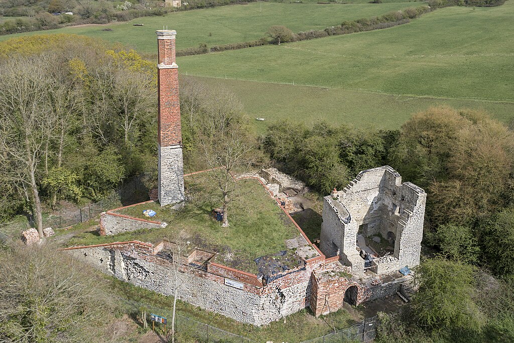
Also known as Brandy Bottom Colliery, it is located on the South Gloucestershire coalfield in the parish of Pucklechurch, and is the site of a 19th century steam-powered colliery. It lay on the line of the Dramway, the horse-drawn railway that was used to haul coal from the Coalpit Heath area either to the River Avon near Keynsham or to Bristol, and which ran until 1850. More here: <a href="http://www.aibt.org/brandy-bottom.html" rel="noreferrer nofollow">www.aibt.org/brandy-bottom.html</a> |
| Date | |
| Source | Brandy Bottom Pit, Bristol |
| Author | Arran Bee from Nottingham, UK |
| Camera location | | View this and other nearby images on: OpenStreetMap |
|---|
.jpg¶ms=051.492317_N_-002.459599_E_globe:Earth_type:camera_alt:-22.963_source:exif_&language=en)
Licensing edit
.jpg&action=edit§ion=2)
This file is licensed under the Creative Commons Attribution 2.0 Generic license.
- You are free:
- to share – to copy, distribute and transmit the work
- to remix – to adapt the work
- Under the following conditions:
- attribution – You must give appropriate credit, provide a link to the license, and indicate if changes were made. You may do so in any reasonable manner, but not in any way that suggests the licensor endorses you or your use.
| This image was originally posted to Flickr by Arran Bee at https://flickr.com/photos/91425144@N04/47556009542 (archive). It was reviewed on 1 June 2019 by FlickreviewR 2 and was confirmed to be licensed under the terms of the cc-by-2.0. |
File history
Click on a date/time to view the file as it appeared at that time.
| Date/Time | Thumbnail | Dimensions | User | Comment | |
|---|---|---|---|---|---|
| current | 20:40, 1 June 2019 | | 4,231 × 2,820 (10.4 MB) | B2Belgium (talk | contribs) | Transferred from Flickr via #flickr2commons |
You cannot overwrite this file.
File usage on Commons
There are no pages that use this file.
.jpg&oldid=831625679)