File:Brateevo Borisovo Tsaritszno (1818-1823).png
Size of this preview: 800 × 546 pixels. Other resolutions: 320 × 218 pixels | 640 × 437 pixels | 809 × 552 pixels.
Original file (809 × 552 pixels, file size: 1.24 MB, MIME type: image/png)
Captions
Captions
Add a one-line explanation of what this file represents
Summary
edit.png&action=edit§ion=1)
| Description |
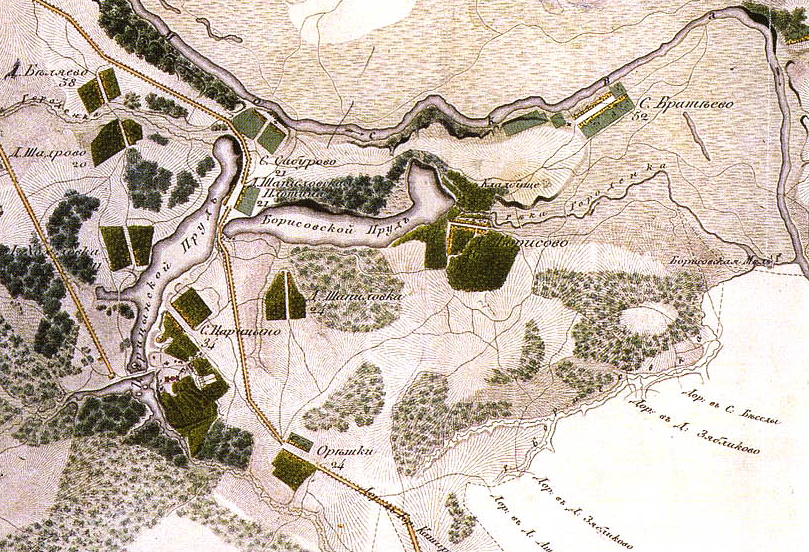
Русский: Участок. Топографическая карта окружности Москвы, снятая офицерами Квантирмейстерской части 1818 года. Гравирована и печатана в военно-топографическом бюро при главном штабе его импереторского Величества 1823 года. |
| Date | 08-06-2010 |
| Source | http://www.etomesto.ru/map-okruga1818/?find=1&x=37.615942955017&y=55.74899937261 |
| Author | DonAvero |
Licensing
edit.png&action=edit§ion=2)
|
This work is in the public domain in its country of origin and other countries and areas where the copyright term is the author's life plus 100 years or fewer. | |
| This file has been identified as being free of known restrictions under copyright law, including all related and neighboring rights. | |
File history
Click on a date/time to view the file as it appeared at that time.
| Date/Time | Thumbnail | Dimensions | User | Comment | |
|---|---|---|---|---|---|
| current | 19:21, 16 June 2010 | | 809 × 552 (1.24 MB) | DonAvero (talk | contribs) | {{Information |Description={{en|1=1}} |Source=1 |Author=1 |Date= |Permission= |other_versions= }} |
You cannot overwrite this file.
File usage on Commons
The following page uses this file:
File usage on other wikis
The following other wikis use this file:
- Usage on fr.wikipedia.org
- Usage on ru.wikipedia.org
- Usage on www.wikidata.org
.png&oldid=854916204)