File:Brigittenau (Wien) - Erlöserkirche.JPG

Size of this preview: 800 × 480 pixels. Other resolutions: 320 × 192 pixels | 1,024 × 615 pixels | 1,280 × 769 pixels | 2,560 × 1,537 pixels | 5,300 × 3,183 pixels.
Original file (5,300 × 3,183 pixels, file size: 9.65 MB, MIME type: image/jpeg)
Captions
Captions
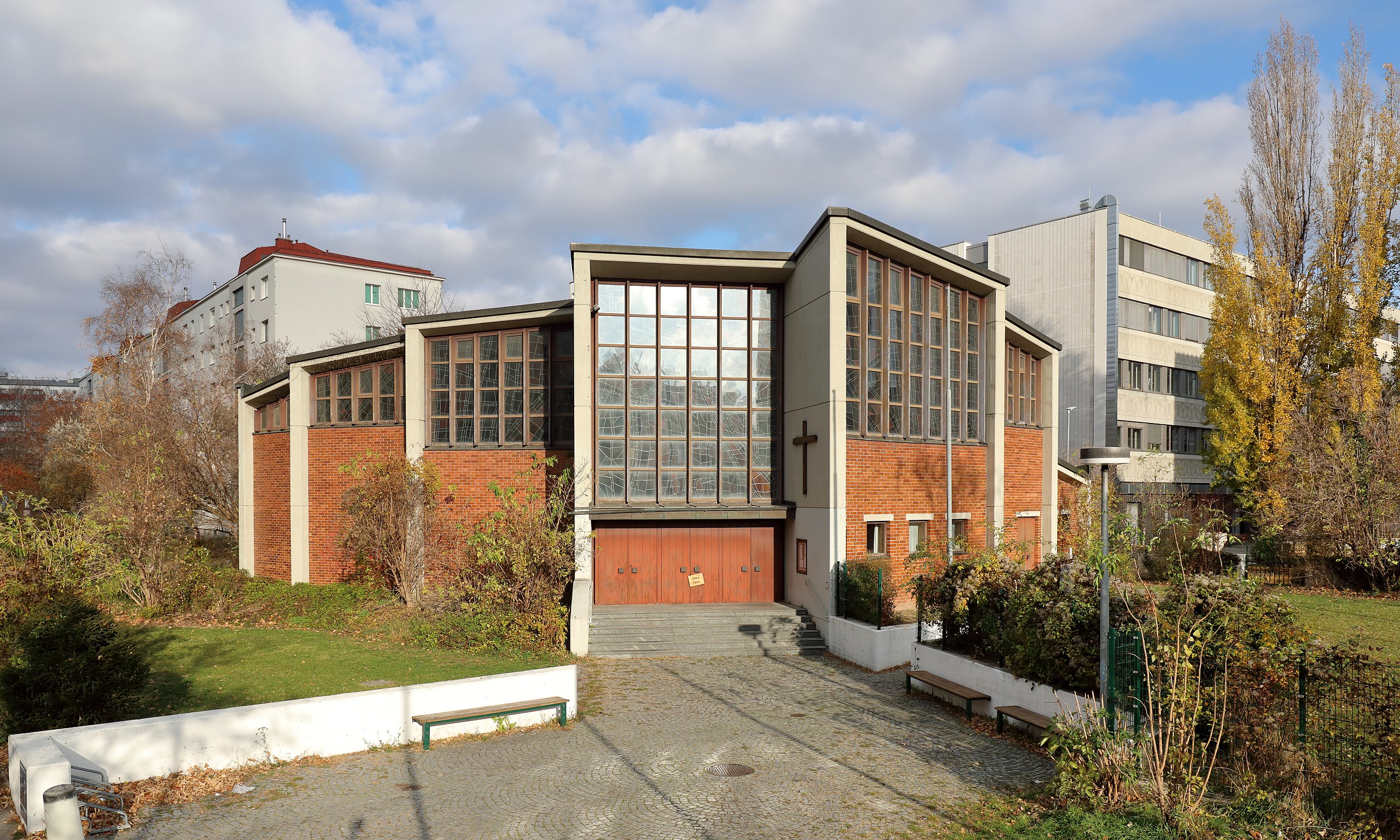
Church "Zum göttlichen Erlöser" in 1200 Vienna, Brigittenau.
Summary
edit_-_Erl%C3%B6serkirche.JPG&action=edit§ion=1)
| Description |
Deutsch: Südwestansicht der röm.-kath. Erlöserkirche in der Eduard-Brückner-Gasse im 20. Wiener Gemeindebezirk Brigittenau.
Die vom Architektenehepaar Karl und Eva Mang entworfene Kirche wurde ab 1982 errichtet und am 27. November 1983 geweiht. Der freistehende Glas-Betonbau mit gestaffelter Eingangsfront und gekrümmter Chorwand ersetzte die „Notkirche Eisfabrik“, die am 20. November 1977 geweiht und 1978 abgerissen wurde: [1]. Diese Notkirche entstand, nachdem zur Entlastung der Pfarren St. Johann Kapistran und St. Brigitta mit 1. Jän. 1978 die Pfarrexpositur „Zum göttlichen Erlöser“ als neue Seelsorgestation errichtet wurde. Diese Expositur wurde dann mit 1. Jän. 1984 zu einer eigenständige Pfarre erhoben: [2]. Mit 1. Sep. 2017 wurden die Pfarre „Zum Göttlichen Erlöser“ mit den Pfarren „Muttergottes im Augarten“ und „Allerheiligen“ zur Pfarre „Zu allen Heiligen“ zusammengelegt und dadurch verlor die Erlöserkirche ihren Status einer Pfarrkirche: [3]. English: Church "Zum göttlichen Erlöser" in 1200 Vienna, Brigittenau.
|
| Date | |
| Source | Own work |
| Author | C.Stadler/Bwag |
| Permission (Reusing this file) |
Deutsch: Hallo, du darfst mein Foto kostenlos nutzen, aber nenne mich bitte als Fotograf, beispielsweise „Foto: C.Stadler/Bwag“ oder © C.Stadler/Bwag; CC-BY-SA-4.0. Auf mehr Angaben bestehe ich nicht - im Gegensatz zu manch anderen, die die Vorgaben der unten angeführten Lizenzierung auf Punkt und Beistrich einfordern. English: Feel free to use my photos, but please mention me as the author like © C.Stadler/Bwag or © C.Stadler/Bwag; CC-BY-SA-4.0 (that's good enough) and if you want send me a message: bwag@gmx.net. |
| Object location | | View this and other nearby images on: OpenStreetMap |
|---|
_-_Erl%C3%B6serkirche.JPG¶ms=048.237880_N_0016.368610_E_globe:Earth_class:object_type:object__&language=en)
| Camera location | | View this and other nearby images on: OpenStreetMap |
|---|
_-_Erl%C3%B6serkirche.JPG¶ms=048.237610_N_0016.368270_E_globe:Earth_type:camera_heading:40.00&language=en)
Licensing
edit_-_Erl%C3%B6serkirche.JPG&action=edit§ion=2)
I, the copyright holder of this work, hereby publish it under the following license:
This file is licensed under the Creative Commons Attribution-Share Alike 4.0 International license.
- You are free:
- to share – to copy, distribute and transmit the work
- to remix – to adapt the work
- Under the following conditions:
- attribution – You must give appropriate credit, provide a link to the license, and indicate if changes were made. You may do so in any reasonable manner, but not in any way that suggests the licensor endorses you or your use.
- share alike – If you remix, transform, or build upon the material, you must distribute your contributions under the same or compatible license as the original.
File history
Click on a date/time to view the file as it appeared at that time.
| Date/Time | Thumbnail | Dimensions | User | Comment | |
|---|---|---|---|---|---|
| current | 19:48, 24 November 2021 | | 5,300 × 3,183 (9.65 MB) | Bwag (talk | contribs) | == {{int:filedesc}} == {{Information |Description= {{de|1= Südwestansicht der röm.-kath. Erlöserkirche in der Eduard-Brückner-Gasse im 20. Wiener Gemeindebezirk Brigittenau.<br/>Die vom Architektenehepaar Karl und Eva Mang entworfene Kirche wurde ab 1982 errichtet und am 27. November 1983 geweiht. Der Glas-Betonbau ersetzte die „Notkirche Eisfabrik“, die am 20. November 1977 geweiht und 1978 abgerissen wurde: [https://www.geschichtewiki.wien.gv.at/Zum_göttlichen_Erlöser]. Diese Notkirche en... |
You cannot overwrite this file.
File usage on Commons
The following page uses this file:
File usage on other wikis
The following other wikis use this file:
- Usage on de.wikipedia.org
- Usage on en.wikipedia.org
- Usage on es.wikipedia.org
- Usage on www.wikidata.org
_-_Erlöserkirche.JPG&oldid=833834468)