File:British Camp Reservoir - geograph.org.uk - 1169117.jpg
No higher resolution available.
British_Camp_Reservoir_-_geograph.org.uk_-_1169117.jpg (640 × 468 pixels, file size: 106 KB, MIME type: image/jpeg)
Captions
Captions
Add a one-line explanation of what this file represents
Summary edit
| Description |
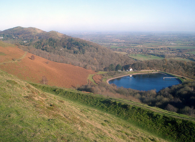
English: British Camp Reservoir Looking north-east from the flank of Millennium Hill. Below is one of the hill fort ramparts, the reservoir and the flat Severn valley. On the left is the bracken-covered hillside of the Herefordshire Beacon and beyond is Pinnacle Hill and Black Hill. The reservoir was opened in 1895 by the Duchess of Teck and it collects water from the many springs on this hillside. |
| Date | |
| Source | From geograph.org.uk |
| Author | Trevor Rickard |
| Attribution (required by the license) | Trevor Rickard / British Camp Reservoir / |
| Camera location | | View this and other nearby images on: OpenStreetMap |
|---|
_heading:22.00&language=en)
| Object location | | View this and other nearby images on: OpenStreetMap |
|---|
_heading:22.00&language=en)
Licensing edit

|
This image was taken from the Geograph project collection. See this photograph's page on the Geograph website for the photographer's contact details. The copyright on this image is owned by Trevor Rickard and is licensed for reuse under the Creative Commons Attribution-ShareAlike 2.0 license.
|
This file is licensed under the Creative Commons Attribution-Share Alike 2.0 Generic license.
Attribution: Trevor Rickard
- You are free:
- to share – to copy, distribute and transmit the work
- to remix – to adapt the work
- Under the following conditions:
- attribution – You must give appropriate credit, provide a link to the license, and indicate if changes were made. You may do so in any reasonable manner, but not in any way that suggests the licensor endorses you or your use.
- share alike – If you remix, transform, or build upon the material, you must distribute your contributions under the same or compatible license as the original.
File history
Click on a date/time to view the file as it appeared at that time.
| Date/Time | Thumbnail | Dimensions | User | Comment | |
|---|---|---|---|---|---|
| current | 13:09, 25 February 2011 | | 640 × 468 (106 KB) | GeographBot (talk | contribs) | == {{int:filedesc}} == {{Information |description={{en|1=British Camp Reservoir Looking north-east from the flank of Millennium Hill. Below is one of the hill fort ramparts, the reservoir and the flat Severn valley. On the left is the bracken-covered hill |
You cannot overwrite this file.
File usage on Commons
There are no pages that use this file.