File:Broadway and Houston, SoHo, Manhattan, New York (7237383856).jpg

Original file (1,600 × 1,200 pixels, file size: 387 KB, MIME type: image/jpeg)
Captions
Captions
Summary edit
.jpg&action=edit§ion=1)
| Description |
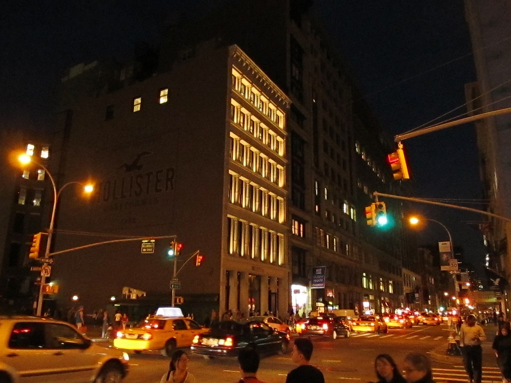
SoHo is a neighborhood in Lower Manhattan, New York City, notable for being the location of many artists' lofts and art galleries, and also, more recently, for the wide variety of stores and shops ranging from trendy boutiques to outlets of upscale national and international chain stores. The area's history is an archetypal example of inner-city regeneration and gentrification, encompassing socio-economic, cultural, political and architectural developments. Almost all of SoHo is included in the SoHo-Cast Iron Historic District, which was designated by the New York City Landmarks Preservation Commission in 1973, extended in 2010, and was listed on the National Register of Historic Places and declared a National Historic Landmark in 1978. It consists of 26 blocks and approximately 500 buildings, many of them incorporating cast iron architectural elements. The side streets in the district are notable for being paved with Belgian blocks. The name SoHo refers to the area being "SOuth of HOuston (Street)". This naming convention has become a model for the names of new and emerging neighborhoods in New York such as NoHo, for "NOrth of HOuston Street", TriBeCa ("TRIangle BElow CAnal Street"), Nolita ("NOrth of Little ITAly"), NoMad ("NOrth of MADison Square"), and DUMBO ("Down Under the Manhattan Bridge Overpass"). <a href="http://en.wikipedia.org/wiki/SoHo" rel="nofollow">en.wikipedia.org/wiki/SoHo</a> <a href="http://en.wikipedia.org/wiki/Wikipedia:Text_of_Creative_Commons_Attribution-ShareAlike_3.0_Unported_License" rel="nofollow">en.wikipedia.org/wiki/Wikipedia:Text_of_Creative_Commons_...</a> |
| Date | |
| Source | Broadway and Houston, SoHo, Manhattan, New York |
| Author | Ken Lund from Reno, Nevada, USA |
| Camera location | | View this and other nearby images on: OpenStreetMap |
|---|
.jpg¶ms=040.725498_N_-073.996814_E_globe:Earth_type:camera_source:Flickr_&language=en)
Licensing edit
.jpg&action=edit§ion=2)
- You are free:
- to share – to copy, distribute and transmit the work
- to remix – to adapt the work
- Under the following conditions:
- attribution – You must give appropriate credit, provide a link to the license, and indicate if changes were made. You may do so in any reasonable manner, but not in any way that suggests the licensor endorses you or your use.
- share alike – If you remix, transform, or build upon the material, you must distribute your contributions under the same or compatible license as the original.
| This image was originally posted to Flickr by Ken Lund at https://flickr.com/photos/75683070@N00/7237383856 (archive). It was reviewed on 11 December 2019 by FlickreviewR 2 and was confirmed to be licensed under the terms of the cc-by-sa-2.0. |
File history
Click on a date/time to view the file as it appeared at that time.
| Date/Time | Thumbnail | Dimensions | User | Comment | |
|---|---|---|---|---|---|
| current | 13:23, 11 December 2019 | | 1,600 × 1,200 (387 KB) | Drabdullayev17 (talk | contribs) | Transferred from Flickr via #flickr2commons |
You cannot overwrite this file.
File usage on Commons
There are no pages that use this file.
.jpg&oldid=834706786)