File:Buildings at Londonderry Wharf near Keynsham - geograph.org.uk - 1754029.jpg

Size of this preview: 800 × 496 pixels. Other resolutions: 320 × 198 pixels | 640 × 396 pixels | 1,024 × 634 pixels | 1,600 × 991 pixels.
Original file (1,600 × 991 pixels, file size: 557 KB, MIME type: image/jpeg)
Captions
Captions
Add a one-line explanation of what this file represents
Summary edit
| Description |
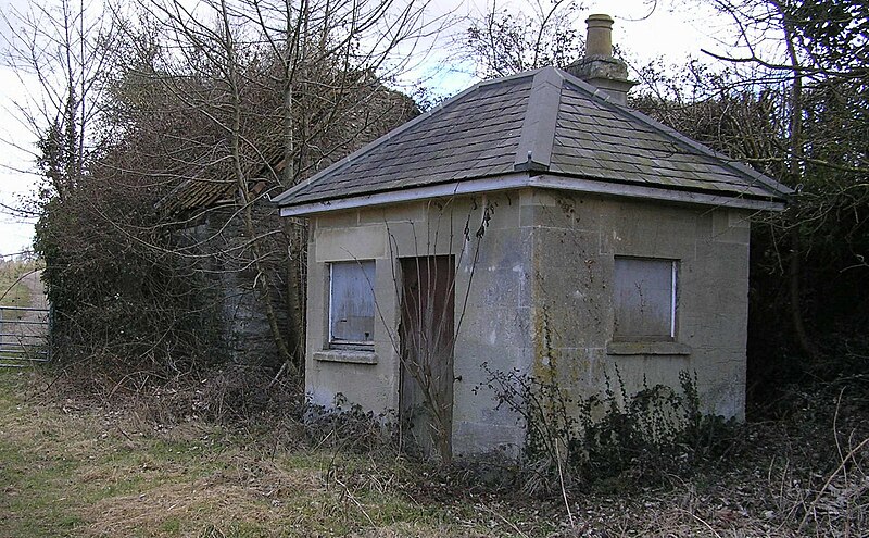
English: Buildings at Londonderry Wharf near Keynsham. The wharf used to load coal delivered here by the dramway, onto barges. I believe these disused buildings used to be the Weighbridge |
| Date | |
| Source | From geograph.org.uk |
| Author | Rick Crowley |
| Attribution (required by the license) | Rick Crowley / Buildings at Londonderry Wharf, Keynsham / |
| Camera location | | View this and other nearby images on: OpenStreetMap |
|---|
_heading:67.00&language=en)
| Object location | | View this and other nearby images on: OpenStreetMap |
|---|
_heading:67.00&language=en)
Licensing edit

|
This image was taken from the Geograph project collection. See this photograph's page on the Geograph website for the photographer's contact details. The copyright on this image is owned by Rick Crowley and is licensed for reuse under the Creative Commons Attribution-ShareAlike 2.0 license.
|
This file is licensed under the Creative Commons Attribution-Share Alike 2.0 Generic license.
Attribution: Rick Crowley
- You are free:
- to share – to copy, distribute and transmit the work
- to remix – to adapt the work
- Under the following conditions:
- attribution – You must give appropriate credit, provide a link to the license, and indicate if changes were made. You may do so in any reasonable manner, but not in any way that suggests the licensor endorses you or your use.
- share alike – If you remix, transform, or build upon the material, you must distribute your contributions under the same or compatible license as the original.
File history
Click on a date/time to view the file as it appeared at that time.
| Date/Time | Thumbnail | Dimensions | User | Comment | |
|---|---|---|---|---|---|
| current | 22:12, 5 March 2011 | | 1,600 × 991 (557 KB) | GeographBot (talk | contribs) | == {{int:filedesc}} == {{Information |description={{en|1=Buildings at Londonderry Wharf, Keynsham The wharf used to load coal delivered here by the dramway, onto barges. I believe these disused buildings used to be the Weighbridge}} |date=2010-03-14 |sou |
You cannot overwrite this file.
File usage on Commons
The following page uses this file: