File:Burnaby BC Aerial view 2015.jpg

Size of this preview: 800 × 530 pixels. Other resolutions: 320 × 212 pixels | 640 × 424 pixels | 1,024 × 678 pixels | 1,280 × 848 pixels | 2,560 × 1,696 pixels | 4,928 × 3,264 pixels.
Original file (4,928 × 3,264 pixels, file size: 8.23 MB, MIME type: image/jpeg)
Captions
Captions
Add a one-line explanation of what this file represents
Summary edit
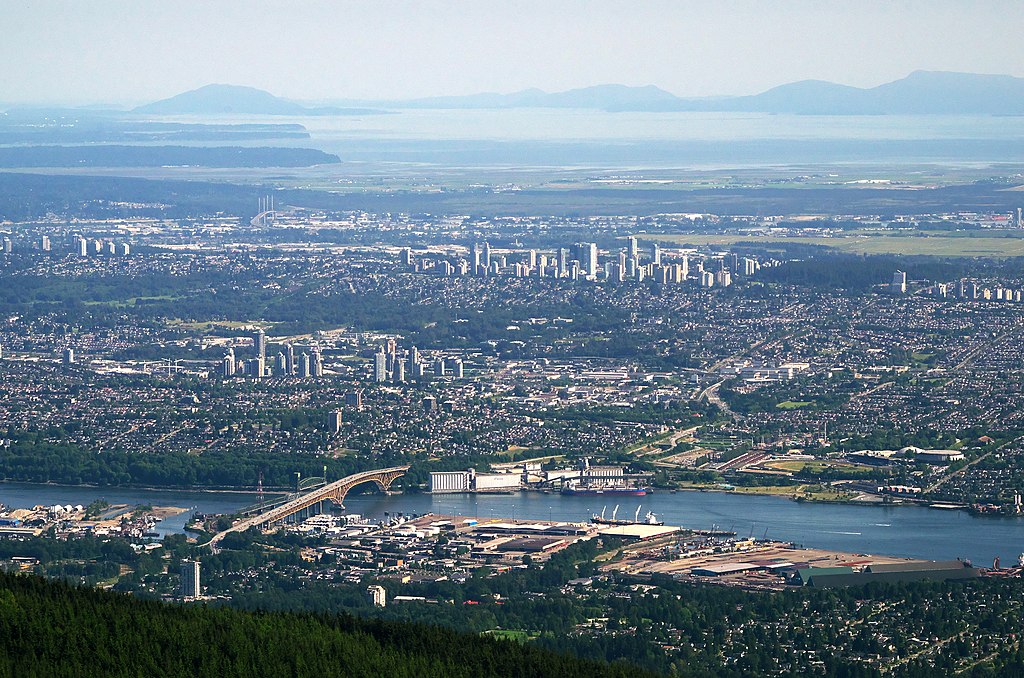
| Description | Burnaby, British Columbia. Mt Baker would be visible on the horizon to the left of centre, if it wasn't for the haze. |
| Date | Taken on 7 June 2015, 01:08 |
| Source | Narrows bridge and Burnaby |
| Author | Rob Hurson from Kentstown, Ireland |
| Camera location | | View this and other nearby images on: OpenStreetMap |
|---|
Licensing edit
This file is licensed under the Creative Commons Attribution-Share Alike 2.0 Generic license.
- You are free:
- to share – to copy, distribute and transmit the work
- to remix – to adapt the work
- Under the following conditions:
- attribution – You must give appropriate credit, provide a link to the license, and indicate if changes were made. You may do so in any reasonable manner, but not in any way that suggests the licensor endorses you or your use.
- share alike – If you remix, transform, or build upon the material, you must distribute your contributions under the same or compatible license as the original.
| This image was originally posted to Flickr by Rob Hurson at https://flickr.com/photos/65378423@N08/18885522031 (archive). It was reviewed on 4 June 2019 by FlickreviewR 2 and was confirmed to be licensed under the terms of the cc-by-sa-2.0. |
File history
Click on a date/time to view the file as it appeared at that time.
| Date/Time | Thumbnail | Dimensions | User | Comment | |
|---|---|---|---|---|---|
| current | 11:23, 4 June 2019 | | 4,928 × 3,264 (8.23 MB) | Alexis Jazz (talk | contribs) | wb |
| 11:14, 4 June 2019 |  | 4,928 × 3,264 (7.72 MB) | Alexis Jazz (talk | contribs) | https://live.staticflickr.com/3858/18885522031_f19f4fc80f_o_d.jpg | |
| 14:31, 14 May 2019 |  | 4,928 × 3,264 (12.64 MB) | Wpcpey (talk | contribs) | =={{int:filedesc}}== {{Information |Description= Burnaby, British Columbia. Mt Rainier would be visible on the horizon to the left of centre, if it wasn't for the haz e. |Source=[https://www.flickr.com/photos/robhurson/18885522031/ Narrows bridge and Burnaby] |Date=2015-06-07 01:08 |Author=[https://www.flickr.com/people/65378423@N08 Rob Hurson] from Kentstown, Ireland |Permission= |other_versions= }} {{Location dec|49.383788|-123.076262|source:Flickr}} =={{int:license-header}}== {{cc-by-sa-2... |
You cannot overwrite this file.
File usage on Commons
There are no pages that use this file.
File usage on other wikis
The following other wikis use this file:
- Usage on en.wikipedia.org
- Usage on id.wikipedia.org
- Usage on it.wikipedia.org
- Usage on ja.wikipedia.org
- Usage on ku.wikipedia.org
- Usage on sw.wikipedia.org