File:CANADA MAP 1542 HARLEYENNE.jpg
Size of this preview: 800 × 571 pixels. Other resolutions: 320 × 229 pixels | 640 × 457 pixels | 1,024 × 731 pixels | 1,280 × 914 pixels | 2,366 × 1,690 pixels.
Original file (2,366 × 1,690 pixels, file size: 1.23 MB, MIME type: image/jpeg)
Captions
Captions
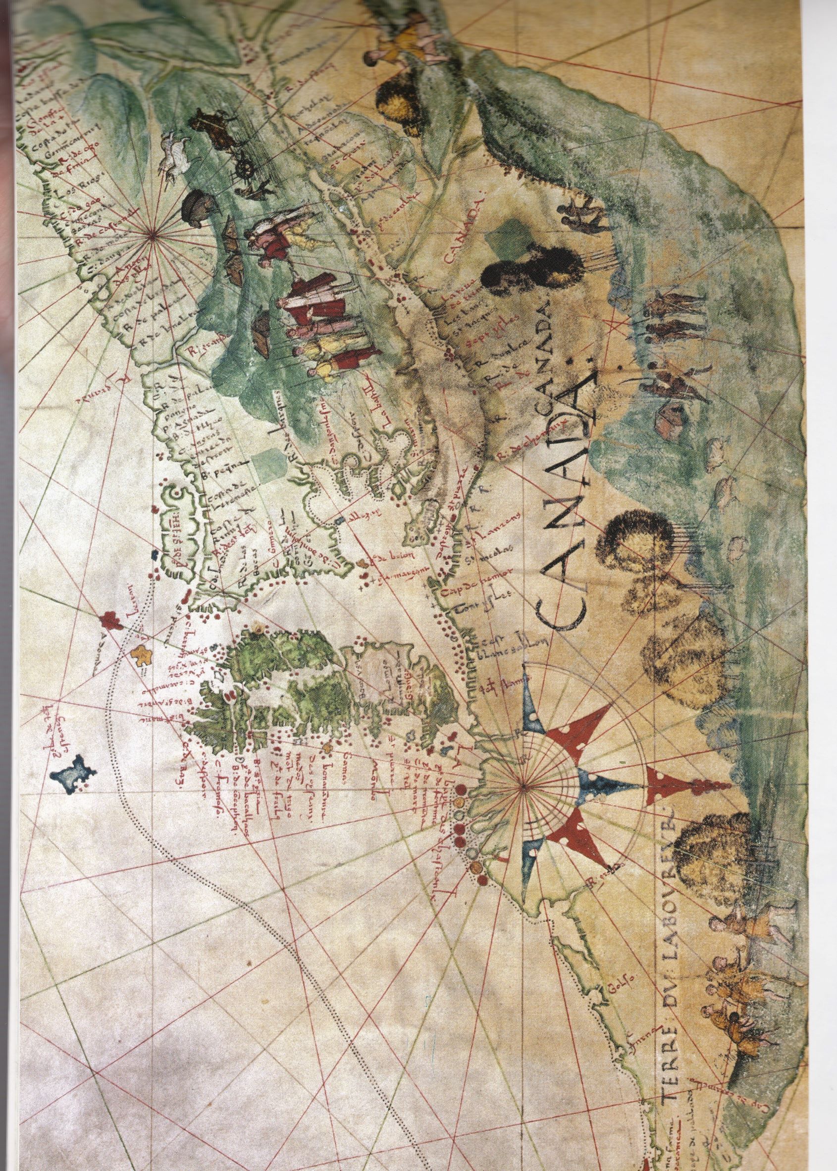
Map of Canada, circa 1542, based on Jacques Cartier's Journal 1535-1536
Summary edit
| Description |
English: Excerpt from a larger map produced by famous École de Dieppe School of Cartographers, circa 1542, depicting the newly named land Canada, based on Jacques Cartier's Journal 1535-1536; from British Library Add MS 5413 |
| Date | circa 1542 |
| Source | Historical Atlas of Canada, Derek Hayes, 2002, page 26, ISBN 978-1-77162--079-6 |
| Author | École de Dieppe famous School of Cartographers, France |
Status of the artwork edit
|
This is a faithful photographic reproduction of a two-dimensional, public domain work of art. The work of art itself is in the public domain in its source country for the following reason:
It is also in the public domain in the United States for the following reason:
The official position taken by the Wikimedia Foundation is that "faithful reproductions of two-dimensional public domain works of art are public domain".
This photographic reproduction is therefore also considered to be in the public domain in the United States. In other jurisdictions, re-use of this content may be restricted; see Reuse of PD-Art photographs for details.
| ||||||
File history
Click on a date/time to view the file as it appeared at that time.
| Date/Time | Thumbnail | Dimensions | User | Comment | |
|---|---|---|---|---|---|
| current | 13:19, 18 May 2020 | | 2,366 × 1,690 (1.23 MB) | X23z5k534 (talk | contribs) | Uploaded a work by École de Dieppe famous School of Cartographers, France, circa 1542 from Historical Atlas of Canada, Derek Hayes, 2002, page 26, ISBN 978-1-77162--079-6 with UploadWizard |
You cannot overwrite this file.
File usage on Commons
There are no pages that use this file.
File usage on other wikis
The following other wikis use this file:
- Usage on fr.wikipedia.org