File:CEMA members.png

Size of this preview: 800 × 351 pixels. Other resolutions: 320 × 140 pixels | 640 × 281 pixels | 1,425 × 625 pixels.
Original file (1,425 × 625 pixels, file size: 56 KB, MIME type: image/png)
Captions
Captions
Add a one-line explanation of what this file represents
Summary edit

|
File:Comecon.svg is a vector version of this file. It should be used in place of this PNG file.
File:CEMA members.png → File:Comecon.svg
For more information, see Help:SVG. |
 |
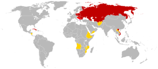
English: This is a map of the members of en:Comecon (aka the Council for Mutual Economic Assistance - CEMA). This map is based of the 1985 blank world map. The CIA World Factbook of 1991 had an profile for Comecon; this profile was used as reference. The text of the profile is below:
Council for Mutual Economic Assistance (CEMA), also known as
CMEA or Comecon, was established 25 January 1949 to promote the
development of socialist economies and was abolished 1 January 1991;
members included Afghanistan (observer), Albania (had not participated
since 1961 break with USSR), Angola (observer), Bulgaria, Cuba,
Czechoslovakia, Ethiopia (observer), GDR, Hungary, Laos (observer),
Mongolia, Mozambique (observer), Nicaragua (observer), Poland, Romania,
USSR, Vietnam, Yemen (observer), Yugoslavia (associate)
link: 1991 CIA World Factbook at the Wiretap Electronic Text Archive archive copy at the Wayback Machine
Note: Even though the Factbook lists "Yemen", I think is logical to conclude that North Yemen wouldn't have joined Comecon since it wasn't communist.
Key edit
members
members who did not participate
associates
observers
Licensing edit
| This work has been released into the public domain by its author, Hoshie. This applies worldwide. In some countries this may not be legally possible; if so: |
File history
Click on a date/time to view the file as it appeared at that time.
| Date/Time | Thumbnail | Dimensions | User | Comment | |
|---|---|---|---|---|---|
| current | 04:59, 5 March 2014 | | 1,425 × 625 (56 KB) | Grachifan (talk | contribs) | uploading |
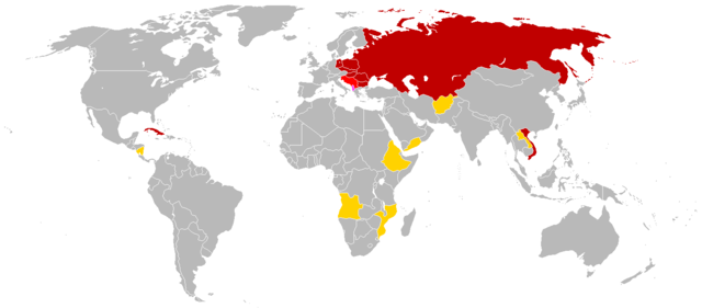
| 09:07, 27 February 2010 |  | 841 × 529 (37 KB) | Hoshie (talk | contribs) | Made a few geographic changes: added Walvis Bay (Nambia; part of S. Africa during CEMA's existence); fixed the boundries of the PDRY. | |
| 21:03, 10 October 2008 |  | 841 × 529 (23 KB) | Milosevo (talk | contribs) | {{Information |Description= |Source= |Date= |Author= |Permission= |other_versions= }} | |
| 14:13, 21 January 2008 |  | 841 × 529 (23 KB) | Aivazovsky~commonswiki (talk | contribs) | {{Information |Description= |Source= |Date= |Author= |Permission= |other_versions= }} | |
| 13:59, 21 January 2008 |  | 841 × 529 (23 KB) | Aivazovsky~commonswiki (talk | contribs) | Updated | |
| 03:59, 29 June 2007 |  | 832 × 490 (30 KB) | Hoshie (talk | contribs) | added Cabinda (between Angola and Zaire). under same lic. as original. | |
| 20:49, 22 November 2006 |  | 832 × 490 (20 KB) | Hoshie (talk | contribs) | put Albania in a more bold color - #FF40FF | |
| 08:27, 18 November 2006 |  | 832 × 490 (20 KB) | Hoshie (talk | contribs) | forgot Afghanistan. I have added it. | |
| 07:54, 18 November 2006 |  | 842 × 496 (20 KB) | Hoshie (talk | contribs) | This is a map of the members of en:Comecon (aka the Council for Mutual Economic Assistance - CEMA). This map is based of the 1985 blank world map. The World Factbook of 1991 has an profile for Comecon; this profile |
You cannot overwrite this file.
File usage on Commons
The following page uses this file:
File usage on other wikis
The following other wikis use this file:
- Usage on als.wikipedia.org
- Usage on ar.wikipedia.org
- Usage on be.wikipedia.org
- Usage on de.wikipedia.org
- Usage on en.wikipedia.org
- Usage on fa.wikipedia.org
- Usage on gl.wikipedia.org
- Usage on hu.wikipedia.org
- Usage on no.wikipedia.org
- Usage on tl.wikipedia.org
- Usage on uk.wikipedia.org