File:CREST OF THE SOUTH CHANNEL DAM, SHOWING BLOCK HOUSE (NOT ORIGINAL) COVERING THE ELECTRICALLY POWERED GATE-LIFTING MECHANISM THAT REPLACED THE ORIGINAL HAND-OPERATED LIFTING HAER ID,28-POFAL,1C-3.tif
Size of this JPG preview of this TIF file: 489 × 599 pixels. Other resolutions: 196 × 240 pixels | 392 × 480 pixels | 627 × 768 pixels | 835 × 1,024 pixels | 1,671 × 2,048 pixels | 4,080 × 5,000 pixels.
Original file (4,080 × 5,000 pixels, file size: 19.46 MB, MIME type: image/tiff)
Captions
Captions
Add a one-line explanation of what this file represents
Summary edit
| Title |
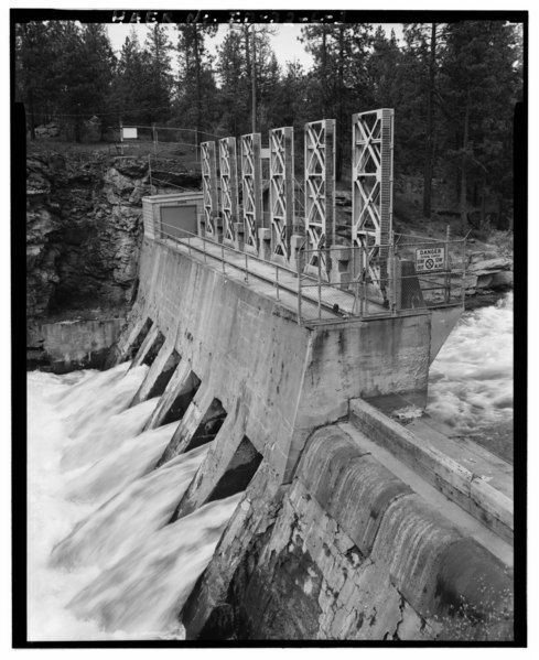
CREST OF THE SOUTH CHANNEL DAM, SHOWING BLOCK HOUSE (NOT ORIGINAL) COVERING THE ELECTRICALLY POWERED GATE-LIFTING MECHANISM THAT REPLACED THE ORIGINAL HAND-OPERATED LIFTING DEVICE, LOOKING NORTH. - Washington Water Power Company Post Falls Power Plant, South Channel Dam, West of intersection of Spokane and Fourth Streets, Post Falls, Kootenai County, ID |
|||
| Depicted place | Idaho; Kootenai County; Post Falls | |||
| Date | Documentation compiled after 1968 | |||
| Dimensions | 4 x 5 in. | |||
| Current location |
Library of Congress Prints and Photographs Division Washington, D.C. 20540 USA http://hdl.loc.gov/loc.pnp/pp.print |
|||
| Accession number |
HAER ID,28-POFAL,1C-3 |
|||
| Credit line |
|
|||
| Notes |
|
|||
| Source | https://www.loc.gov/pictures/item/id0403.photos.318194p | |||
| Permission (Reusing this file) |
|

| Object location | | View this and other nearby images on: OpenStreetMap |
|---|
File history
Click on a date/time to view the file as it appeared at that time.
| Date/Time | Thumbnail | Dimensions | User | Comment | |
|---|---|---|---|---|---|
| current | 10:02, 15 July 2014 |  | 4,080 × 5,000 (19.46 MB) | Fæ (talk | contribs) | GWToolset: Creating mediafile for Fæ. HABS 11 July 2014 (1001:1200) |
You cannot overwrite this file.
File usage on Commons
The following page uses this file: