File:CSIRO ScienceImage 4302 Yellow Kandosol soil profile in the Bamaga Reserve Cape York Peninsula north Queensland.jpg
Size of this preview: 719 × 600 pixels. Other resolutions: 288 × 240 pixels | 576 × 480 pixels | 921 × 768 pixels | 1,228 × 1,024 pixels | 1,626 × 1,356 pixels.
Original file (1,626 × 1,356 pixels, file size: 3.43 MB, MIME type: image/jpeg)
Captions
Captions
Add a one-line explanation of what this file represents
Summary edit
| Description |
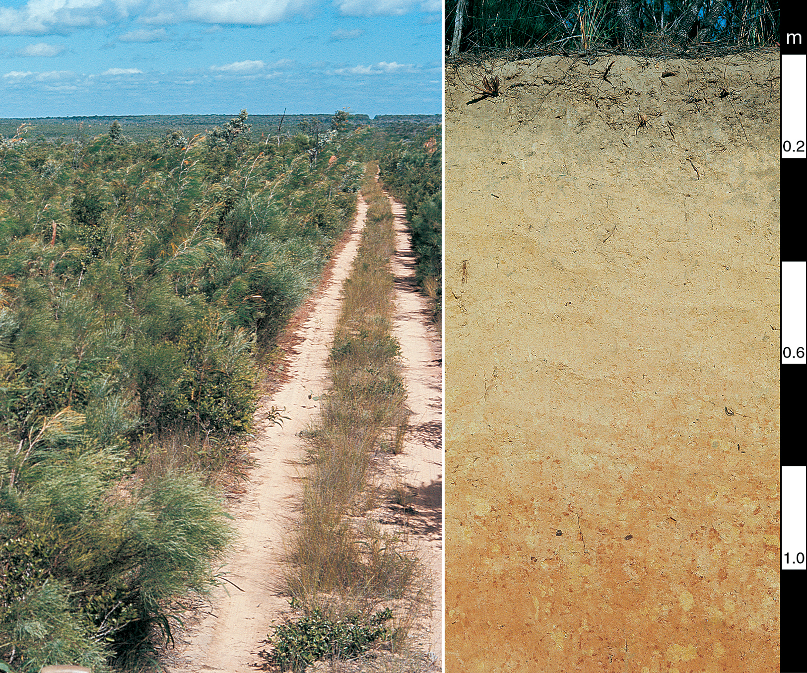
English: The picture on the right shows a yellow Kandosol soil profile in the Bamaga Reserve, Cape York Peninsula, north Queensland. On the left is a typical landscape showing rolling low rises with closed heath on Cape York Peninsula, far north Queensland. For more information see McKenzie, N. J., Jacquier, D. W., Isbell, R. F. and Brown, K. L. (2004). Australian Soils and Landscapes: an illustrated compendium. 416pp (CSIRO Publishing: Melbourne). |
| Date | |
| Source | http://www.scienceimage.csiro.au/image/4302 |
| Author | Ray Isbell, CSIRO |
| Permission (Reusing this file) |
http://www.scienceimage.csiro.au/pages/about/ |
| Rights holder | CSIRO |
Licensing edit
This file is licensed under the Creative Commons Attribution 3.0 Unported license.
Attribution: CSIRO
- You are free:
- to share – to copy, distribute and transmit the work
- to remix – to adapt the work
- Under the following conditions:
- attribution – You must give appropriate credit, provide a link to the license, and indicate if changes were made. You may do so in any reasonable manner, but not in any way that suggests the licensor endorses you or your use.
File history
Click on a date/time to view the file as it appeared at that time.
| Date/Time | Thumbnail | Dimensions | User | Comment | |
|---|---|---|---|---|---|
| current | 10:48, 19 September 2014 | | 1,626 × 1,356 (3.43 MB) | File Upload Bot (99of9) (talk | contribs) | {{User:99of9/CSIRO_template |id=4302 |Title=Yellow Kandosol soil profile in the Bamaga Reserve, Cape York Peninsula, north Queensland |Creator=Ray Isbell |Creator_scheme=LCNA |Date=2007-07-26 |Date_scheme=ISO8601 |Description=The picture on the right s... |
You cannot overwrite this file.
File usage on Commons
There are no pages that use this file.
File usage on other wikis
The following other wikis use this file:
- Usage on az.wikipedia.org
- Usage on da.wikipedia.org
- Usage on ru.wikipedia.org
- Usage on uk.wikipedia.org
- Usage on www.wikidata.org