File:CT 4th Congressional District.png
No higher resolution available.
CT_4th_Congressional_District.png (640 × 405 pixels, file size: 62 KB, MIME type: image/png)
Captions
Captions
Add a one-line explanation of what this file represents
Summary edit

|
This file was moved to Wikimedia Commons from en.wikipedia using a bot script. All source information is still present. It requires review. Additionally, there may be errors in any or all of the information fields; information on this file should not be considered reliable and the file should not be used until it has been reviewed and any needed corrections have been made. Once the review has been completed, this template should be removed. For details about this file, see below. Check now! |
| Description |
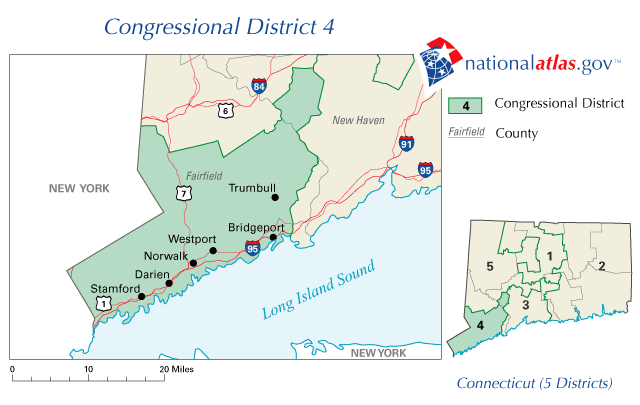
English: Map of Connecticut's 4th congressional district. Downloaded from http://nationalatlas.gov/printable/images/preview/congdist/ct04_109.gif and converted to PNG. |
| Source | Government of the United States |
| Author | Government of the United States |
Licensing edit
This map was obtained from an edition of the National Atlas of the United States. Like almost all works of the U.S. federal government, works from the National Atlas are in the public domain in the United States.
Online access: NationalAtlas.gov | 1970 print edition: Library of Congress, Perry-Castañeda Library
|
Original upload log edit
The original description page was here. All following user names refer to en.wikipedia.
- 2006-12-22 09:45 Acntx 640×405× (63999 bytes) Map of Connecticut's 4th congressional district. Downloaded from http://nationalatlas.gov/printable/images/preview/congdist/ct04_109.gif and converted to PNG.
File history
Click on a date/time to view the file as it appeared at that time.
| Date/Time | Thumbnail | Dimensions | User | Comment | |
|---|---|---|---|---|---|
| current | 20:46, 12 January 2012 | | 640 × 405 (62 KB) | MGA73bot2 (talk | contribs) | {{BotMoveToCommons|en.wikipedia|year={{subst:CURRENTYEAR}}|month={{subst:CURRENTMONTHNAME}}|day={{subst:CURRENTDAY}}}} {{Information |Description={{en|Map of Connecticut's 4th congressional district. Downloaded from http://nationalatlas.gov/printable/i |
You cannot overwrite this file.
File usage on Commons
There are no pages that use this file.
File usage on other wikis
The following other wikis use this file:
- Usage on en.wikipedia.org
- Usage on fa.wikipedia.org
- Usage on fr.wikipedia.org