File:Caerphilly UK community map (blank).svg

Size of this PNG preview of this SVG file: 423 × 599 pixels. Other resolutions: 169 × 240 pixels | 339 × 480 pixels | 542 × 768 pixels | 723 × 1,024 pixels | 1,446 × 2,048 pixels | 894 × 1,266 pixels.
Original file (SVG file, nominally 894 × 1,266 pixels, file size: 473 KB)
Captions
Captions
Add a one-line explanation of what this file represents
| Description |
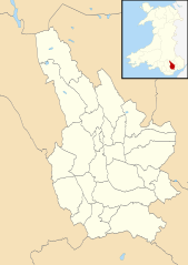
Blank map of Caerphilly, UK with communities shown. Equirectangular map projection on WGS 84 datum, with N/S stretched 160% Geographic limits:
|
| Date | |
| Source |
|
| Author | Nilfanion, created using Ordnance Survey data |
| Permission (Reusing this file) |
This file is licensed under the Creative Commons Attribution-Share Alike 3.0 Unported license. Attribution: Contains Ordnance Survey data © Crown copyright and database right
|
File history
Click on a date/time to view the file as it appeared at that time.
| Date/Time | Thumbnail | Dimensions | User | Comment | |
|---|---|---|---|---|---|
| current | 17:58, 16 October 2010 | | 894 × 1,266 (473 KB) | Nilfanion (talk | contribs) | {{Information |Description=Blank map of Caerphilly, UK with communities shown. Equirectangular map projection on WGS 84 datum, with N/S stretched 160% Geographic limits: *West: 3.40W *East: 3.05W *North: 51.83N *South: 51.52N |Source=[[ |
You cannot overwrite this file.
File usage on Commons
The following 29 pages use this file:
- User:Nilfanion/Maps/Counties
- User:Nilfanion/Maps/Wales
- File:2010 Wales Caerphilly Community Aber Valley map.svg
- File:2010 Wales Caerphilly Community Abercarn map.svg
- File:2010 Wales Caerphilly Community Argoed map.svg
- File:2010 Wales Caerphilly Community Bargoed map.svg
- File:2010 Wales Caerphilly Community Bedwas, Trethomas and Machen map.svg
- File:2010 Wales Caerphilly Community Blackwood map.svg
- File:2010 Wales Caerphilly Community Caerphilly map.svg
- File:2010 Wales Caerphilly Community Cefn Fforest map.svg
- File:2010 Wales Caerphilly Community Crosskeys map.svg
- File:2010 Wales Caerphilly Community Crumlin map.svg
- File:2010 Wales Caerphilly Community Darran Valley map.svg
- File:2010 Wales Caerphilly Community Gelligaer map.svg
- File:2010 Wales Caerphilly Community Llanbradach and Pwllypant map.svg
- File:2010 Wales Caerphilly Community Maesycwmmer map.svg
- File:2010 Wales Caerphilly Community Nelson map.svg
- File:2010 Wales Caerphilly Community New Tredegar map.svg
- File:2010 Wales Caerphilly Community Newbridge map.svg
- File:2010 Wales Caerphilly Community Pengam map.svg
- File:2010 Wales Caerphilly Community Penmaen map.svg
- File:2010 Wales Caerphilly Community Penyrheol, Trecenydd and Energlyn map.svg
- File:2010 Wales Caerphilly Community Pontllanfraith map.svg
- File:2010 Wales Caerphilly Community Rhymney map.svg
- File:2010 Wales Caerphilly Community Risca map.svg
- File:2010 Wales Caerphilly Community Rudry map.svg
- File:2010 Wales Caerphilly Community Van map.svg
- File:2010 Wales Caerphilly Community Ynysddu map.svg
- File:2024 Wales Caerphilly Community map.svg
.svg&oldid=845327662)