File:Calcutta (ASTER).jpg
Size of this preview: 490 × 599 pixels. Other resolutions: 196 × 240 pixels | 393 × 480 pixels | 628 × 768 pixels | 838 × 1,024 pixels | 1,800 × 2,200 pixels.
Original file (1,800 × 2,200 pixels, file size: 1.83 MB, MIME type: image/jpeg)
Captions
Captions
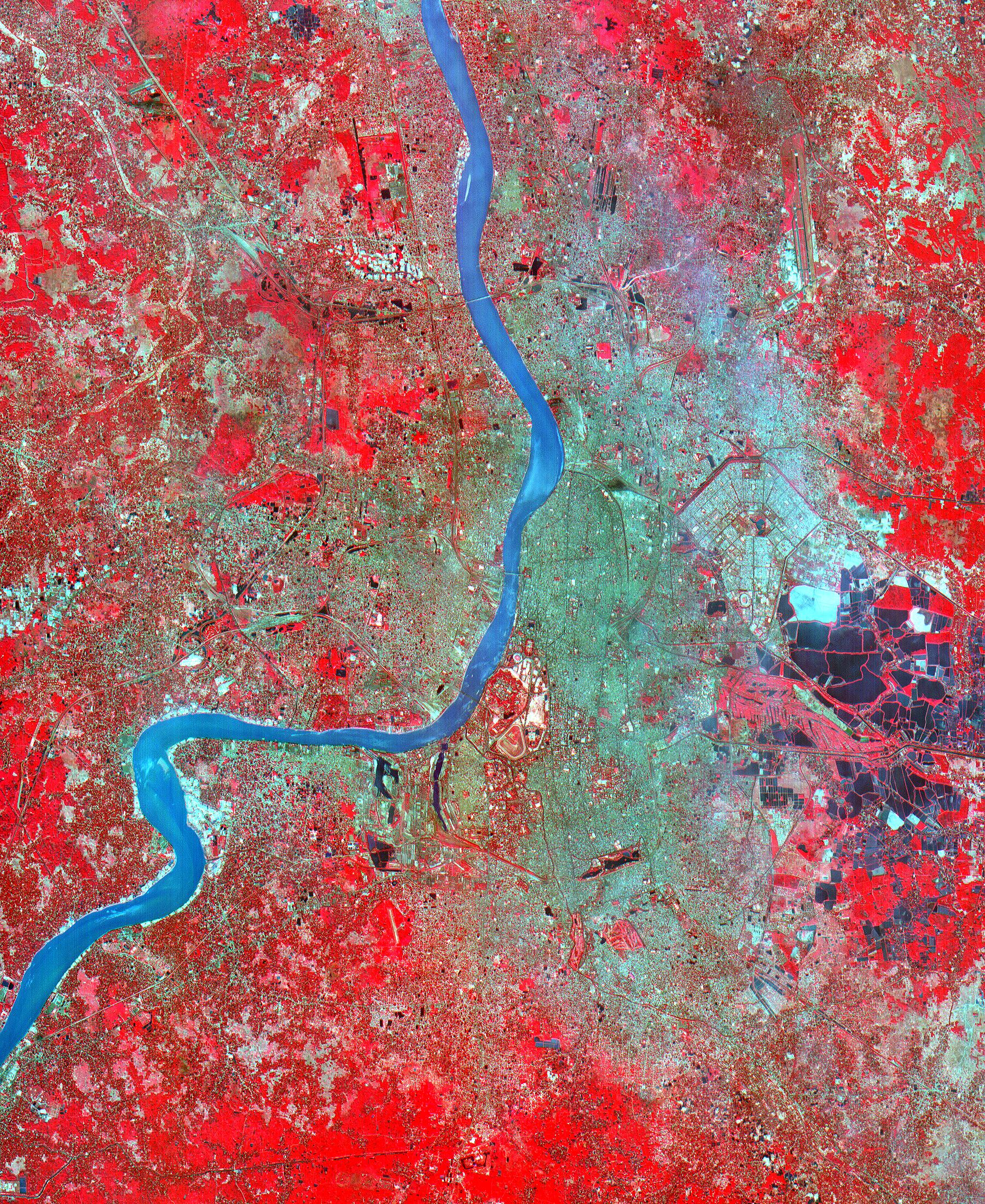
The city of Calcutta appears in this 24 by 34 km (15 by 21 mile) sub-scene, acquired March 29, 2000. In 1690 the British East India Company founded Calcutta as a trading post on the marshy east bank of the Hugli River.
Summary edit
.jpg&action=edit§ion=1)
| Description |
English: The city of Calcutta appears in this 24 by 34 km (15 by 21 mile) sub-scene, acquired March 29, 2000. In 1690 the British East India Company founded Calcutta as a trading post on the marshy east bank of the Hugli River. Chosen for its easily defensible location and its access to the Bay of Bengal, the site developed into an important trading port. In 1773 Calcutta was made the capital of British India. As merchants and workers from all over the Indian subcontinent flocked to the city, British interests prospered, and British colonizers built mansions and palaces on land reclaimed from the marshes and swampland. In 1912, however, Calcutta lost its position as the colonial capital to Delhi. The end of British rule in India in 1947 cut off many of Calcutta's sources of trade and brought a deluge of immigrants to the city. The Bangladesh war in 1971 exacerbated the influx of refugees. Today this vibrant city has a population of over 5 million, and continues to sprawl to the north and south from the central grid of its old European section. This image was acquired on June 23, 2002, covers an area of 33 x 27 km, and is located at 22.6 degrees north latitude and 88.3 degrees east longitude. (c) 1995-1997 Microsoft Corporation. All rights reserved. |
||
| Date | Taken on 23 June 2002 | ||
| Source |
|
||
| Author | NASA/METI/AIST/Japan Space Systems, and U.S./Japan ASTER Science Team |
| Object location | | View this and other nearby images on: OpenStreetMap |
|---|
.jpg¶ms=022.600000_N_0088.300000_E_globe:Earth_class:object_type:object__&language=en)
| This media is a product of the Terra mission Credit and attribution belongs to the Advanced Spaceborne Thermal Emission and Reflection Radiometer (ASTER) team, NASA/METI/AIST/Japan Space Systems |
Licensing edit
.jpg&action=edit§ion=2)
| This file is in the public domain in the United States because it was solely created by NASA. NASA copyright policy states that "NASA material is not protected by copyright unless noted". (See Template:PD-USGov, NASA copyright policy page or JPL Image Use Policy.) | ||
 |
Warnings:
|
File history
Click on a date/time to view the file as it appeared at that time.
| Date/Time | Thumbnail | Dimensions | User | Comment | |
|---|---|---|---|---|---|
| current | 18:52, 7 May 2023 | | 1,800 × 2,200 (1.83 MB) | OptimusPrimeBot (talk | contribs) | #Spacemedia - Upload of https://asterweb.jpl.nasa.gov/gallery/images/callcutta.jpg via Commons:Spacemedia |
You cannot overwrite this file.
File usage on Commons
There are no pages that use this file.
.jpg&oldid=845683022)