File:Canada Line cut and cover construction 2007.JPG
Size of this preview: 800 × 600 pixels. Other resolutions: 320 × 240 pixels | 640 × 480 pixels | 1,024 × 768 pixels | 1,280 × 960 pixels | 2,304 × 1,728 pixels.
Original file (2,304 × 1,728 pixels, file size: 1.55 MB, MIME type: image/jpeg)
Captions
Captions
Add a one-line explanation of what this file represents
Summary edit
| Description |
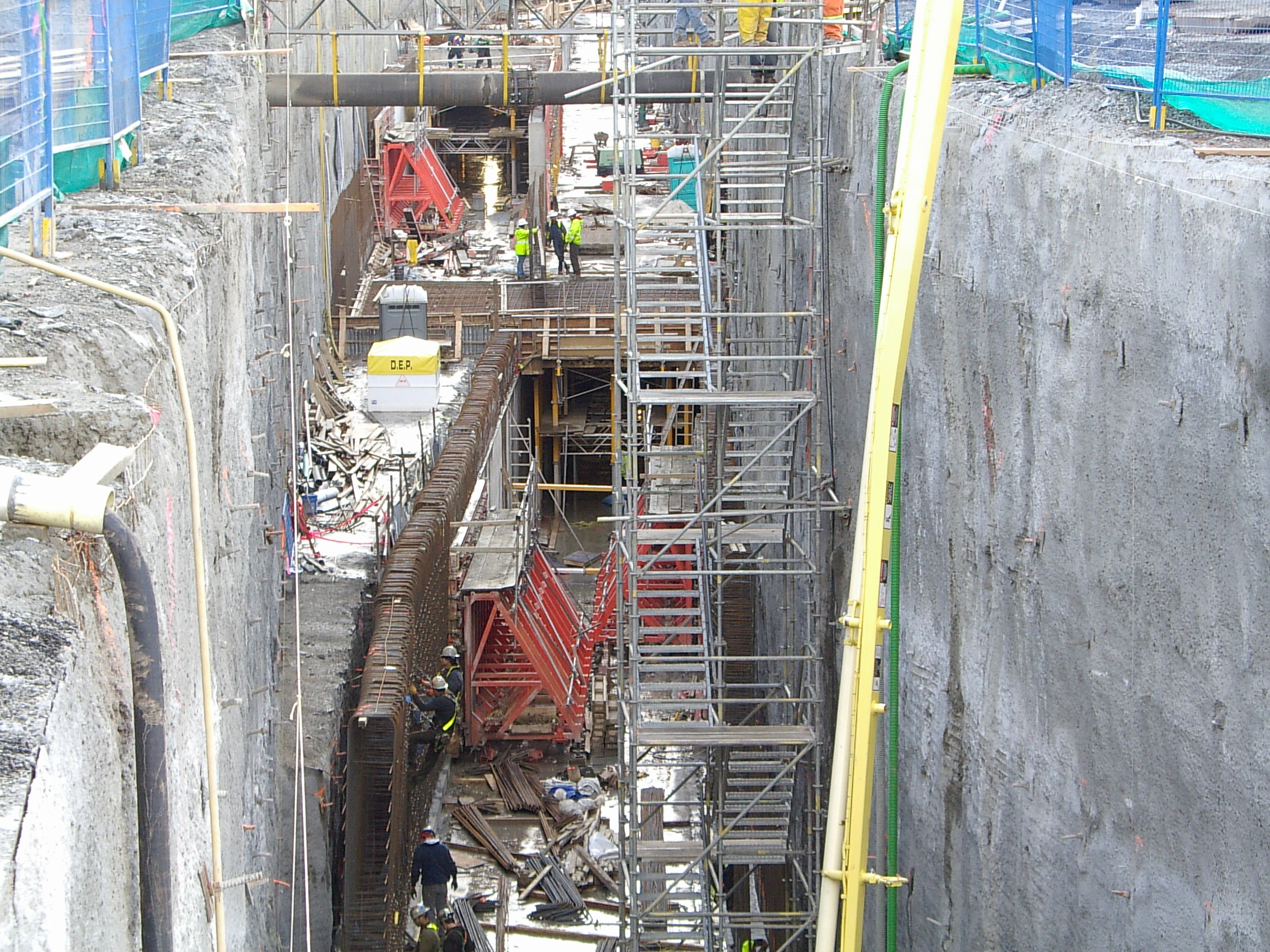
English: Cut and cover construction on Cambie Street just south of 29th avenue next to Queen Elizabeth Park. The tracks go from side to side configuration south of this location to top and bottom configuration north of this location. |
| Date | |
| Source | Own work |
| Author | Whatever2009 at en.wikipedia |
Licensing edit

|
The copyright holder of this file allows anyone to use it for any purpose, provided that the copyright holder is properly attributed. Redistribution, derivative work, commercial use, and all other use is permitted. |
|
|
Original upload log edit
The original description page was here. All following user names refer to en.wikipedia.
- 2009-06-14 17:05 Whatever2009 2304×1728× (1626011 bytes) Cut and cover construction on Cambie Street just south of 29th avenue next to Queen Elizabeth Park. The tracks go from side to side configuration south of this location to top and bottom configuration north of this location. Picture taken February 23, 200
File history
Click on a date/time to view the file as it appeared at that time.
| Date/Time | Thumbnail | Dimensions | User | Comment | |
|---|---|---|---|---|---|
| current | 15:17, 21 March 2012 | | 2,304 × 1,728 (1.55 MB) | File Upload Bot (Magnus Manske) (talk | contribs) | {{BotMoveToCommons|en.wikipedia|year={{subst:CURRENTYEAR}}|month={{subst:CURRENTMONTHNAME}}|day={{subst:CURRENTDAY}}}} {{Information |Description={{en|Cut and cover construction on Cambie Street just south of 29th avenue next to Queen Elizabeth Park. ... |
You cannot overwrite this file.
File usage on Commons
The following page uses this file:
File usage on other wikis
The following other wikis use this file:
- Usage on en.wikipedia.org
- Usage on ku.wikipedia.org