File:CapeYork-Map-2014.png
Size of this preview: 384 × 599 pixels. Other resolutions: 154 × 240 pixels | 308 × 480 pixels | 700 × 1,092 pixels.
Original file (700 × 1,092 pixels, file size: 728 KB, MIME type: image/png)
Captions
Captions
Add a one-line explanation of what this file represents
Summary edit
| Description |
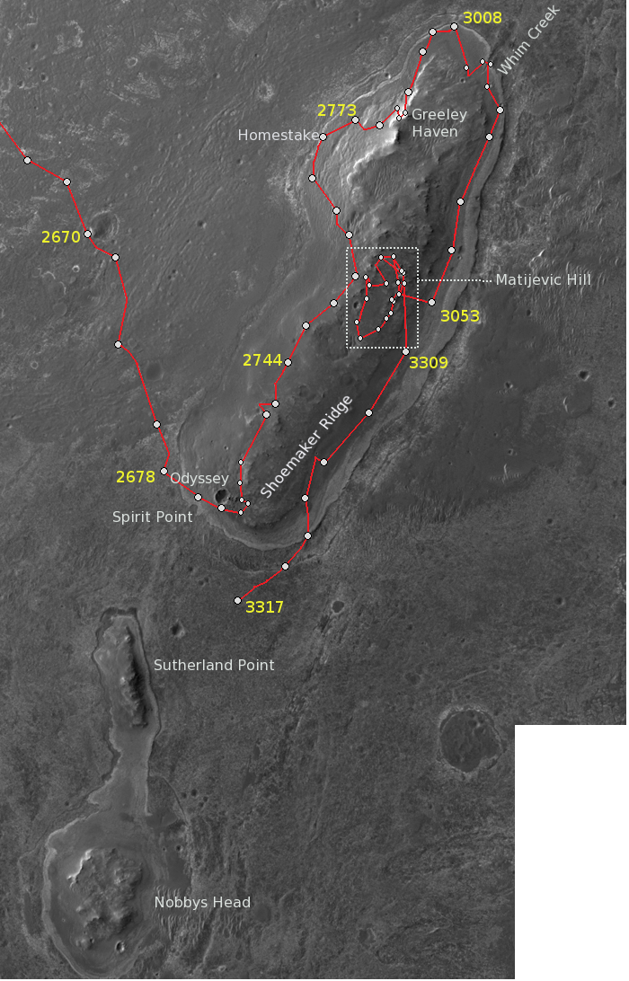
English: Opportunity's traverse on Cape York from Sol 2678 to Sol 3317 with some additional annnotations of the main features. |
| Date | |
| Source | http://marsrovers.jpl.nasa.gov/mission/tm-opportunity/opportunity-sol3317.html, http://marsrovers.jpl.nasa.gov/mission/tm-opportunity/opportunity-sol3310.html |
| Author | NASA |
Licensing edit
| This file is in the public domain in the United States because it was solely created by NASA. NASA copyright policy states that "NASA material is not protected by copyright unless noted". (See Template:PD-USGov, NASA copyright policy page or JPL Image Use Policy.) | ||
 |
Warnings:
|
File history
Click on a date/time to view the file as it appeared at that time.
| Date/Time | Thumbnail | Dimensions | User | Comment | |
|---|---|---|---|---|---|
| current | 00:27, 6 January 2014 | | 700 × 1,092 (728 KB) | MoreInput (talk | contribs) | User created page with UploadWizard |
You cannot overwrite this file.
File usage on Commons
The following 2 pages use this file:
File usage on other wikis
The following other wikis use this file:
- Usage on de.wikipedia.org
- Usage on en.wikipedia.org
- Usage on es.wikipedia.org
- Usage on fr.wikipedia.org
- Usage on ja.wikipedia.org