File:Capps Glacier, one source of valley glacier, bergschrund, and icefall, August 26, 1969 (GLACIERS 6445).jpg
Size of this preview: 616 × 599 pixels. Other resolutions: 247 × 240 pixels | 494 × 480 pixels | 768 × 747 pixels.
Original file (768 × 747 pixels, file size: 89 KB, MIME type: image/jpeg)
Captions
Captions
Add a one-line explanation of what this file represents

|
The categories of this image need checking. You can do so here.
|
.jpg&action=edit&withJS=MediaWiki:Catcheck.js)
Summary
edit.jpg&action=edit§ion=1)
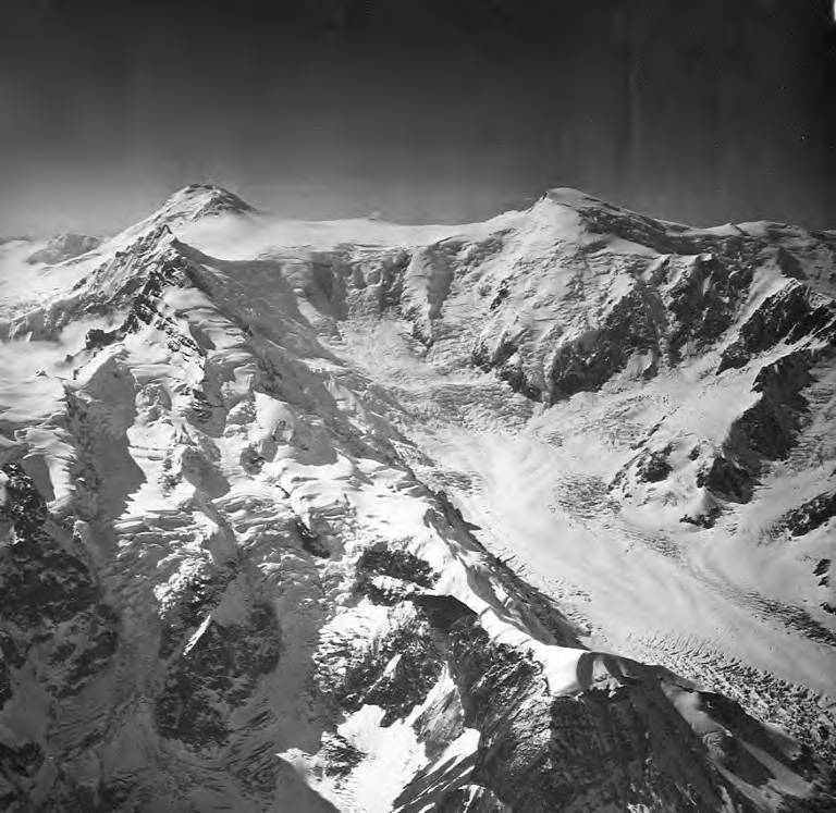
| English: Capps Glacier, one source of valley glacier, bergschrund, and icefall, August 26, 1969
( |
||||||||||||||||||||||||
|---|---|---|---|---|---|---|---|---|---|---|---|---|---|---|---|---|---|---|---|---|---|---|---|---|
| Photographer |
|
|||||||||||||||||||||||
| Title |
English: Capps Glacier, one source of valley glacier, bergschrund, and icefall, August 26, 1969 |
|||||||||||||||||||||||
| Description |
English: Capps Glacier, one source of valley glacier, bergschrund, and icefall, August 26, 1969 |
|||||||||||||||||||||||
| Depicted place | Alaska Range | |||||||||||||||||||||||
| Date | Taken on 26 August 1969 | |||||||||||||||||||||||
| Dimensions | height: 9 in (22.8 cm); width: 9 in (22.8 cm) | |||||||||||||||||||||||
| Collection |
|
|||||||||||||||||||||||
| Current location | ||||||||||||||||||||||||
| Accession number | ||||||||||||||||||||||||
| Source | ||||||||||||||||||||||||
| Permission (Reusing this file) |
|
|||||||||||||||||||||||
| Order Number | EAS5542 | |||||||||||||||||||||||
| Reference Number on Photograph | AH-168 | |||||||||||||||||||||||
| Judicial District | Kenai Peninsula Borough | |||||||||||||||||||||||
| Mountain Range | Alaska Range | |||||||||||||||||||||||
| Camera Altitude | 10,000 feet | |||||||||||||||||||||||
| Annotations | This image is annotated: View the annotations at Commons |
.jpg)
File history
Click on a date/time to view the file as it appeared at that time.
| Date/Time | Thumbnail | Dimensions | User | Comment | |
|---|---|---|---|---|---|
| current | 00:21, 9 June 2019 | | 768 × 747 (89 KB) | BMacZeroBot (talk | contribs) | Batch upload (Commons:Batch uploading/University of Washington Digital Collections) |
You cannot overwrite this file.
File usage on Commons
The following 3 pages use this file:
.jpg)
File usage on other wikis
The following other wikis use this file:
- Usage on en.wikipedia.org
.jpg&oldid=847986808)