File:Carte ITALIE R2.jpg
No higher resolution available.
Carte_ITALIE_R2.jpg (466 × 573 pixels, file size: 62 KB, MIME type: image/jpeg)
Captions
Captions
Add a one-line explanation of what this file represents
Summary edit
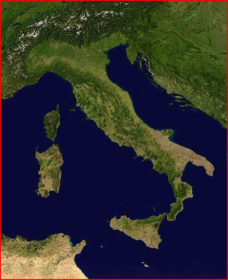
| Description |
English: NASA satellite map of Italy
Italiano: Mapa satellitare di Italia di NASA
Français : Carte satellite radar NASA reformatée pour la Géolocalisation |
| Date | |
| Source | Carte satellite radar NASA |
| Author | Wikisoft* @@@-fr 10:30, 29 December 2008 (UTC) |
| Other versions |
Derivative works of this file: Tuninter TS-LBB route.pngItalie |


Licensing edit
| This file is in the public domain in the United States because it was solely created by NASA. NASA copyright policy states that "NASA material is not protected by copyright unless noted". (See Template:PD-USGov, NASA copyright policy page or JPL Image Use Policy.) | ||
 |
Warnings:
|
File history
Click on a date/time to view the file as it appeared at that time.
| Date/Time | Thumbnail | Dimensions | User | Comment | |
|---|---|---|---|---|---|
| current | 10:30, 29 December 2008 | | 466 × 573 (62 KB) | Wikisoft* (talk | contribs) | {{Information |Description={{fr|1=Carte satellite radar NASA reformatée pour la Géolocalisation}} |Source=Carte satellite radar NASA |Author=~~~~ |Date=29/12/2008 |Permission= |other_versions=Italie }} <!--{{ImageUpload|full}}--> |
You cannot overwrite this file.
File usage on Commons
The following 3 pages use this file:
File usage on other wikis
The following other wikis use this file:
- Usage on fr.wikipedia.org
- Golfe de Tarente
- Communauté de montagne des Apennins de Modène Est
- Val Venosta
- Barbagia
- Lipari (île)
- Solfatare (Italie)
- Îles Pontines
- Volturno
- Filicudi
- Panarea
- Îles Égades
- Misène
- Baie de Naples
- Lac d'Agnano
- Gennargentu
- Giudecca
- Côte amalfitaine
- Lac Averne
- Garigliano
- Procida
- Nébrodes
- Île de Capraia
- Monts Euganéens
- Îles Borromées
- Île de Salina
- Archipel toscan
- Sant'Erasmo
- Alpes lépontines
- Madonies
- Monts Héréens
- Glacier du Calderone
- Corno Grande
- Lac de Campotosto
- Monts de la Laga
- Communauté de montagne
- Communauté de montagne Pollupice
- Monte Zoncolan
- Mont Époméo
- Grotte du Chien (Pouzzoles)
- Mont Somma
- Arc volcanique campanien
- Discussion modèle:Ébauche
- Lambro (Campanie)
- Îles Pélages
- Union des communes de montagne Amiata-Grossetana
- Area metropolitana fiorentina
- Communauté de montagne des collines métallifères
- Communauté de montagne du Val d'Orco et Soana
- Communauté de montagne des vals de Nure et de l'Arda
- Sangro
View more global usage of this file.