File:Carte de Lanaudière.png
No higher resolution available.
Carte_de_Lanaudière.png (301 × 366 pixels, file size: 195 KB, MIME type: image/png)
Captions
Captions
Add a one-line explanation of what this file represents
Summary edit
| Description |
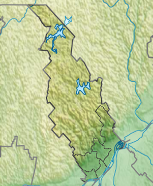
Français : Carte de localisation de la région administrative de Lanaudière, Québec, Canada |
| Date | |
| Source | File:Canada Quebec relief location map.jpg |
| Author | Carport |
Licensing edit
This file is licensed under the Creative Commons Attribution-Share Alike 4.0 International license.
- You are free:
- to share – to copy, distribute and transmit the work
- to remix – to adapt the work
- Under the following conditions:
- attribution – You must give appropriate credit, provide a link to the license, and indicate if changes were made. You may do so in any reasonable manner, but not in any way that suggests the licensor endorses you or your use.
- share alike – If you remix, transform, or build upon the material, you must distribute your contributions under the same or compatible license as the original.
File history
Click on a date/time to view the file as it appeared at that time.
| Date/Time | Thumbnail | Dimensions | User | Comment | |
|---|---|---|---|---|---|
| current | 16:56, 15 October 2019 | | 301 × 366 (195 KB) | YanikB (talk | contribs) | Remove corner map |
| 13:39, 30 March 2018 |  | 600 × 731 (610 KB) | YanikB (talk | contribs) | Level | |
| 13:23, 30 March 2018 |  | 600 × 731 (626 KB) | YanikB (talk | contribs) | carte en coin | |
| 19:26, 23 March 2018 |  | 800 × 975 (887 KB) | YanikB (talk | contribs) | level+detail | |
| 12:06, 23 March 2018 |  | 800 × 975 (913 KB) | YanikB (talk | contribs) | +resolution + proportion | |
| 18:43, 17 March 2018 |  | 800 × 764 (542 KB) | YanikB (talk | contribs) | User created page with UploadWizard |
You cannot overwrite this file.
File usage on Commons
There are no pages that use this file.
File usage on other wikis
The following other wikis use this file:
- Usage on fr.wikipedia.org
- L'Assomption
- Saint-Gabriel
- Repentigny (Québec)
- Baie-de-la-Bouteille
- Baie-Obaoca
- Lac-Cabasta
- Lac-des-Dix-Milles
- Lac-Devenyns
- Lac-du-Taureau
- Lac-Legendre
- Lac-Matawin
- Lac-Minaki
- Lac-Santé
- Saint-Guillaume-Nord
- Terminus Terrebonne
- Seigneurie d'Antaya
- Cité du Sport de Terrebonne
- Centre Marcel-Bonin
- Lac Crépeau (Saint-Zénon)
- Lac Archambault (Saint-Donat)
- Moulin à vent Antoine-Jetté
- Septième Lac
- Lac Hénault
- Lac Sainte-Rose
- Terminus Repentigny
- Lac Ouareau
- Île Saint-Jean (Terrebonne)
- Île Bourdon
- Ski Montcalm
- Seigneurie Du Sablé
- Lac Mandeville
- Lac Cristal
- Lac Kaël
- Lac Cloutier
- Réservoir Taureau
- Lac Stevens
- Lac Long (Québec)
- Lac Loyer
- Lac Pierre
- Lac Miro
- Pont Mathieu
- Pont Benjamin-Moreau
- Lac Kempt (Matawinie)
- Cathédrale Saint-Charles-Borromée de Joliette
- Lac Matawin
- Lac Lusignan (Lanaudière)
- Lac Charland (Matawinie)
- Lac de L'Assomption
- Lac Devenyns
- Val Saint-Côme
View more global usage of this file.