File:Carte de la Palestine ou Terre Sainte - dressée par Pierre Tardieu - btv1b53035311v.jpg

Size of this preview: 426 × 599 pixels. Other resolutions: 171 × 240 pixels | 341 × 480 pixels | 546 × 768 pixels | 728 × 1,024 pixels | 1,457 × 2,048 pixels | 7,501 × 10,544 pixels.
Original file (7,501 × 10,544 pixels, file size: 10.86 MB, MIME type: image/jpeg)
Captions
Captions
Add a one-line explanation of what this file represents
Summary
edit| Warning | The original file is very high-resolution. It might not load properly or could cause your browser to freeze when opened at full size. |
|---|
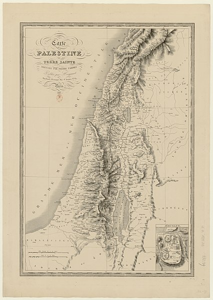
| Carte de la Palestine ou Terre Sainte / dressée par Pierre Tardieu
( |
|||||||||||||||||||||||||||
|---|---|---|---|---|---|---|---|---|---|---|---|---|---|---|---|---|---|---|---|---|---|---|---|---|---|---|---|
| Author |
Tardieu, Pierre Antoine (1784-1869). Cartographe |
||||||||||||||||||||||||||
| Title |
Carte de la Palestine ou Terre Sainte / dressée par Pierre Tardieu |
||||||||||||||||||||||||||
| Description |
Français : Sujet : Palestine
Échelle(s) : [ca 1:563 000], échelle 30 milles romains de 70 au degré [= 7,9 cm] Couverture : Israël E 34°13' - E 36°28' / N 34° - S 30°30' Langue : français Éditeur : Hocquart (Paris) |
||||||||||||||||||||||||||
| Date | 1840 | ||||||||||||||||||||||||||
| Dimensions | height: 52 cm (20.4 in); width: 76 cm (29.9 in) | ||||||||||||||||||||||||||
| Collection |
|
||||||||||||||||||||||||||
| References |
Français : Notice du catalogue : http://catalogue.bnf.fr/ark:/12148/cb425798442 |
||||||||||||||||||||||||||
| Source/Photographer |
Français : Bibliothèque nationale de France, département Cartes et plans, GE DL 1839-132
Bibliothèque nationale de France |
||||||||||||||||||||||||||
| Permission (Reusing this file) |
|
||||||||||||||||||||||||||

File history
Click on a date/time to view the file as it appeared at that time.
| Date/Time | Thumbnail | Dimensions | User | Comment | |
|---|---|---|---|---|---|
| current | 08:58, 23 July 2022 | | 7,501 × 10,544 (10.86 MB) | Gzen92Bot (talk | contribs) | Gallica btv1b53035311v |
You cannot overwrite this file.
File usage on Commons
The following page uses this file: