File:Carte de la station Arctowski.svg

Size of this PNG preview of this SVG file: 604 × 600 pixels. Other resolutions: 242 × 240 pixels | 483 × 480 pixels | 773 × 768 pixels | 1,031 × 1,024 pixels | 2,062 × 2,048 pixels | 744 × 739 pixels.
Original file (SVG file, nominally 744 × 739 pixels, file size: 159 KB)
Captions
Captions
Add a one-line explanation of what this file represents
| Description |
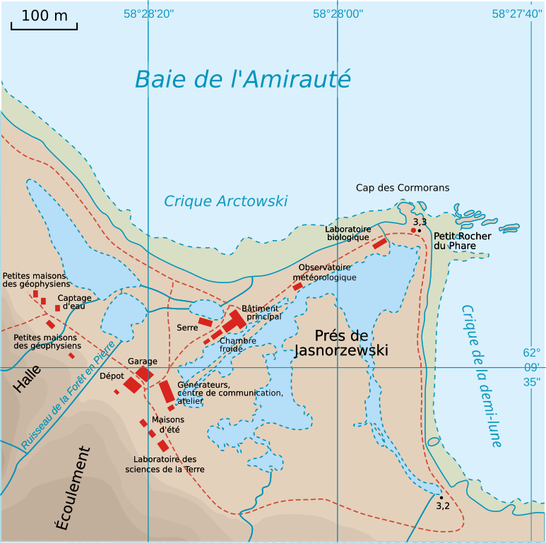
English: Map of Henryk Arctowski Polish Antarctic Station Français : Carte de la station polonaise d'Arctowski |
| Date | (UTC) |
| Source | |
| Author |
|
| This is a retouched picture, which means that it has been digitally altered from its original version. Modifications: Traduction et vectorisation. The original can be viewed here: Map of Arctowski Station.png:
|
I, the copyright holder of this work, hereby publish it under the following license:
This file is licensed under the Creative Commons Attribution 3.0 Unported license.
- You are free:
- to share – to copy, distribute and transmit the work
- to remix – to adapt the work
- Under the following conditions:
- attribution – You must give appropriate credit, provide a link to the license, and indicate if changes were made. You may do so in any reasonable manner, but not in any way that suggests the licensor endorses you or your use.
Original upload log edit
This image is a derivative work of the following images:
- File:Map_of_Arctowski_Station.png licensed with Cc-by-3.0
- 2009-09-15T08:19:41Z Aotearoa 744x737 (267401 Bytes) drobne poprawki
- 2009-09-15T07:49:08Z Aotearoa 744x737 (265297 Bytes) {{Information |Description={{en|1=Map of Henryk Arctowski Polish Antarctic Station}} {{pl|1=Mapa [[:pl:Polska Stacja Antarktyczna im. Henryka Arctowskiego|Polskiej Stacji Antarktycznej im. Henryka Arctowskiego]]Warstwy hipsom
Uploaded with derivativeFX
File history
Click on a date/time to view the file as it appeared at that time.
| Date/Time | Thumbnail | Dimensions | User | Comment | |
|---|---|---|---|---|---|
| current | 19:36, 19 September 2017 | | 744 × 739 (159 KB) | Treehill (talk | contribs) | accent above the capital E in French. |
| 18:19, 16 November 2010 |  | 744 × 739 (159 KB) | Treehill (talk | contribs) | correspond à l'aspect des cartes de la zone à plus grandes échelles | |
| 09:36, 23 April 2010 |  | 744 × 739 (98 KB) | Trex (talk | contribs) | {{Information |Description={{en|1=Map of Henryk Arctowski Polish Antarctic Station}} {{fr|1=Carte de la station polonaise d'Arctowski}} |Source=*File:Map_of_Arctowski_Station.png |Date=2010-04-23 09:35 (UTC) |Author=*[[:File:Map_of_Arctowski_Station |
You cannot overwrite this file.
File usage on Commons
The following page uses this file:
File usage on other wikis
The following other wikis use this file:
- Usage on fr.wikipedia.org