File:Carte de locean occidental et partie de lAmerique septentrionale.jpg
Size of this preview: 800 × 528 pixels. Other resolutions: 320 × 211 pixels | 640 × 422 pixels | 1,024 × 675 pixels | 1,280 × 844 pixels | 2,000 × 1,319 pixels.
Original file (2,000 × 1,319 pixels, file size: 2.57 MB, MIME type: image/jpeg)
Captions
Captions
Add a one-line explanation of what this file represents
Summary edit
| Description |
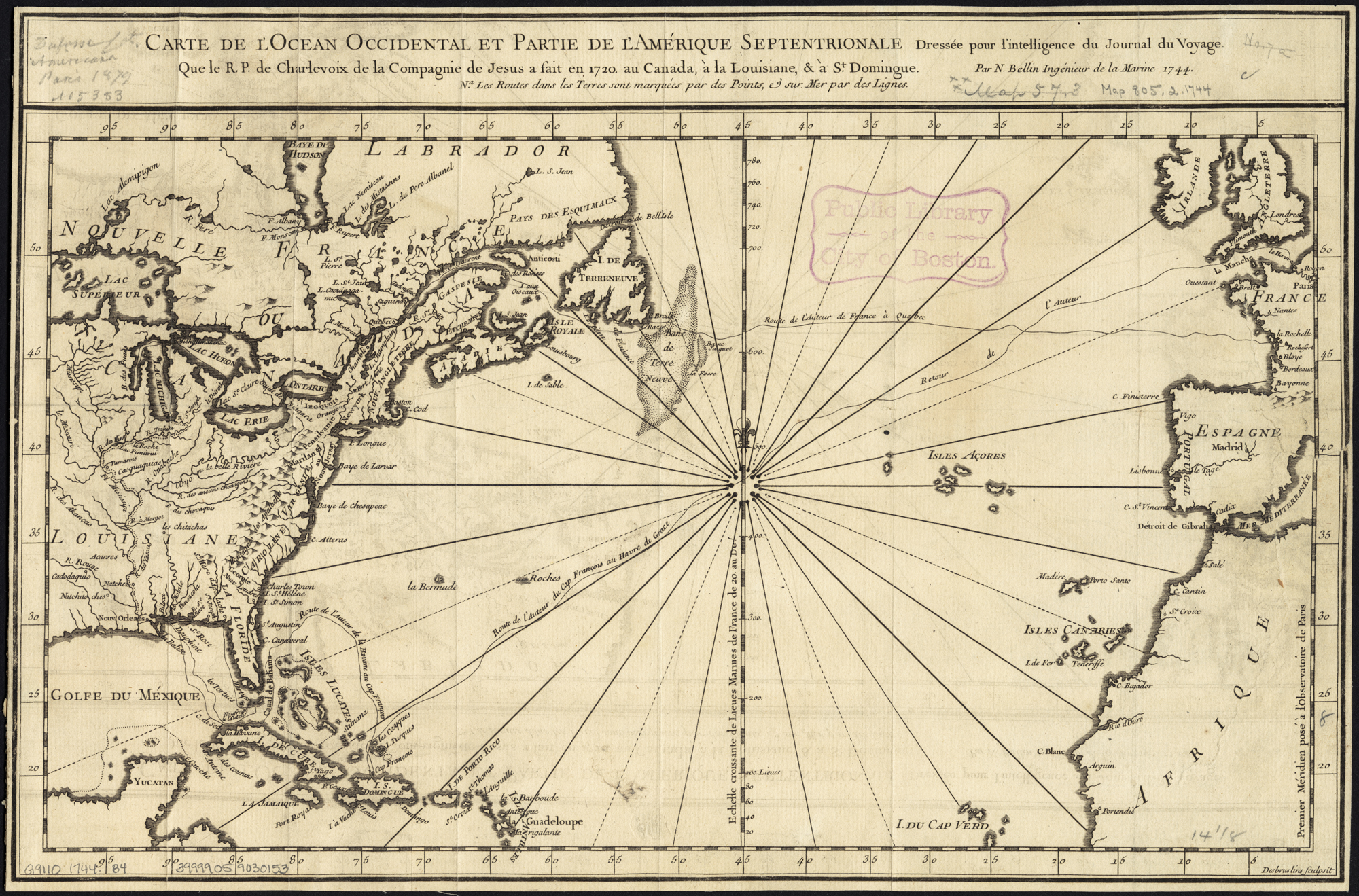
English: Zoom into this map at maps.bpl.org.
Author: Bellin, Jacques Nicolas Publisher: Date: 1744 Location: Atlantic Coast (North America), North Atlantic Ocean Dimension: 22x37cm Scale: ca. 1:20,000,000 Call Number: G9110 1744 .B44 |
| Date | |
| Source |
Carte de l'ocean occidental et partie de l'Amerique septentrionale
|
| Author | http://maps.bpl.org |
Licensing edit
This file is licensed under the Creative Commons Attribution 2.0 Generic license.
- You are free:
- to share – to copy, distribute and transmit the work
- to remix – to adapt the work
- Under the following conditions:
- attribution – You must give appropriate credit, provide a link to the license, and indicate if changes were made. You may do so in any reasonable manner, but not in any way that suggests the licensor endorses you or your use.
| This image, originally posted to Flickr, was reviewed on July 29, 2011 by the administrator or reviewer File Upload Bot (Magnus Manske), who confirmed that it was available on Flickr under the stated license on that date. |
File history
Click on a date/time to view the file as it appeared at that time.
| Date/Time | Thumbnail | Dimensions | User | Comment | |
|---|---|---|---|---|---|
| current | 22:31, 29 July 2011 | | 2,000 × 1,319 (2.57 MB) | File Upload Bot (Magnus Manske) (talk | contribs) | {{Information |Description=Zoom into [http://maps.bpl.org/id/14694 this map] at [http://maps.bpl.org maps.bpl.org]. Author: Bellin, Jacques Nicolas Publisher: Date: 1744 Location: Atlantic Coast (North America), North Atlantic Ocean Dimension: 22x37cm S |
You cannot overwrite this file.
File usage on Commons
The following page uses this file: