File:Carte des environs de Mastricht - lith. de P. Bineteau - btv1b53087666j.jpg
Size of this preview: 751 × 600 pixels. Other resolutions: 301 × 240 pixels | 601 × 480 pixels | 962 × 768 pixels | 1,280 × 1,022 pixels | 2,560 × 2,044 pixels | 4,288 × 3,424 pixels.
Original file (4,288 × 3,424 pixels, file size: 2.8 MB, MIME type: image/jpeg)
Captions
Captions
Add a one-line explanation of what this file represents
Summary edit
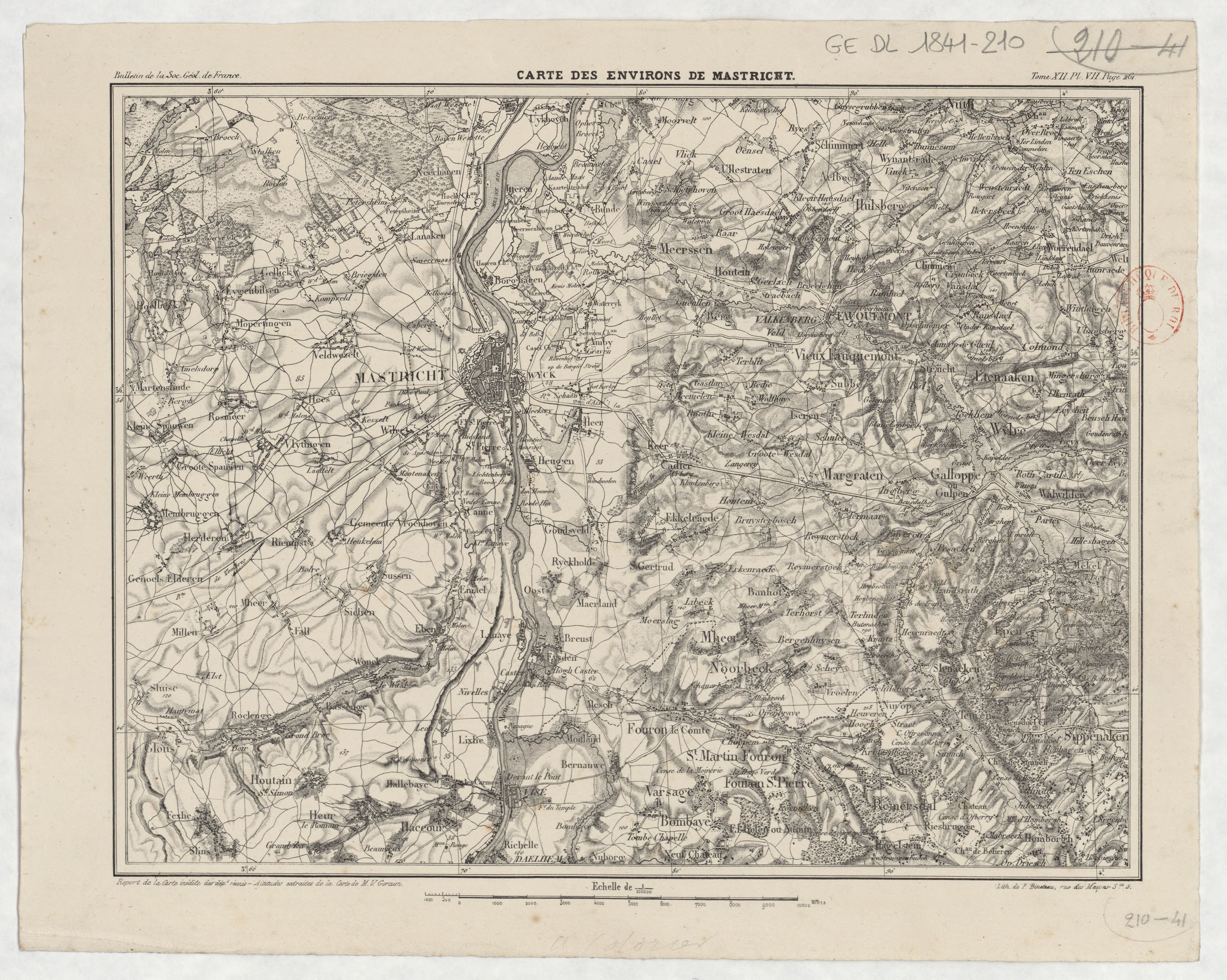
| Carte des environs de Mastricht / lith. de P. Bineteau
( |
|||||||||||||||||||||||||||
|---|---|---|---|---|---|---|---|---|---|---|---|---|---|---|---|---|---|---|---|---|---|---|---|---|---|---|---|
| Author |
Bineteau, P. (18..-.... ; Géographe et imprimeur). Lithographe |
||||||||||||||||||||||||||
| Title |
Carte des environs de Mastricht / lith. de P. Bineteau |
||||||||||||||||||||||||||
| Description |
Français : Sujet : Maastricht -- Environs
Échelle(s) : 1:100 000 Couverture : Pays-Bas – Limbourg Belgique – Limbourg E 5°31' - E 5°57' / N 50°55' - N 50°42' Langue : français Éditeur : P. Bineteau (Paris) |
||||||||||||||||||||||||||
| Date | 1841 | ||||||||||||||||||||||||||
| Dimensions | height: 30.5 cm (12 in); width: 23.5 cm (9.2 in) | ||||||||||||||||||||||||||
| Collection |
|
||||||||||||||||||||||||||
| References |
Français : Notice du catalogue : http://catalogue.bnf.fr/ark:/12148/cb42780528c |
||||||||||||||||||||||||||
| Source/Photographer |
Français : Bibliothèque nationale de France, département Cartes et plans, GE DL 1841-210
Bibliothèque nationale de France |
||||||||||||||||||||||||||
| Permission (Reusing this file) |
|
||||||||||||||||||||||||||

File history
Click on a date/time to view the file as it appeared at that time.
| Date/Time | Thumbnail | Dimensions | User | Comment | |
|---|---|---|---|---|---|
| current | 08:14, 15 August 2022 | | 4,288 × 3,424 (2.8 MB) | Gzen92Bot (talk | contribs) | Gallica btv1b53087666j |
You cannot overwrite this file.
File usage on Commons
The following page uses this file: