File:Carte des provinces de Salta et de Jujuy et d'une partie de la Bolivie.jpg

Size of this preview: 760 × 599 pixels. Other resolutions: 304 × 240 pixels | 609 × 480 pixels | 974 × 768 pixels | 1,280 × 1,010 pixels | 2,560 × 2,019 pixels | 3,594 × 2,835 pixels.
Original file (3,594 × 2,835 pixels, file size: 1.93 MB, MIME type: image/jpeg)
Captions
Captions
Add a one-line explanation of what this file represents
Summary edit
| Description |
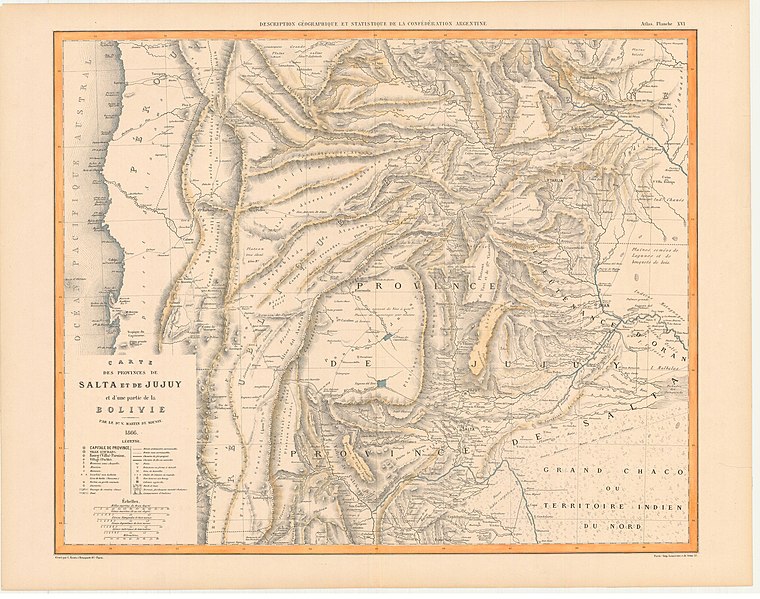
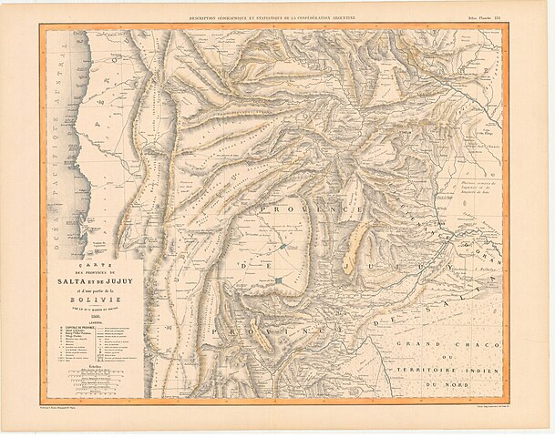
Español: 1 mapa, col. Full de l'Atlas de Description géographique et statistique de la Confédération Argentine (Planche XVI). (Descripción geográfica y estadística de la Confederación Argentina) Paris: Firmin Didot Fres., 1860-64. 3. vol. Imp. Lemercier. |
| Date | |
| Source | Carte des provinces de Salta et de Jujuy et d'une partie de la Bolivie / par le Dr. V. Martin de Moussy ; gravé par Kautz, Paris |
| Author | Moussy, Martin de ; Kautz |
Licensing edit
|
This work is in the public domain in its country of origin and other countries and areas where the copyright term is the author's life plus 70 years or fewer. This work is in the public domain in the United States because it was published (or registered with the U.S. Copyright Office) before January 1, 1929. | |
| This file has been identified as being free of known restrictions under copyright law, including all related and neighboring rights. | |
File history
Click on a date/time to view the file as it appeared at that time.
| Date/Time | Thumbnail | Dimensions | User | Comment | |
|---|---|---|---|---|---|
| current | 21:59, 7 October 2022 | | 3,594 × 2,835 (1.93 MB) | Jassad415 (talk | contribs) | Uploaded a work by Moussy, Martin de ; Kautz from Carte des provinces de Salta et de Jujuy et d'une partie de la Bolivie / par le Dr. V. Martin de Moussy ; gravé par Kautz, Paris with UploadWizard |
You cannot overwrite this file.
File usage on Commons
There are no pages that use this file.
File usage on other wikis
The following other wikis use this file:
- Usage on es.wikipedia.org