File:Carte générale de l'Empire d'Autriche du Royaume de Prusse de la Confédération Germanique et du Royaume de Pologne.pdf

Size of this JPG preview of this PDF file: 776 × 600 pixels. Other resolutions: 311 × 240 pixels | 621 × 480 pixels | 994 × 768 pixels | 1,280 × 989 pixels | 2,560 × 1,979 pixels | 4,683 × 3,620 pixels.
Original file (4,683 × 3,620 pixels, file size: 8.59 MB, MIME type: application/pdf)
Captions
Captions
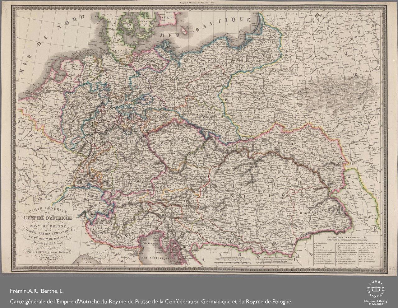
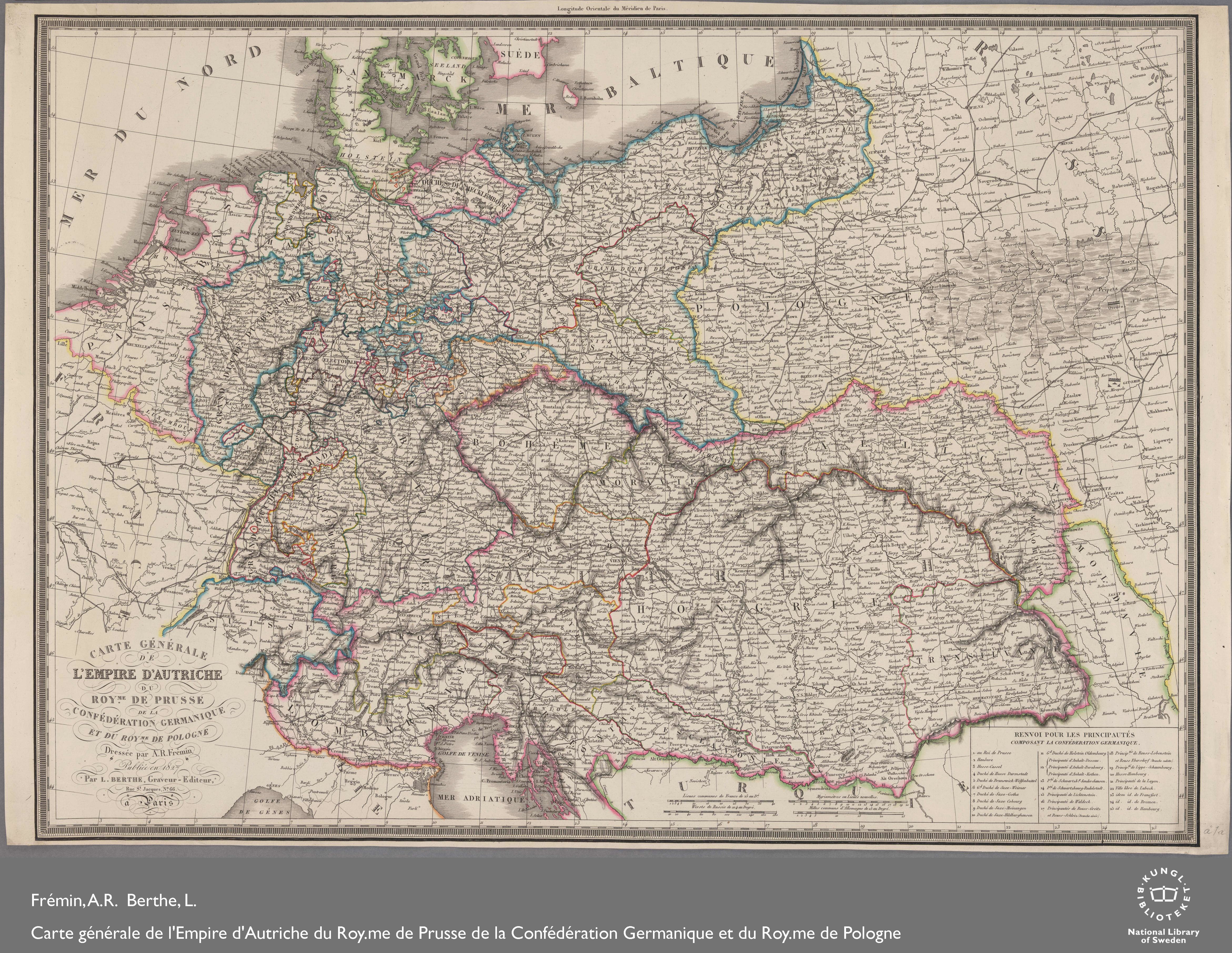
1827 Map of the Austrian Empire, the Kingdom of Prussia, the German Confederation and the Kingdom of Poland
Summary edit
| Description |
English: dressée par A.R. Frémin ; publiée en 1827 par L. Berthe, graveur - editeur, Rue St. Jaques, no 66 à Paris |
||
| Date | |||
| Source |
|
||
| Author | National Library of Sweden |
Licensing edit
|
This work is in the public domain in its country of origin and other countries and areas where the copyright term is the author's life plus 70 years or fewer. This work is in the public domain in the United States because it was published (or registered with the U.S. Copyright Office) before January 1, 1929. | |
| This file has been identified as being free of known restrictions under copyright law, including all related and neighboring rights. | |
File history
Click on a date/time to view the file as it appeared at that time.
| Date/Time | Thumbnail | Dimensions | User | Comment | |
|---|---|---|---|---|---|
| current | 21:01, 7 February 2019 |  | 4,683 × 3,620 (8.59 MB) | Balkanique (talk | contribs) | User created page with UploadWizard |
You cannot overwrite this file.
File usage on Commons
There are no pages that use this file.