File:Carte historique des Royaumes d'Espagne et Portugal.jpg
Size of this preview: 725 × 600 pixels. Other resolutions: 290 × 240 pixels | 580 × 480 pixels | 928 × 768 pixels | 1,237 × 1,024 pixels | 2,475 × 2,048 pixels | 2,795 × 2,313 pixels.
Original file (2,795 × 2,313 pixels, file size: 5.1 MB, MIME type: image/jpeg)
Captions
Captions
Add a one-line explanation of what this file represents
Summary edit
| Description |
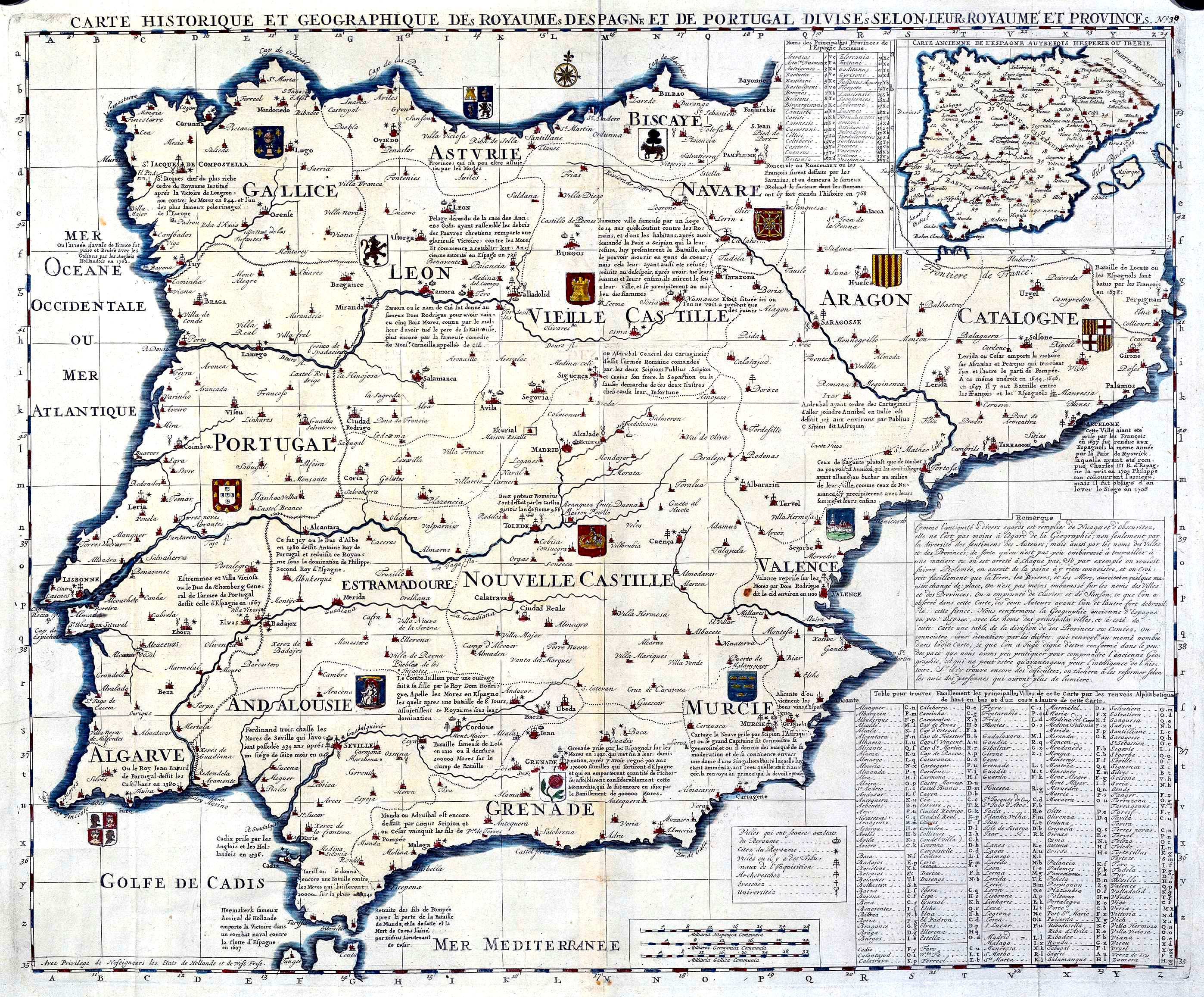
Français : Carte historique et geographique des Royaumes D’Espagne et de Portugal Divises selon leurs Royaume et Provinces : Nº 30. Mapa procedente del "Atlas historique... de H.A. Chatelain", con ediciones desde 1705 a 1739 |
| Date | between 1705 and 1739 |
| Source | http://www.bne.es/BDH/index.htm http://bibliotecadigitalhispanica.bne.es:80/webclient/DeliveryManager?application=DIGITOOL-3&owner=resourcediscovery&custom_att_2=simple_viewer&pid=90357 |
| Author | Henri Abraham Chatelain |
Licensing edit
|
This work is in the public domain in its country of origin and other countries and areas where the copyright term is the author's life plus 100 years or fewer. | |
| This file has been identified as being free of known restrictions under copyright law, including all related and neighboring rights. | |
File history
Click on a date/time to view the file as it appeared at that time.
| Date/Time | Thumbnail | Dimensions | User | Comment | |
|---|---|---|---|---|---|
| current | 19:47, 9 September 2008 | | 2,795 × 2,313 (5.1 MB) | Escarlati (talk | contribs) | {{Information |Description={{fr|1=Carte historique et geographique des Royaumes D’Espagne et de Portugal Divises selon leurs Royaume et Provinces : Nº 30. Mapa procedente del "Atlas historique... de H.A. Chatelain", con ediciones desde 1705 a 1739}} |S |
You cannot overwrite this file.
File usage on Commons
There are no pages that use this file.
File usage on other wikis
The following other wikis use this file:
- Usage on ar.wikipedia.org
- بنو نصر
- ملوك الطوائف
- قوط غربيون
- قائمة ملوك إسبانيا
- مملكة القوط الغربيين
- قائمة ملوك البرتغال والغرب
- قائمة ملوك أراغون
- قائمة ولاة الأندلس الأمويين
- قائمة ملوك نافارا
- قائمة ملوك ليون
- قائمة حكام إسبانيا
- قائمة ملوك أستورياس
- قالب:ملوك شبه جزيرة إيبيريا
- قائمة ملوك مايوركا
- إمبراطور كل هيسبانيا
- قائمة ملوك جليقية
- Usage on ast.wikipedia.org
- Usage on es.wikipedia.org
- Usage on ht.wikipedia.org
- Usage on io.wikipedia.org
- Usage on nn.wikipedia.org