File:Carte pour servir a l eclaircissement du papier terrier de la Nouvelle-France.png

Size of this preview: 800 × 459 pixels. Other resolutions: 320 × 184 pixels | 640 × 367 pixels | 1,024 × 588 pixels | 1,280 × 735 pixels | 2,516 × 1,444 pixels.
Original file (2,516 × 1,444 pixels, file size: 6.87 MB, MIME type: image/png)
Captions
Captions
Add a one-line explanation of what this file represents
Summary edit
| Description |
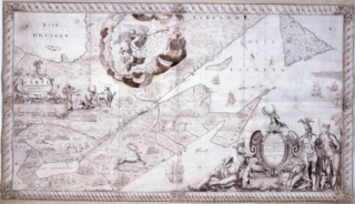
English: Map for the Clarification of Land Titles in New France, 1678
Français : Carte pour servir à l'éclaircissement du papier terrier de la Nouvelle-France |
| Date | |
| Source | https://catalogue.bnf.fr/ark:/12148/cb40634435v |
| Author | Jean-Baptiste Franquelin (1650-17..) |
Licensing edit
|
This work is in the public domain in its country of origin and other countries and areas where the copyright term is the author's life plus 70 years or fewer. This work is in the public domain in the United States because it was published (or registered with the U.S. Copyright Office) before January 1, 1929. | |
| This file has been identified as being free of known restrictions under copyright law, including all related and neighboring rights. | |
File history
Click on a date/time to view the file as it appeared at that time.
| Date/Time | Thumbnail | Dimensions | User | Comment | |
|---|---|---|---|---|---|
| current | 00:55, 15 October 2018 | | 2,516 × 1,444 (6.87 MB) | Jeangagnon (talk | contribs) | clarté |
| 00:43, 15 October 2018 |  | 2,516 × 1,444 (4.77 MB) | Jeangagnon (talk | contribs) | User created page with UploadWizard |
You cannot overwrite this file.
File usage on Commons
There are no pages that use this file.