File:Carte religieuse - Europe centrale - 1901.svg

Size of this PNG preview of this SVG file: 694 × 600 pixels. Other resolutions: 278 × 240 pixels | 555 × 480 pixels | 889 × 768 pixels | 1,185 × 1,024 pixels | 2,369 × 2,048 pixels | 1,977 × 1,709 pixels.
Original file (SVG file, nominally 1,977 × 1,709 pixels, file size: 2.35 MB)
Captions
Captions
Add a one-line explanation of what this file represents
Summary edit
| Description |
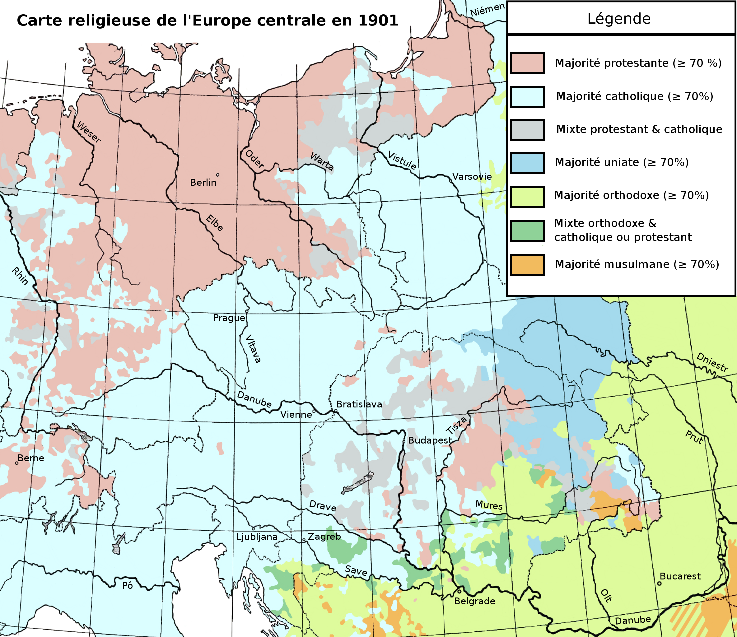
Français : Carte religieuse de l'Europe centrale en 1901. English: Religious map of Central Europe in 1901. |
| Date | |
| Source | File:Mitteleuropa-Konfessionen_1901.JPG |
| Creator |
"Andrees Handatlas", page 26, Velhagen & Klasing, 1901. |
| Georeferencing | If inappropriate please set warp_status = skip to hide. |
Licensing edit
|
This work is in the public domain in its country of origin and other countries and areas where the copyright term is the author's life plus 70 years or fewer. This work is in the public domain in the United States because it was published (or registered with the U.S. Copyright Office) before January 1, 1929. | |
| This file has been identified as being free of known restrictions under copyright law, including all related and neighboring rights. | |
File history
Click on a date/time to view the file as it appeared at that time.
| Date/Time | Thumbnail | Dimensions | User | Comment | |
|---|---|---|---|---|---|
| current | 16:51, 30 November 2015 | | 1,977 × 1,709 (2.35 MB) | Ddjahh (talk | contribs) | User created page with UploadWizard |
You cannot overwrite this file.
File usage on Commons
There are no pages that use this file.
File usage on other wikis
The following other wikis use this file:
- Usage on fr.wikipedia.org