File:Cartouche in a Tartary map by Anville.jpg
Size of this preview: 789 × 600 pixels. Other resolutions: 316 × 240 pixels | 632 × 480 pixels | 1,010 × 768 pixels | 1,280 × 973 pixels | 1,768 × 1,344 pixels.
Original file (1,768 × 1,344 pixels, file size: 794 KB, MIME type: image/jpeg)
Captions
Captions
Add a one-line explanation of what this file represents
Summary edit
| Description |
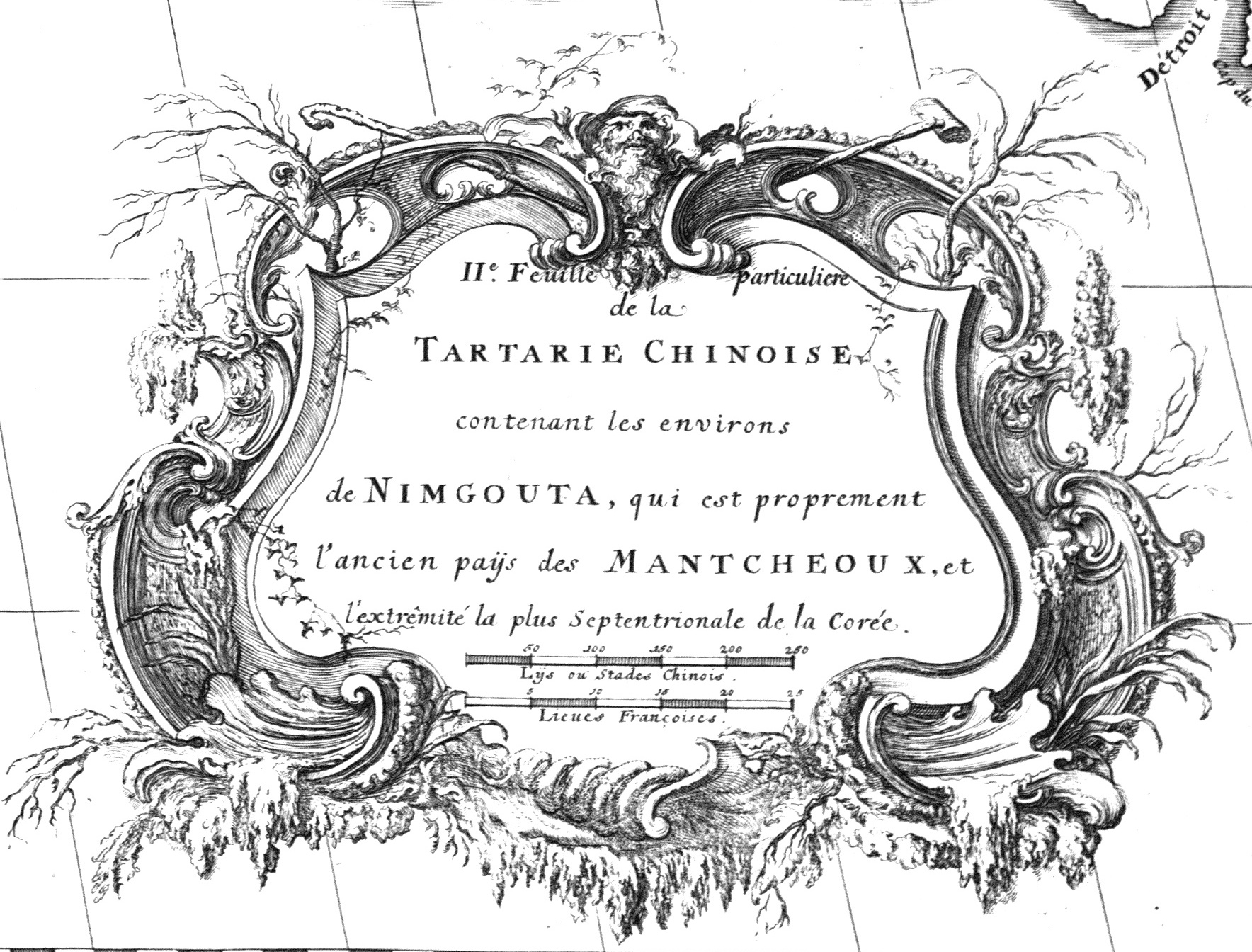
English: "2nd Detail Map of CHINESE TARTARY Containing the Area of NINGUTA, which is Properly the Ancient Land of the MANCHUS, and the Northernmost Extremity of Korea", from the 1737 New Atlas of China, Chinese Tartary, and Tibet. Ninguta (Manchu: ᠨᡳᠩᡤᡠᡨᠠ, "The Six"; Chinese: 寧吉塔, Nínggǔtǎ) was an area around the Hurka and Hailang River valleys where—along with Ilan Hala—the Jurchens grew in strength until Nurhachi organized them as the Manchus. The chief fortress—also known as Ninguta—was near Gucheng Village (古城村) in Changting Township (长汀镇), Hailin County (海林市), Mudenjiang Prefecture (牡丹江市), Heilongjiang Province, China. Still known as Ninguta, it was subsequently moved 50 km to the present seat of Ning'an County (寧安市) in Mudenjiang.
Français : IIe. Feuille particuliere de la TARTARIE CHINOISE contenant les environs de NIMGOUTA, qui est proprement l'ancien paÿs des MANTCHEOUX, et l'extrêmité la plus Septentrionale de la Corée", Nouvel Atlas de la Chine, de la Tartarie Chinoise, et du Thibet, La Haye, 1737. |
||||||||||||||||||||
| Date | |||||||||||||||||||||
| Source | GDZ Université de Göttingen http://gdz.sub.uni-goettingen.de/de/dms/load/toc/?PPN=PPN340023538 | ||||||||||||||||||||
| Author |
|
||||||||||||||||||||
| Other versions |
General Map with the Other Regions |
||||||||||||||||||||


.jpg)
.jpg)
.jpg)
.jpg)


Licensing edit
|
This is a faithful photographic reproduction of a two-dimensional, public domain work of art. The work of art itself is in the public domain for the following reason:
The official position taken by the Wikimedia Foundation is that "faithful reproductions of two-dimensional public domain works of art are public domain".
This photographic reproduction is therefore also considered to be in the public domain in the United States. In other jurisdictions, re-use of this content may be restricted; see Reuse of PD-Art photographs for details. | ||||
File history
Click on a date/time to view the file as it appeared at that time.
| Date/Time | Thumbnail | Dimensions | User | Comment | |
|---|---|---|---|---|---|
| current | 14:30, 23 March 2023 | | 1,768 × 1,344 (794 KB) | Enyavar (talk | contribs) | File:Anville Nouvel atlas de la Chine - Page60 tartarie 2 nimgouta.jpg cropped 58 % horizontally, 48 % vertically using CropTool with precise mode. |
You cannot overwrite this file.
File usage on Commons
The following page uses this file: