File:Castelnou château et Roc de Majorca.jpg

Size of this preview: 800 × 523 pixels. Other resolutions: 320 × 209 pixels | 640 × 418 pixels | 1,024 × 669 pixels | 1,280 × 836 pixels | 2,560 × 1,673 pixels | 4,141 × 2,706 pixels.
Original file (4,141 × 2,706 pixels, file size: 3.74 MB, MIME type: image/jpeg)
Captions
Captions
Add a one-line explanation of what this file represents
Summary edit
| Description |
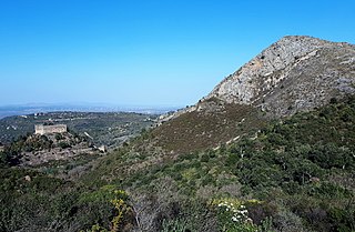
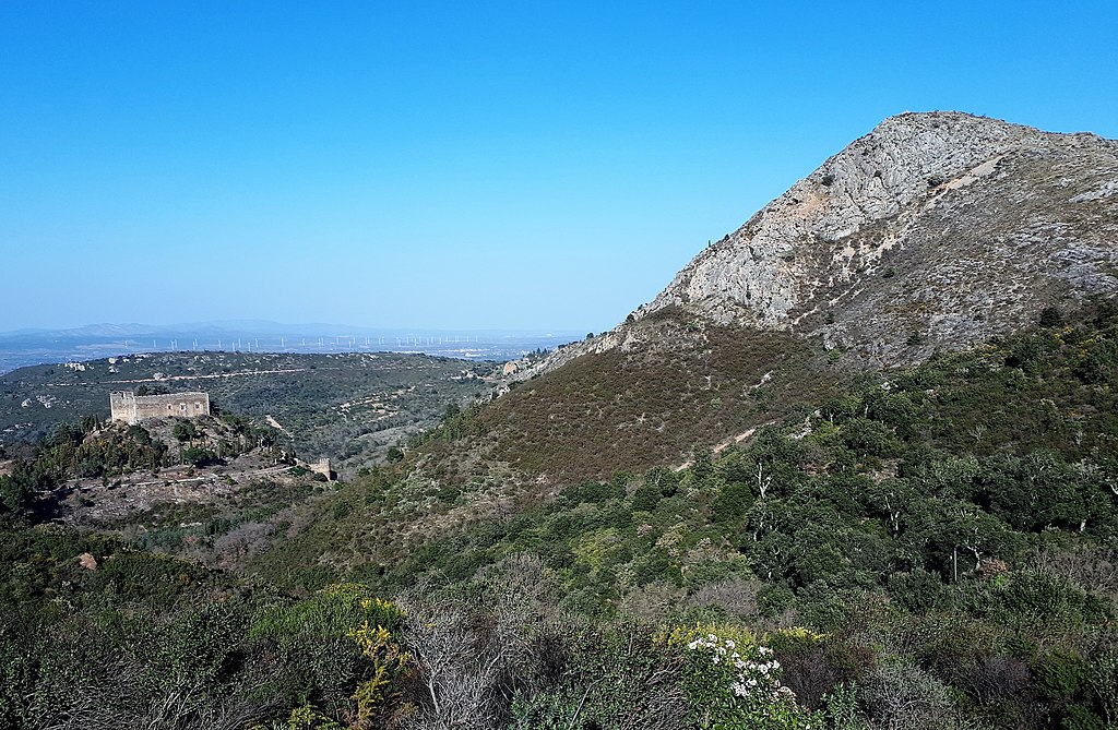
Français : Le château de Castelnou et le roc de Majorca, Pyrénées-Orientales.
Le château de Castelnou est situé sur un piton dominé par le roc de Majorca, tous les deux situés dans une zone de calcaire dévonien, bordée immédiatement au sud par la faille de Castelnou.[1][2] Le point où cette photo a été prise est situé au sud de la faille, sur des roches (pélites) cambriens du massif de l'Aspre. |
| Date | |
| Source | Own work |
| Author | Alan Mattingly |
| Camera location | | View this and other nearby images on: OpenStreetMap |
|---|
Licensing edit
I, the copyright holder of this work, hereby publish it under the following license:
This file is licensed under the Creative Commons Attribution-Share Alike 4.0 International license.
- You are free:
- to share – to copy, distribute and transmit the work
- to remix – to adapt the work
- Under the following conditions:
- attribution – You must give appropriate credit, provide a link to the license, and indicate if changes were made. You may do so in any reasonable manner, but not in any way that suggests the licensor endorses you or your use.
- share alike – If you remix, transform, or build upon the material, you must distribute your contributions under the same or compatible license as the original.
- ↑ Sur géoportail : www.geoportail.gouv.fr
- ↑ Carte géologique de la France: Notice explicative de la feuille Céret (1096) à 1/50 000. (2015). ficheinfoterre.brgm.fr. Orléans : BRGM. p27. Consulté le 13 août 2021.
File history
Click on a date/time to view the file as it appeared at that time.
| Date/Time | Thumbnail | Dimensions | User | Comment | |
|---|---|---|---|---|---|
| current | 15:17, 13 August 2021 | | 4,141 × 2,706 (3.74 MB) | Alan Mattingly (talk | contribs) | Uploaded own work with UploadWizard |
You cannot overwrite this file.
File usage on Commons
There are no pages that use this file.
File usage on other wikis
The following other wikis use this file:
- Usage on fr.wikipedia.org