File:Castilla-La Mancha-loc.svg

Size of this PNG preview of this SVG file: 512 × 517 pixels. Other resolutions: 238 × 240 pixels | 475 × 480 pixels | 761 × 768 pixels | 1,014 × 1,024 pixels | 2,028 × 2,048 pixels.
Original file (SVG file, nominally 512 × 517 pixels, file size: 876 KB)
Captions
Captions
Add a one-line explanation of what this file represents
Polígono 20 parcela 1045
Summary
edit
| Description |
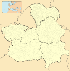
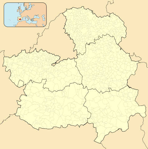
English: Location map of Castile-La Mancha
Equirectangular projection, N/S stretching 130 %. Geographic limits of the map:
Español: Mapa de localización de Castilla-La Mancha
Proyección equirrectangular, N/S estirada 130 %. Límites geográficos del mapa:
|
|
| Date | ||
| Source | Own work based on: EspañaLoc.svg by HansenBCN and Spain location map.svg by NNW | |
| Author | Miguillen | |
| SVG development | This locator map was created with Inkscape.
|
Licensing
edit
Miguillen, the copyright holder of this work, hereby publishes it under the following license:
This file is licensed under the Creative Commons Attribution-Share Alike 3.0 Unported license.
Attribution: Miguillen
- You are free:
- to share – to copy, distribute and transmit the work
- to remix – to adapt the work
- Under the following conditions:
- attribution – You must give appropriate credit, provide a link to the license, and indicate if changes were made. You may do so in any reasonable manner, but not in any way that suggests the licensor endorses you or your use.
- share alike – If you remix, transform, or build upon the material, you must distribute your contributions under the same or compatible license as the original.
File history
Click on a date/time to view the file as it appeared at that time.
| Date/Time | Thumbnail | Dimensions | User | Comment | |
|---|---|---|---|---|---|
| current | 14:08, 4 November 2023 | | 512 × 517 (876 KB) | Lojwe (talk | contribs) | Removing frame |
| 19:41, 11 May 2010 |  | 512 × 517 (876 KB) | Miguillen (talk | contribs) | == {{int:filedesc}} == {{Information |Description= {{en|Location map of Castilla-La Mancha}} Equirectangular projection, N/S stretching 130 %. Geographic limits of the map: * N: 43.469909° N * S: 41.829151° N * W: 2.62585 |
You cannot overwrite this file.
File usage on Commons
The following page uses this file:
File usage on other wikis
The following other wikis use this file:
- Usage on an.wikipedia.org
- Villarrobledo
- Albacet
- Poyatos
- Landet
- Valtablado del Río
- Castiello de Serriella
- Ablanque
- Abánades
- Adobes
- Alaminos
- Alarilla
- Albalate de Zorita
- Albares
- Albendiego
- Alcocer
- Alcolea de las Peñas
- Alcolea del Pinar
- Alcoroches
- Aldeanueva de Guadalajara
- Algora
- Alique
- Almadrones
- Almoguera
- Almonacid de Zorita
- Alocén
- Alovera
- Alustante
- Anguita
- Angón
- Anquela del Ducado
- Anquela del Pedregal
- Aranzueque
- Arbancón
- Arbeteta
- Argecilla
- Armallones
- Armuña de Tajuña
- Arroyo de las Fraguas
- Atanzón
- Atienza
- Auñón
- Azuqueca de Henares
- Baides
- Barriopedro
- Baños de Tajo
- Bañuelos
- Berninches
- Brihuega
- Budia
- Bujalaro
View more global usage of this file.