File:Central Intelligence Agency map of Luxembourg, June 1950 (159083541).png
Size of this preview: 433 × 599 pixels. Other resolutions: 173 × 240 pixels | 347 × 480 pixels | 555 × 768 pixels | 740 × 1,024 pixels | 1,479 × 2,048 pixels | 2,778 × 3,846 pixels.
Original file (2,778 × 3,846 pixels, file size: 4.41 MB, MIME type: image/png)
Captions
Captions
Add a one-line explanation of what this file represents
Summary edit
.png&action=edit§ion=1)
| Description |
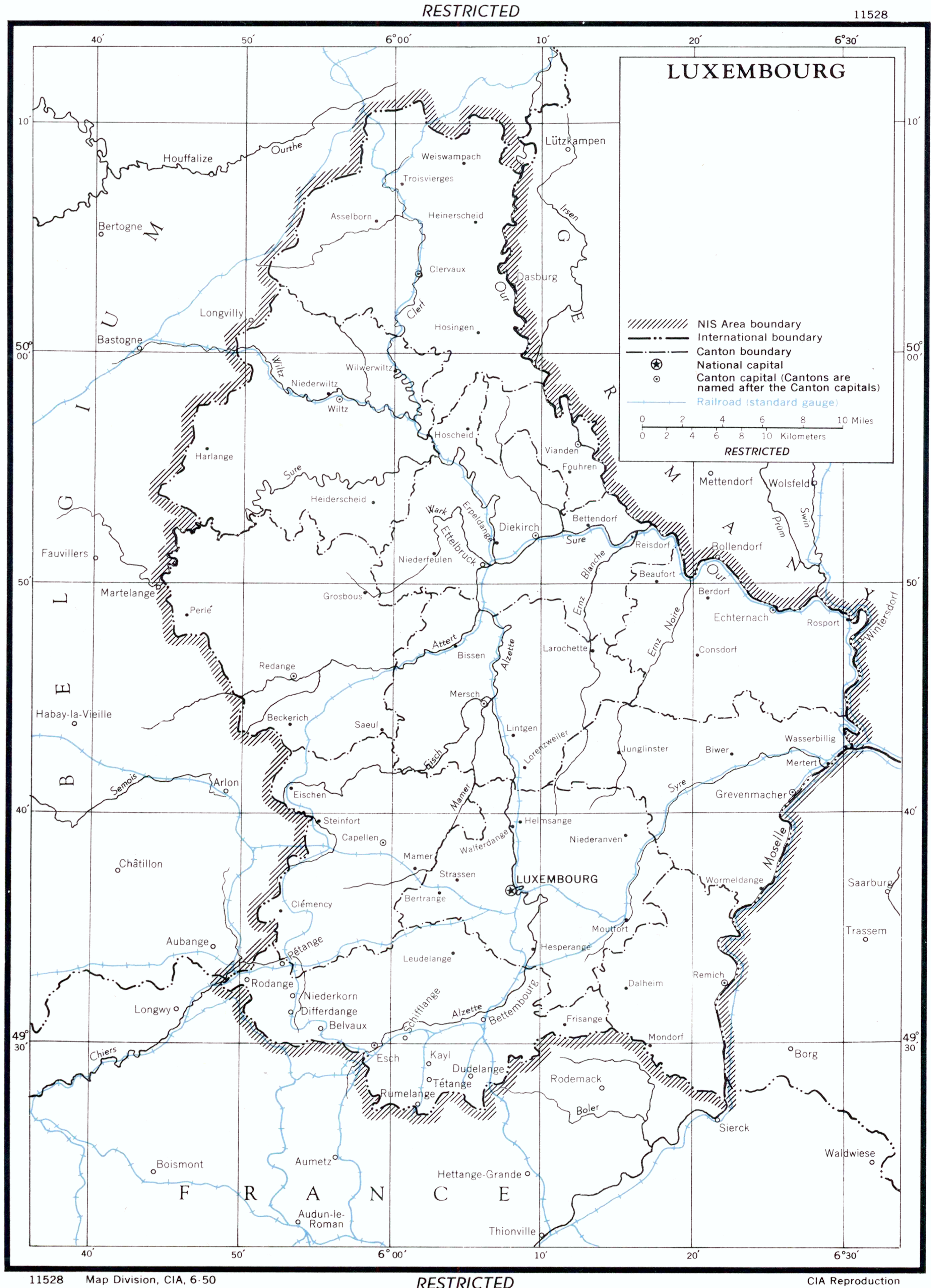
English: U.S. Central Intelligence Agency map of Luxembourg, June 1950. |
|||
| Date | June 1950 | |||
| Source |
|
|||
| Author | U.S. Central Intelligence Agency |
Licensing edit
.png&action=edit§ion=2)
| This image is a work of a Central Intelligence Agency employee, taken or made as part of that person's official duties. As a Work of the United States Government, this image or media is in the public domain in the United States.
|

|
File history
Click on a date/time to view the file as it appeared at that time.
| Date/Time | Thumbnail | Dimensions | User | Comment | |
|---|---|---|---|---|---|
| current | 17:57, 29 May 2022 | | 2,778 × 3,846 (4.41 MB) | Cobatfor (talk | contribs) | == {{int:filedesc}} == {{Information |Description={{en|1=U.S. Central Intelligence Agency map of Luxembourg, June 1950.}} |Source={{NARA-image|id=159083541}} |Date={{ISOdate|1950-06}} |Author=U.S. Central Intelligence Agency |Permission= |other_versions= }} =={{int:license-header}}== {{PD-USGov-CIA}} Category:CIA World Factbook maps of Luxembourg Category:Rail transport maps of Luxembourg |
You cannot overwrite this file.
File usage on Commons
The following 3 pages use this file:
.png&oldid=852551054)