File:Ceredigion in Wales.svg

Size of this PNG preview of this SVG file: 501 × 599 pixels. Other resolutions: 201 × 240 pixels | 401 × 480 pixels | 642 × 768 pixels | 856 × 1,024 pixels | 1,713 × 2,048 pixels | 1,047 × 1,252 pixels.
Original file (SVG file, nominally 1,047 × 1,252 pixels, file size: 395 KB)
Captions
Captions
Add a one-line explanation of what this file represents
Summary edit
| Description |
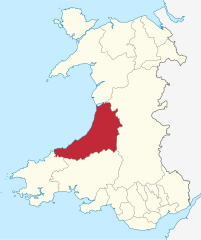
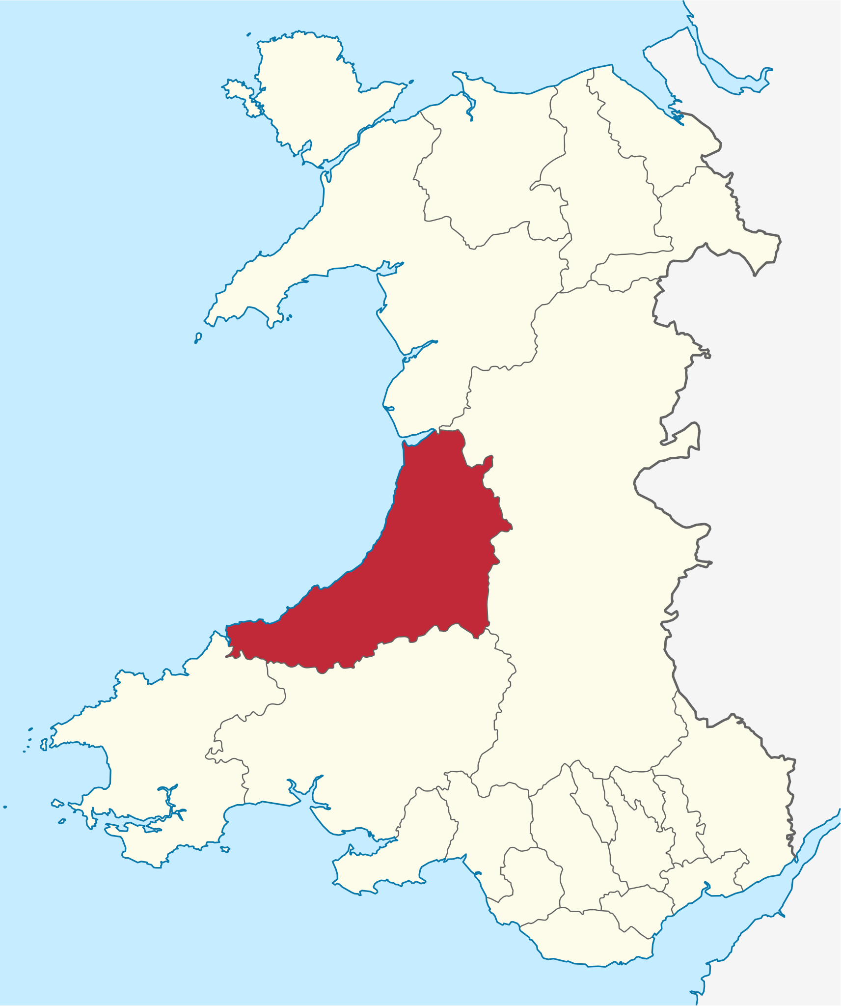
Deutsch: Lage der "Unitary Authority" Ceredigion in Wales in Wales.
English: Location of unitary authority area Ceredigion in Wales in Wales. |
| Date | |
| Source | Own work |
| Author |
TUBS |
| Other versions |
|
| SVG development | This W3C-invalid locator map was created with Adobe Illustrator by TUBS. This W3C-invalid SVG locator map was uploaded with Commonist. This Adobe SVG locator map is very large because TUBS kept the superfluous Adobe PGF or other CDATA garbage . |
Licensing edit
I, the copyright holder of this work, hereby publish it under the following license:
This file is licensed under the Creative Commons Attribution-Share Alike 3.0 Unported license.
- You are free:
- to share – to copy, distribute and transmit the work
- to remix – to adapt the work
- Under the following conditions:
- attribution – You must give appropriate credit, provide a link to the license, and indicate if changes were made. You may do so in any reasonable manner, but not in any way that suggests the licensor endorses you or your use.
- share alike – If you remix, transform, or build upon the material, you must distribute your contributions under the same or compatible license as the original.

|
I'd greatly appreciate, that you attribute this media file to Wikimedia Commons, if used outside Wikipedia or Commons. For use in publications such as books, newspapers, blogs, websites, please insert here the following line:
|
File history
Click on a date/time to view the file as it appeared at that time.
| Date/Time | Thumbnail | Dimensions | User | Comment | |
|---|---|---|---|---|---|
| current | 13:13, 8 September 2011 | | 1,047 × 1,252 (395 KB) | TUBS (talk | contribs) |
You cannot overwrite this file.
File usage on Commons
The following 16 pages use this file:
- Category:Archaeological sites in Ceredigion
- Category:Bridges in Ceredigion
- Category:Castles in Ceredigion
- Category:Ceredigion
- Category:Education in Ceredigion
- Category:Hill forts in Ceredigion
- Category:Hills of Ceredigion
- Category:History of Ceredigion
- Category:Maps of Ceredigion
- Category:People of Ceredigion
- Category:Populated places in Ceredigion
- Category:Rail transport in Ceredigion
- Category:Rivers of Ceredigion
- Category:Roads in Ceredigion
- Category:Views of Ceredigion
- Category:Villages in Ceredigion
File usage on other wikis
The following other wikis use this file:
- Usage on ca.wikipedia.org
- Usage on cy.wikipedia.org
- Usage on de.wikipedia.org
- Usage on de.wikivoyage.org
- Usage on en.wikipedia.org
- Usage on es.wikipedia.org
- Usage on et.wikipedia.org
- Usage on fi.wikipedia.org
- Usage on frr.wikipedia.org
- Usage on fr.wikipedia.org
- Ceredigion
- Aberystwyth
- Aberteifi
- Dyfed
- Y Ferwig
- Utilisateur:Ælfgar/Brouillon6
- Llangrannog
- Aberaeron
- Borth
- Tregaron
- Ceredigion (circonscription du Parlement britannique)
- Lampeter
- Llanfair Clydogau
- Ceredigion (circonscription du Senedd)
- Devil's Bridge
- Zone principale (pays de Galles)
- New Quay
- Ysgubor-y-coed
- Ystrad Meurig
- Ysbyty Ystwyth
- Llanwnnen
- Blaenrheidol
- Llangynfelyn
- Llangwyryfon
- Llanddewi Brefi
- Llangybi (Ceredigion)
- Geneu'r Glyn
- Ystrad Fflur
- Lledrod
- Nantcwnlle
- Llangeitho
- Llanllwchaiarn (Ceredigion)
- Ciliau Aeron
- Llanrhystyd
- Trawsgoed
- Ceulanamaesmawr
- Henfynyw
- Melindwr
View more global usage of this file.