File:Chalatenango in El Salvador.svg

Size of this PNG preview of this SVG file: 800 × 508 pixels. Other resolutions: 320 × 203 pixels | 640 × 406 pixels | 1,024 × 650 pixels | 1,280 × 813 pixels | 2,560 × 1,625 pixels | 983 × 624 pixels.
Original file (SVG file, nominally 983 × 624 pixels, file size: 260 KB)
Captions
Captions
Add a one-line explanation of what this file represents
Summary edit
| Description |
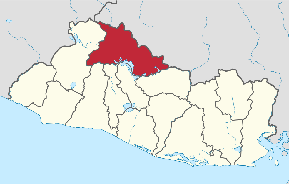
Deutsch: Lage des Departements XY (siehe Dateiname) in El Salvador.
English: Location of department xy (see filename) in El Salvador. |
| Date | |
| Source |
Own work This W3C-unspecified vector image was created with Adobe Illustrator. This SVG file was uploaded with Commonist. This vector image includes elements that have been taken or adapted from this file: |
| Author |
TUBS |
| Other versions |
|
Licensing edit
I, the copyright holder of this work, hereby publish it under the following license:
This file is licensed under the Creative Commons Attribution 3.0 Unported license.
- You are free:
- to share – to copy, distribute and transmit the work
- to remix – to adapt the work
- Under the following conditions:
- attribution – You must give appropriate credit, provide a link to the license, and indicate if changes were made. You may do so in any reasonable manner, but not in any way that suggests the licensor endorses you or your use.

|
I'd greatly appreciate, that you attribute this media file to Wikimedia Commons, if used outside Wikipedia or Commons. For use in publications such as books, newspapers, blogs, websites, please insert here the following line:
|
File history
Click on a date/time to view the file as it appeared at that time.
| Date/Time | Thumbnail | Dimensions | User | Comment | |
|---|---|---|---|---|---|
| current | 11:29, 4 November 2011 | | 983 × 624 (260 KB) | TUBS (talk | contribs) |
You cannot overwrite this file.
File usage on Commons
The following page uses this file:
File usage on other wikis
The following other wikis use this file:
- Usage on bg.wikipedia.org
- Usage on ca.wikipedia.org
- Usage on de.wikipedia.org
- Usage on en.wikipedia.org
- Departments of El Salvador
- Chalatenango Department
- Tejutla, El Salvador
- Santa Rita, El Salvador
- Potonico
- San Antonio de la Cruz
- San Antonio Los Ranchos
- San Fernando, Chalatenango
- San Francisco Lempa
- San Ignacio, El Salvador
- San Francisco Morazán
- San Isidro Labrador, El Salvador
- San José Cancasque
- San Luis del Carmen
- San Miguel de Mercedes
- San Rafael, El Salvador
- Arcatao
- Azacualpa, El Salvador
- Chalatenango, Chalatenango
- Citalá
- El Paraíso, El Salvador
- La Palma, El Salvador
- La Reina, El Salvador
- Las Vueltas
- Nombre de Jesús
- Nueva Concepción
- Nueva Trinidad
- Agua Caliente, El Salvador
- Las Flores, El Salvador
- Comalapa, El Salvador
- El Carrizal, El Salvador
- Cerro El Pital
- Wikipedia:WikiProject El Salvador/Department templates
- Template:Chalatenango Department
- La Laguna, El Salvador
- Ojos de Agua, El Salvador
- Cayahuanca Stone
- Sumpul River
- List of Salvadoran flags
- Usage on es.wikipedia.org
- Usage on frr.wikipedia.org
- Usage on fr.wikipedia.org
View more global usage of this file.