File:Chatham-Islands map topo-fr.svg

Size of this PNG preview of this SVG file: 702 × 599 pixels. Other resolutions: 281 × 240 pixels | 562 × 480 pixels | 900 × 768 pixels | 1,199 × 1,024 pixels | 2,399 × 2,048 pixels | 1,669 × 1,425 pixels.
Original file (SVG file, nominally 1,669 × 1,425 pixels, file size: 746 KB)
Captions
Captions
Add a one-line explanation of what this file represents
Summary edit
| Description |
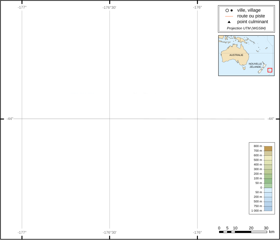
English: Topographic map in french of Chatham Islands. The archipelago of the Chatham Islands, consists of about 10 islands within a 40-km radius. The islands have officially belonged to New Zealand since 1842.
Scale ca 1:1.000.000 Français : Carte topographique des Îles Chatham. Cet archipel est formé d'une dizaine d'îles et groupes d'ilôts, répartie dans un rayon de quarante kilomètres autour de l'île principale. Il dépend officiellement de la Nouvelle Zélande depuis 1842. Échelle environ au 1:1 000 000. |
| Date | |
| Source | Traduction de Image:Chatham-Islands map topo en.svg par Alexrk, sous licence CC-BY-SA. |
| Author | Sémhur |
| Other versions |
|


| Camera location | | View this and other nearby images on: OpenStreetMap |
|---|

|
This SVG file contains embedded text that can be translated into your language, using any capable SVG editor, text editor or the SVG Translate tool. For more information see: About translating SVG files. |
This W3C-unspecified vector image was created with Inkscape .
Licensing edit
I, the copyright holder of this work, hereby publish it under the following licenses:

|
Permission is granted to copy, distribute and/or modify this document under the terms of the GNU Free Documentation License, Version 1.2 or any later version published by the Free Software Foundation; with no Invariant Sections, no Front-Cover Texts, and no Back-Cover Texts. A copy of the license is included in the section entitled GNU Free Documentation License. |
This file is licensed under the Creative Commons Attribution-Share Alike 3.0 Unported, 2.5 Generic, 2.0 Generic and 1.0 Generic license.
- You are free:
- to share – to copy, distribute and transmit the work
- to remix – to adapt the work
- Under the following conditions:
- attribution – You must give appropriate credit, provide a link to the license, and indicate if changes were made. You may do so in any reasonable manner, but not in any way that suggests the licensor endorses you or your use.
- share alike – If you remix, transform, or build upon the material, you must distribute your contributions under the same or compatible license as the original.
You may select the license of your choice.
File history
Click on a date/time to view the file as it appeared at that time.
| Date/Time | Thumbnail | Dimensions | User | Comment | |
|---|---|---|---|---|---|
| current | 10:11, 5 April 2009 | | 1,669 × 1,425 (746 KB) | Alexrk (talk | contribs) | Grid |
| 11:14, 12 April 2008 |  | 1,669 × 1,425 (746 KB) | Sémhur (talk | contribs) | == Description == {{Information |Description= {{en|Topographic map in french of '''Chatham Islands'''. The archipelago of the Chatham Islands, consists of about 10 islands within a 40-km radius. The islands have officially belonged |
You cannot overwrite this file.
File usage on Commons
The following 2 pages use this file:
File usage on other wikis
The following other wikis use this file: