File:Chesapeake and Ohio Railway System Map.PNG
No higher resolution available.
Chesapeake_and_Ohio_Railway_System_Map.PNG (340 × 368 pixels, file size: 12 KB, MIME type: image/png)
Captions
Captions
Add a one-line explanation of what this file represents
Summary edit
| Description |
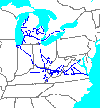
English: Chesapeake and Ohio Railway System Map (1950) |
| Source | Own work |
| Author | Central Data Bank (talk) |
Licensing edit
User:Central Data Bank, the copyright holder of this work, hereby publishes it under the following license:
This file is licensed under the Creative Commons Attribution 3.0 Unported license.
Attribution: User:Central Data Bank
- You are free:
- to share – to copy, distribute and transmit the work
- to remix – to adapt the work
- Under the following conditions:
- attribution – You must give appropriate credit, provide a link to the license, and indicate if changes were made. You may do so in any reasonable manner, but not in any way that suggests the licensor endorses you or your use.
Original upload log edit
Transferred from en.wikipedia to Commons using For the Common Good.
The original description page was here. All following user names refer to en.wikipedia.
| Date/Time | Dimensions | User | Comment |
|---|---|---|---|
| 11:29, 18 June 2009 | 340 × 368 (11,985 bytes) | w:en:Central Data Bank (talk | contribs) | {{Information |Description = |Source = I created this work entirely by myself. |Date = |Author = ~~~ |other_versions = }} |
File history
Click on a date/time to view the file as it appeared at that time.
| Date/Time | Thumbnail | Dimensions | User | Comment | |
|---|---|---|---|---|---|
| current | 02:04, 18 November 2013 | | 340 × 368 (12 KB) | ChrisGualtieri (talk | contribs) | Transferred from en.wikipedia: see original upload log above |
You cannot overwrite this file.
File usage on Commons
The following page uses this file:
File usage on other wikis
The following other wikis use this file:
- Usage on en.wikipedia.org
- Usage on fr.wikipedia.org
- Usage on www.wikidata.org
- Usage on zh.wikipedia.org