File:Chihshui.JPG

Size of this preview: 800 × 600 pixels. Other resolutions: 320 × 240 pixels | 640 × 480 pixels | 1,024 × 768 pixels | 1,280 × 960 pixels | 2,048 × 1,536 pixels.
Original file (2,048 × 1,536 pixels, file size: 395 KB, MIME type: image/jpeg)
Captions
Captions
Add a one-line explanation of what this file represents
Summary
edit
| Description |
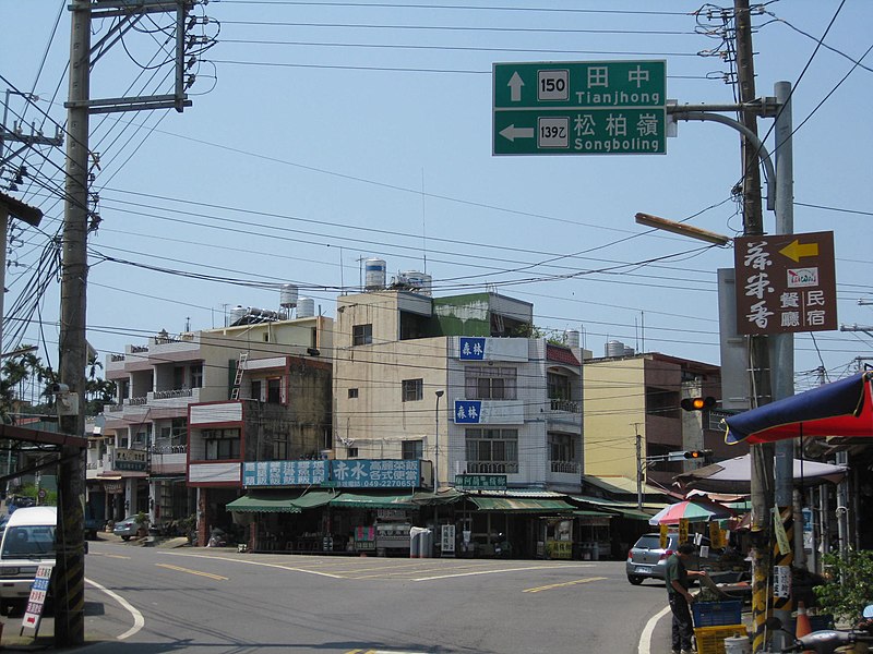
中文(繁體):赤水是名間鄉一個村,位於八卦臺地南境。這張圖顯示在赤水的139乙線與150線兩條縣道交叉口,接近彰化、南投交界。
中文(简体):赤水是名间乡一个村,位于八卦台地南境。这张图显示在赤水的139乙线与150线兩條县道交叉口,接近彰化、南投交界。
English: Chihshui is a village in Mingjian Township,it located on the southern side of Bagua Plateau.This photo shows the intersection of No.139B and No.150 in Chihshui,near on the border of Changhua and Nantou. |
| Date | |
| Source | Own work |
| Author | Yiken |
| Camera location | | View this and other nearby images on: OpenStreetMap |
|---|
Licensing
edit
I, the copyright holder of this work, hereby publish it under the following licenses:
This file is licensed under the Creative Commons Attribution-Share Alike 3.0 Unported, 2.5 Generic, 2.0 Generic and 1.0 Generic license.
- You are free:
- to share – to copy, distribute and transmit the work
- to remix – to adapt the work
- Under the following conditions:
- attribution – You must give appropriate credit, provide a link to the license, and indicate if changes were made. You may do so in any reasonable manner, but not in any way that suggests the licensor endorses you or your use.
- share alike – If you remix, transform, or build upon the material, you must distribute your contributions under the same or compatible license as the original.

|
Permission is granted to copy, distribute and/or modify this document under the terms of the GNU Free Documentation License, Version 1.2 or any later version published by the Free Software Foundation; with no Invariant Sections, no Front-Cover Texts, and no Back-Cover Texts. A copy of the license is included in the section entitled GNU Free Documentation License. |
You may select the license of your choice.
File history
Click on a date/time to view the file as it appeared at that time.
| Date/Time | Thumbnail | Dimensions | User | Comment | |
|---|---|---|---|---|---|
| current | 10:10, 18 April 2010 | | 2,048 × 1,536 (395 KB) | Yiken (talk | contribs) | {{Information |Description={{zh-hant|1=赤水是名間鄉一個村,位於八卦臺地南境。這張圖顯示在赤水的139乙線與150線兩條縣道交叉口,接近彰化、南投交界。}} {{zh-hans|1=赤水是名间乡一个村,位于八卦台 |
You cannot overwrite this file.
File usage on Commons
The following page uses this file:
File usage on other wikis
The following other wikis use this file: