File:China Inner Mongolia location map.svg

Size of this PNG preview of this SVG file: 577 × 433 pixels. Other resolutions: 320 × 240 pixels | 640 × 480 pixels | 1,024 × 768 pixels | 1,280 × 961 pixels | 2,560 × 1,921 pixels.
Original file (SVG file, nominally 577 × 433 pixels, file size: 366 KB)
Captions
Captions
Add a one-line explanation of what this file represents
Summary edit
| Description |
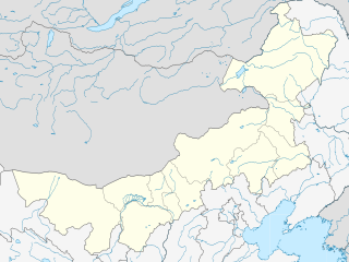
English: Location map of Inner Mongolia, People's Republic of China
Equirectangular projection, N/S stretching 141 %. True scale parallel: 45°00' N. Geographic limits of the map:
|
| Date | |
| Source |
Own work, using
|
| Author | Das steinerne Herz |
| Other versions |
Derivative works of this file: |
.svg)
Licensing edit
I, the copyright holder of this work, hereby publish it under the following licenses:
This file is licensed under the Creative Commons Attribution-Share Alike 3.0 Unported license.
- You are free:
- to share – to copy, distribute and transmit the work
- to remix – to adapt the work
- Under the following conditions:
- attribution – You must give appropriate credit, provide a link to the license, and indicate if changes were made. You may do so in any reasonable manner, but not in any way that suggests the licensor endorses you or your use.
- share alike – If you remix, transform, or build upon the material, you must distribute your contributions under the same or compatible license as the original.

|
Permission is granted to copy, distribute and/or modify this document under the terms of the GNU Free Documentation License, Version 1.2 or any later version published by the Free Software Foundation; with no Invariant Sections, no Front-Cover Texts, and no Back-Cover Texts. A copy of the license is included in the section entitled GNU Free Documentation License. |
You may select the license of your choice.
File history
Click on a date/time to view the file as it appeared at that time.
| Date/Time | Thumbnail | Dimensions | User | Comment | |
|---|---|---|---|---|---|
| current | 21:56, 20 February 2011 | | 577 × 433 (366 KB) | Das steinerne Herz (talk | contribs) | completly new version |
| 19:55, 13 February 2011 |  | 663 × 500 (2.21 MB) | Das steinerne Herz (talk | contribs) | trying to correct | |
| 14:14, 10 February 2011 |  | 664 × 508 (2.21 MB) | Das steinerne Herz (talk | contribs) | cropping | |
| 08:02, 10 February 2011 |  | 748 × 605 (2.16 MB) | Das steinerne Herz (talk | contribs) | correction | |
| 18:54, 9 February 2011 |  | 748 × 605 (2.17 MB) | Das steinerne Herz (talk | contribs) | {{Information |Description ={{en|1=Location map of Inner Mongolia, People's Republic of China Equirectangular projection, N/S stretching 141 %. Geographic limits of the map: * N: 55.0° N * S: 3 |
You cannot overwrite this file.
File usage on Commons
The following 2 pages use this file:
File usage on other wikis
The following other wikis use this file:
- Usage on ar.wikipedia.org
- Usage on azb.wikipedia.org
- Usage on ba.wikipedia.org
- Usage on bg.wikipedia.org
- Usage on bn.wikipedia.org
- Usage on ceb.wikipedia.org
- Usage on cv.wikipedia.org
- Usage on de.wikipedia.org
- Usage on en.wikipedia.org
- Hohhot
- Battles of Khalkhin Gol
- Wuhai
- Chifeng
- Hulunbuir
- Hailar District
- Zalantun
- Ulanqab
- Jining District
- Fengzhen
- Xilinhot
- Hanggai (village)
- Dorbod Banner
- Manzhouli
- Dolon Nor
- Linhe District
- Ewenki Autonomous Banner
- Oroqen Autonomous Banner
- Five Pagoda Temple (Hohhot)
- Solun, Horqin Right Front Banner
- Yakeshi
- Dongsheng District
- Wuchuan County, Inner Mongolia
- Erenhot
- Baotou Donghe Airport
- Chifeng Yulong Airport
- Hulunbuir Hailar Airport
- Hohhot Baita International Airport
- Manzhouli Xijiao Airport
- Tongliao Airport
- Ulanhot Yilelite Airport
- Wuhai Airport
- Xilinhot Airport
- Bayannur
- Tsondol
- Ejin Horo Banner
View more global usage of this file.