File:China Loess Plateau and Ordos Desert.png
Size of this preview: 800 × 407 pixels. Other resolutions: 320 × 163 pixels | 640 × 326 pixels | 1,024 × 521 pixels | 1,280 × 652 pixels | 2,160 × 1,100 pixels.
Original file (2,160 × 1,100 pixels, file size: 155 KB, MIME type: image/png)
Captions
Captions
Add a one-line explanation of what this file represents
Summary edit
| Description |
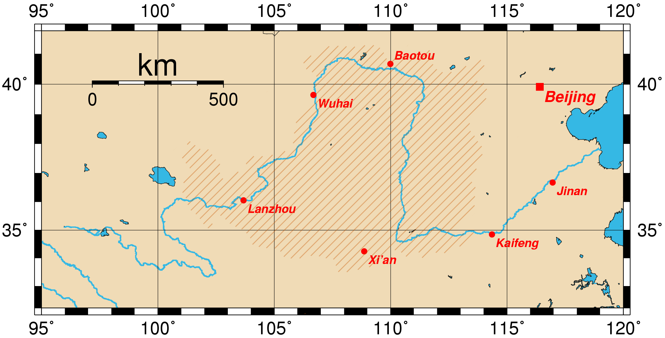
English: Localisation of the Loess Plateau (hachured area) - based upon the maps in Regional impacts of re-vegetation on water resources of the Loess Plateau, China and the Middle and Upper Murrumbidgee Catchment, Australia (CSIRO) - and the Huang He valley (Yellow River) in China. Depending on the authors, the Ordos Desert (Northwest) is included (the present option) or not.
Français : Localisation du Plateau de lœss (zone hachurée) - basée sur les cartes de Regional impacts of re-vegetation on water resources of the Loess Plateau, China and the Middle and Upper Murrumbidgee Catchment, Australia (CSIRO) - et la vallée du Huang He (Fleuve Jaune) en Chine.
Selon les auteurs, le désert de l'Ordos (au nord-ouest) en fait partie (option retenue ici) ou non. |
| Date | (UTC) |
| Source | |
| Author | Croquant |
| Other versions | File:China Loess Plateau.png (Ordos Desert excluded) |
Licensing edit
I, the copyright holder of this work, hereby publish it under the following licenses:

|
Permission is granted to copy, distribute and/or modify this document under the terms of the GNU Free Documentation License, Version 1.2 or any later version published by the Free Software Foundation; with no Invariant Sections, no Front-Cover Texts, and no Back-Cover Texts. A copy of the license is included in the section entitled GNU Free Documentation License. |
This file is licensed under the Creative Commons Attribution-Share Alike 4.0 International, 3.0 Unported, 2.5 Generic, 2.0 Generic and 1.0 Generic license.
- You are free:
- to share – to copy, distribute and transmit the work
- to remix – to adapt the work
- Under the following conditions:
- attribution – You must give appropriate credit, provide a link to the license, and indicate if changes were made. You may do so in any reasonable manner, but not in any way that suggests the licensor endorses you or your use.
- share alike – If you remix, transform, or build upon the material, you must distribute your contributions under the same or compatible license as the original.
You may select the license of your choice.
Original upload log edit
This image is a derivative work of the following image:
- File:Huanghemap.png licensed with GFDL
- 2005-07-31T02:50:02Z Fanghong 2160x1100 (96391 Bytes) {{information| |Description =Map of the [[Huang He]] and the location of major cities along its course. This map was generated using the Generic Mapping Tools (GMT). The city coordinates ([[longitude]], [[latitude]]) used are
Uploaded with derivativeFX
File history
Click on a date/time to view the file as it appeared at that time.
| Date/Time | Thumbnail | Dimensions | User | Comment | |
|---|---|---|---|---|---|
| current | 07:59, 27 July 2009 | | 2,160 × 1,100 (155 KB) | Croquant (talk | contribs) | {{Information |Description={{en|Localisation of the Loess Plateau (hachured area), based upon the [http://www.clw.csiro.au/ReVegIH/Maps.htm maps] in ''Regional impacts of re-vegetation on water resources of the Loess Plateau, China and the Middle and Uppe |
You cannot overwrite this file.
File usage on Commons
There are no pages that use this file.