File:Church, Mushabbak (المشبك), Syria - Nave looking west and view of north aisle - PHBZ024 2016 1832 - Dumbarton Oaks.jpg
Size of this preview: 800 × 533 pixels. Other resolutions: 320 × 213 pixels | 640 × 426 pixels | 1,024 × 682 pixels | 1,280 × 853 pixels | 2,560 × 1,705 pixels | 4,721 × 3,145 pixels.
Original file (4,721 × 3,145 pixels, file size: 11.99 MB, MIME type: image/jpeg)
Captions
Captions
Add a one-line explanation of what this file represents
Summary edit
,_Syria_-_Nave_looking_west_and_view_of_north_aisle_-_PHBZ024_2016_1832_-_Dumbarton_Oaks.jpg&action=edit§ion=1)
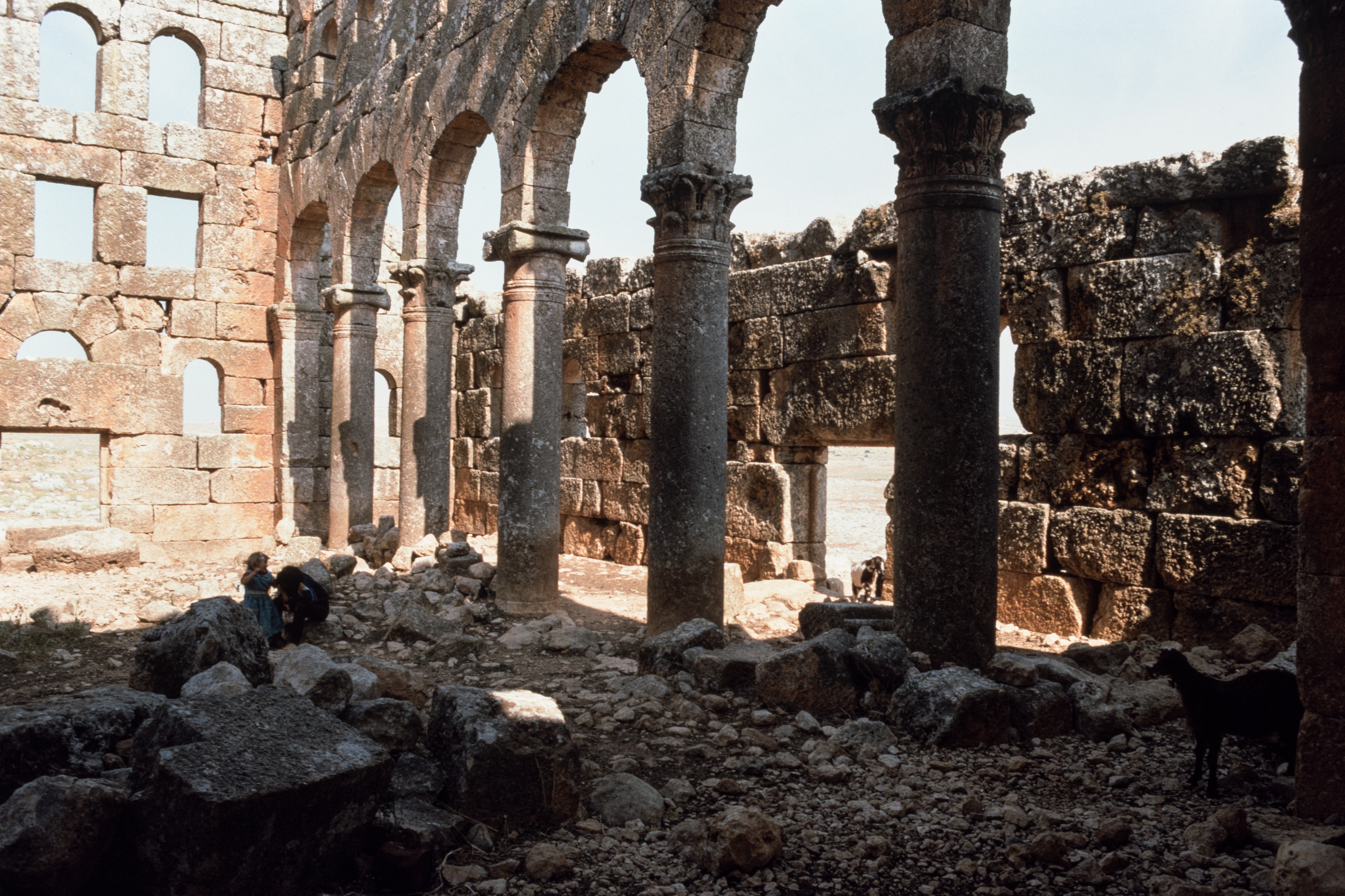
| Church, Mushabbak (المشبك), Syria - Nave looking west and view of north aisle | |
|---|---|
| Photographer |
Frank Kidner |
| Title |
Church, Mushabbak (المشبك), Syria - Nave looking west and view of north aisle |
| Depicted place | Mushabbak (المشبك), Syria |
| Date | 1995 |
| Medium | color slide |
| Dimensions | 35 mm |
| Collection | Dumbarton Oaks, Trustees for Harvard University, Washington, DC |
| Accession number |
PHBZ024_2016_1832 |
| Credit line | Frank Kidner Collection, Dumbarton Oaks, Trustees for Harvard University, Washington, DC |
| Notes | Alternate transliterations: Mushabbaq; al-Musabbak; Msabbak. |
| Source | Dumbarton Oaks |
| Other versions | http://id.lib.harvard.edu/images/8001504293/catalog |
Licensing edit
,_Syria_-_Nave_looking_west_and_view_of_north_aisle_-_PHBZ024_2016_1832_-_Dumbarton_Oaks.jpg&action=edit§ion=2)
This file is licensed under the Creative Commons Attribution-Share Alike 4.0 International license.
- You are free:
- to share – to copy, distribute and transmit the work
- to remix – to adapt the work
- Under the following conditions:
- attribution – You must give appropriate credit, provide a link to the license, and indicate if changes were made. You may do so in any reasonable manner, but not in any way that suggests the licensor endorses you or your use.
- share alike – If you remix, transform, or build upon the material, you must distribute your contributions under the same or compatible license as the original.
| Camera location | | View this and other nearby images on: OpenStreetMap |
|---|
,_Syria_-_Nave_looking_west_and_view_of_north_aisle_-_PHBZ024_2016_1832_-_Dumbarton_Oaks.jpg¶ms=036.254470_N_0036.883570_E_globe:Earth_type:camera__&language=en)
| Object location | | View this and other nearby images on: OpenStreetMap |
|---|
,_Syria_-_Nave_looking_west_and_view_of_north_aisle_-_PHBZ024_2016_1832_-_Dumbarton_Oaks.jpg¶ms=036.254570_N_0036.883430_E_globe:Earth_class:object_type:object__&language=en)
File history
Click on a date/time to view the file as it appeared at that time.
| Date/Time | Thumbnail | Dimensions | User | Comment | |
|---|---|---|---|---|---|
| current | 16:28, 4 March 2020 | | 4,721 × 3,145 (11.99 MB) | Dboomhower (talk | contribs) | pattypan 19.06 |
You cannot overwrite this file.
File usage on Commons
The following page uses this file:
,_Syria_-_Nave_looking_west_and_view_of_north_aisle_-_PHBZ024_2016_1832_-_Dumbarton_Oaks.jpg)
,_Syria_-_Nave_looking_west_and_view_of_north_aisle_-_PHBZ024_2016_1832_-_Dumbarton_Oaks.jpg&oldid=781836801)